
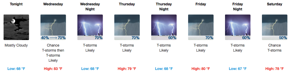
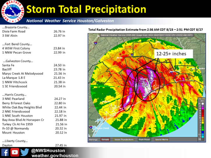
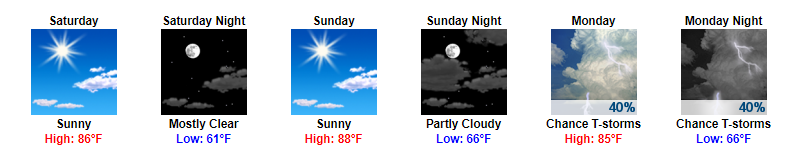
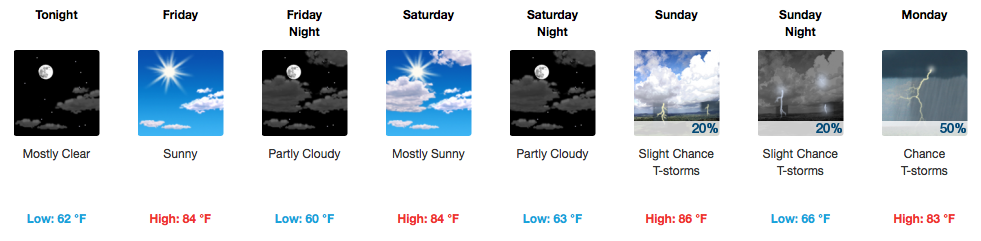
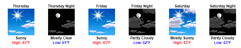
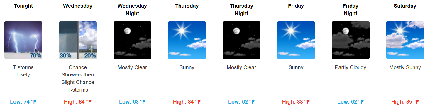
Rain Stays North Today, Isolated Shower May Sneak In
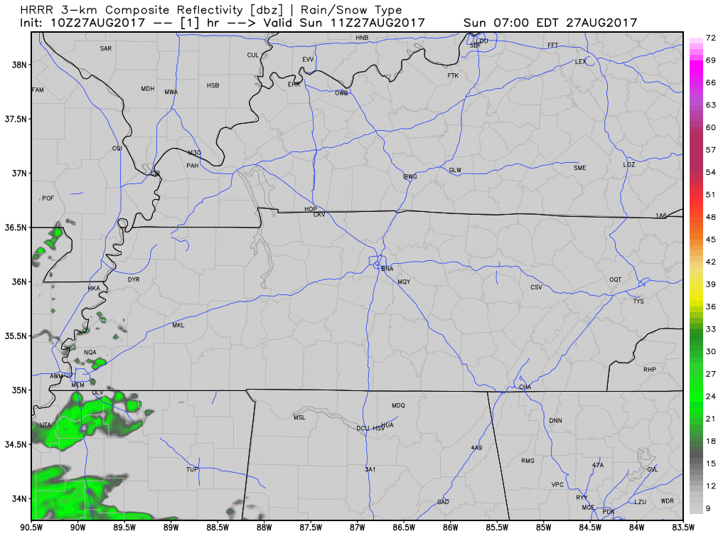
Latest HRRR Model Loop
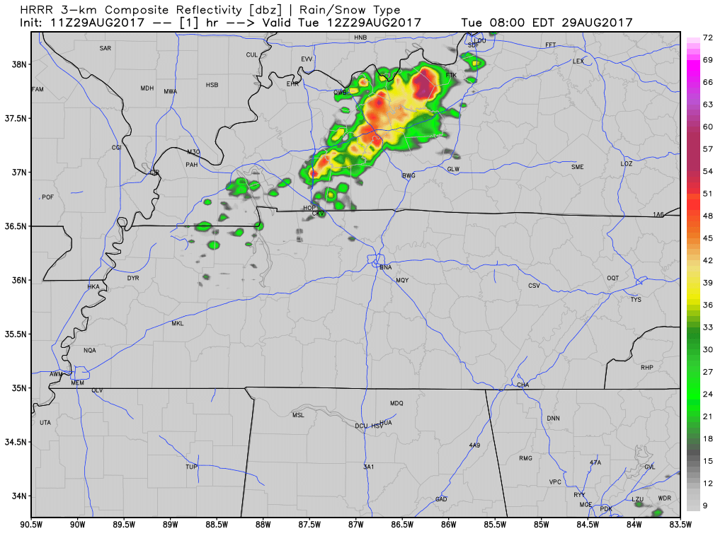
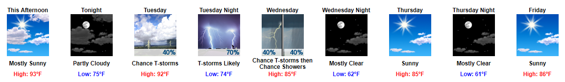
A weak upper level impulse will slide further south today, sparking showers and an isolated storm in Kentucky and along the KY/TN border. One or two of these may meander far enough south into Davidson County, but the chances are low. Temperatures will stay in the mid 80s for afternoon highs. Otherwise, expect some cloud cover around…as already evidenced by GOES this morning (also, note the fog around Nashville):
You must be logged in to post a comment.