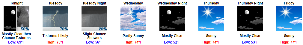
It May Rain and Storm Overnight
We aren’t sure when it’ll start.
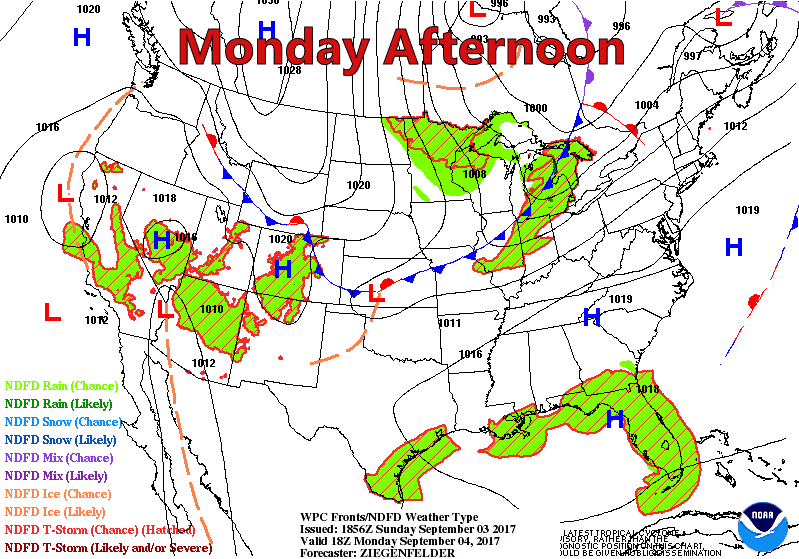
Chances begin around 3 AM, or . . . around 10 AM . . . or sometime in between. Models disagree!

(1) The NAM3 model thinks 3 AM. Here it is coming down I-24 tonight:

We aren’t sure when it’ll start.
Chances begin around 3 AM, or . . . around 10 AM . . . or sometime in between. Models disagree!
(1) The NAM3 model thinks 3 AM. Here it is coming down I-24 tonight:
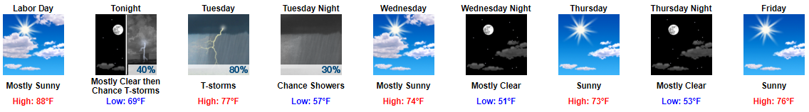
Sunny, high 88°, with mid-60°s dewpoint will make a great Labor Day.
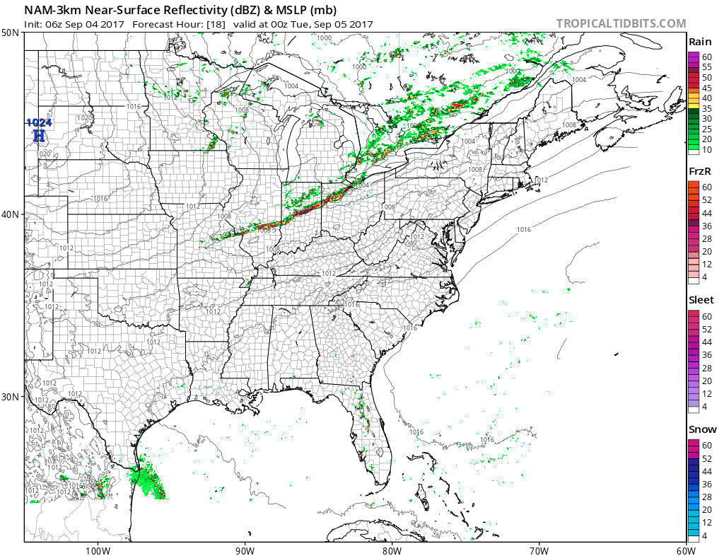
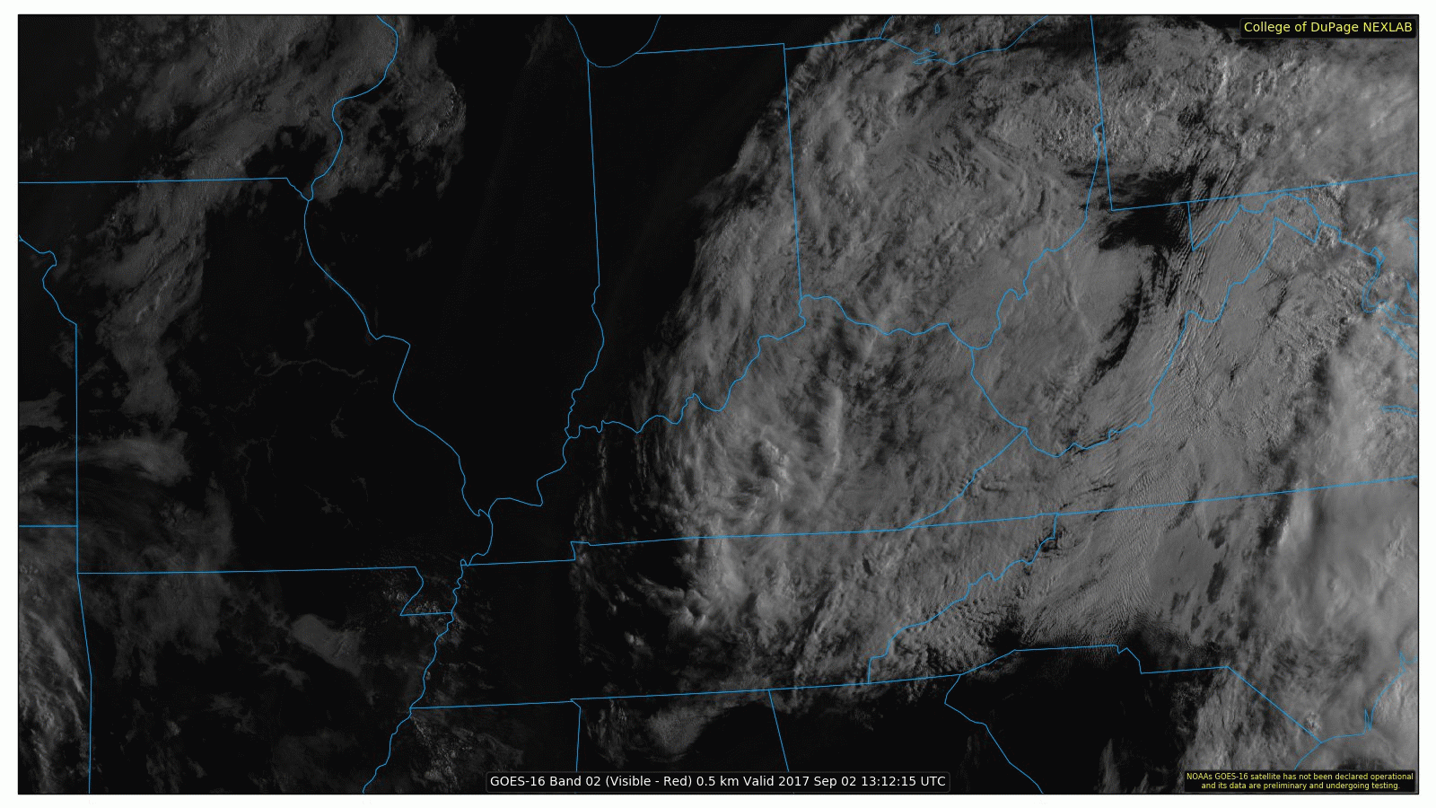
Late tonight, rain and a few thunderstorms will form in the midwest, then dive southeast, pick up I-24, and arrive here in the wee hours of Tuesday morning.
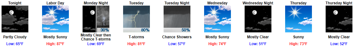
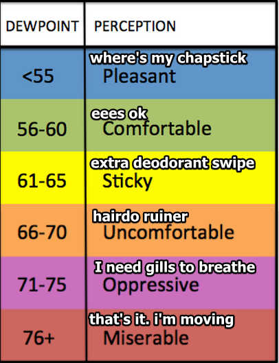
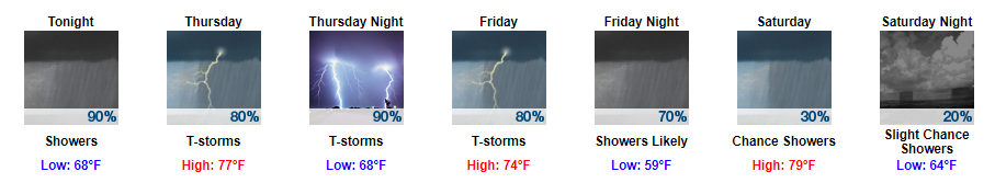
Monday (Labor Day) will be fantastic, even with dewpoints in the mid 60°s bringing sticky and uncomfortable humidity.
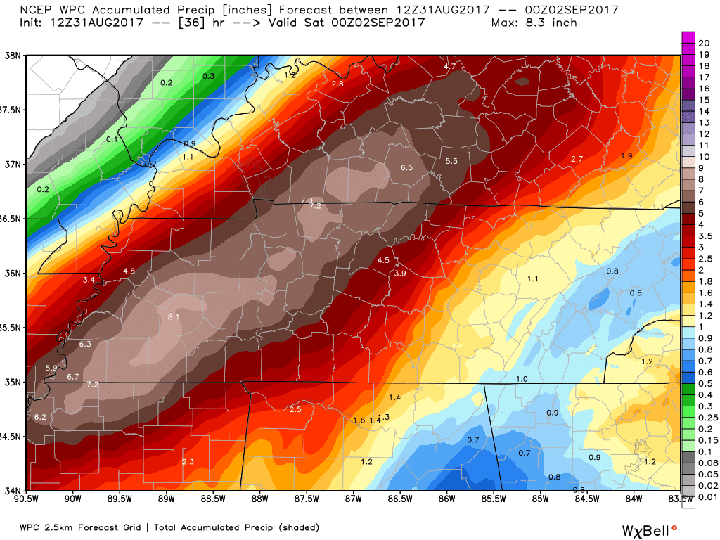
Rain should last most of Tuesday, clearing out Tuesday night. Most outdoor sports will suffer a rainout if we get 0.58″ (up from this morning’s 0.36″).
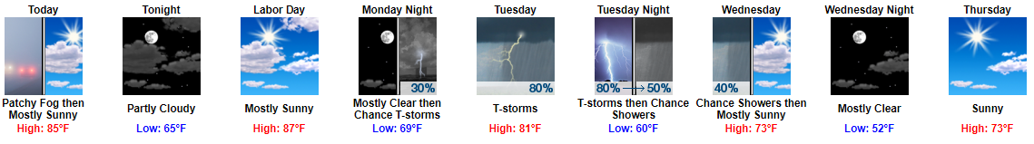
Early morning fog has formed around water. Fog will mix out soon as the sun does its thing, revealing a great day.
A great two days, actually. Sunday (Live on the Green) and Monday (Labor Day) will be fantastic, except for humidity rocketing back up. Dewpoints in the mid/upper 60°s today and tomorrow mean uncomfortable, hairdo ruining humidity.
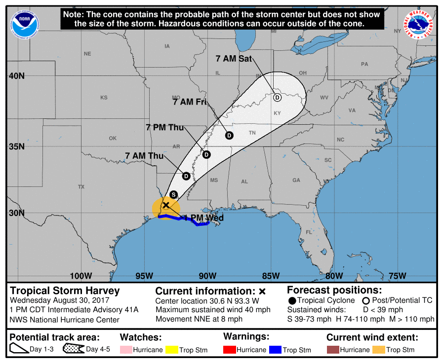
After all this time, we can finally cease our discussions (here in Middle TN) on Harvey. Clouds are still wrapping around the remnant low pressure system, centered over eastern Kentucky, leaving us with fair weather skies for today.
Y’all saw me frustrated (yet again) with Thursday night’s tornado sirens in Davidson County.
The main problems were:
(1) Tornado sirens alerted the entire county even though the Tornado Warning covered only part of the county. Areas unwarned were warned by the siren. Those outside the NWS warning area were confused when watching us and/or local TV. We’d say, for example, “Bellevue is not in the warning,” but y’all in Bellevue would clearly hear the tornado siren. It’s confusing.
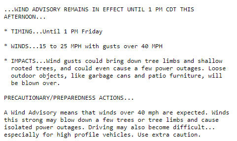
We have several advisories and watches in place currently. The first advisory in place is a wind advisory. Expect for winds to stay a bit gusty at times through the morning thanks to remnants of Harvey.
Periscope from 4 pm Detailing Latest Thinking on Rain/Storms
Harvey's Rain and Storm (low tornado) Potential Tonight. Review and discussion. https://t.co/Fo8v6jqeu2
— NashSevereWx (@NashSevereWx) August 31, 2017
Periscope from 4 pm Detailing Latest Thinking on Rain/Storms
Harvey's Rain and Storm (low tornado) Potential Tonight. Review and discussion. https://t.co/Fo8v6jqeu2
— NashSevereWx (@NashSevereWx) August 31, 2017
Harvey’s rain is arriving.
Current rain is just the beginning. Most of it (the "bulk" of it) will begin late tonight, heaviest rain for entire event ETA Thurs night. pic.twitter.com/dEr31qhoKP
You must be logged in to post a comment.