
Editor’s Note about Nashville’s Tornado Sirens Thursday Night
Y’all saw me frustrated (yet again) with Thursday night’s tornado sirens in Davidson County.
The main problems were:
(1) Tornado sirens alerted the entire county even though the Tornado Warning covered only part of the county. Areas unwarned were warned by the siren. Those outside the NWS warning area were confused when watching us and/or local TV. We’d say, for example, “Bellevue is not in the warning,” but y’all in Bellevue would clearly hear the tornado siren. It’s confusing.
(2) The sirens continued to wail 15+ minutes after the Tornado Warning was canceled. More confusion. It’s only fair to think: “TV/Twitter says the tornado is canceled, yet the sirens are going off! Who do we believe?”
Sirens polarize the weather community.
There’s lots of debate about whether to even have them at all (for example, they’re not designed to be heard indoors, yet those close to them can hear them).
The main debate is about when to sound them. Some think it’s best (a) to sound them whenever a tornado is close, even if outside the warned area, in case the warned area is wrong, or the storm moves out of the warning polygon. Others think (b) you should only warn those inside the polygon drawn by the NWS; if you warn those outside the path, over-warning occurs, and the sirens are never taken seriously.
I’m not here to argue the merits of (a) vs (b), except to point out my view is that (b) is the right answer and if there was a jury of 9, side (b) would win in a 7-2 decision.
Some background. The “take cover/shelter” message has three players, with one player pulling in the opposite direction of the other two.
First, there’s the National Weather Service office in Nashville. They alone issue warnings. They draw a polygon around the warned area and publish it. They stopped issuing warnings covering entire counties in 2007. Now, they only issue warnings for those in the path of the storm.
Second, the media. The media distributes the warning. TV, radio, and social media sources follow the NWS warnings. Inside the polygon: you’re warned. Outside the polygon: you’re not.
Third, city and/or county emergency management. They control the sirens.
Here’s my main problem. While our NWS and local media are doing one thing, Metro OEM is doing another.
These three parties must work together to provide clear, actionable information. When one member does its own thing, confusion arises. Confusion produces inaction, apathy, and/or delay in response times.
It’s not just that sirens are waking people in unwarned areas because local emergency management agency thinks it knows more about where a tornado is going than the media and National Weather Service. And it’s not just that there seems to be no one at the switch to turn off the sirens when the warning has expired or has moved out of the county. And it’s not only that commerce grinds to a halt when the sirens go off in areas outside the warning polygon.
It’s that we have a system that causes confusion. This confusion has been going on for 10+ years. We are better than that. At least, we should be. Can we at least all agree that it’s better to have all three partners pulling in the same direction, rather than continuing to confuse and alarm the public?
More Showers, Kinda Chilly Tonight
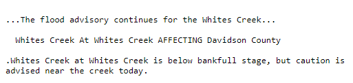
Our flash flood watch and wind advisory have both expired. However, we do still have a flood advisory out for Whites Creek in Davidson County.
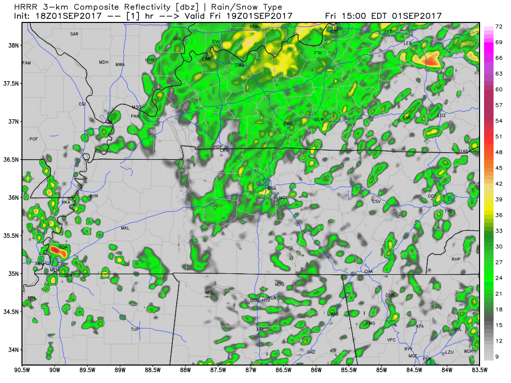
For the remainder of today, expect for more rain.
HRRR Loop through 7 AM Tomorrow
As of right now our temperatures are already in the 60s. Expect for temperatures to cool off even more into the evening hours.
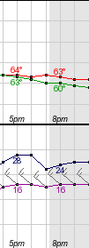
Red – Temperature | Green – Dew Point Temperature | Purple – Wind Speed & Direction | Navy – Wind Gusts
For those heading out to football games tonight, bundle up. Its going to be cold and wet with winds still hanging around making it even worse. When you add temps in the mid to low 60s, rain, and 15 mph you’ll want to be bundled up if you are sitting outside.
https://giphy.com/gifs/snl-3oEjHKj26YqQmAFgqY
Live on the Green Forecast – Tonight and Tomorrow & *NEW* Sunday!

The final weekend of LOTG is upon us. Things kick off at 5 PM tonight and 1 PM tomorrow AND 1:45 PM Sunday.
Tonight: Expect showers, luckily none will be severe. Tonight’s show was canceled and reset for Sunday.
Tomorrow: May have a few lingering showers to start, but showers should clear as the afternoon/evening continues.
Sunday looks like a phenomenal day for LOTG. Sunny skies and cool temps!
Sunny Skies Sunday/Monday, First Taste of Fall by the Middle of Next Week?
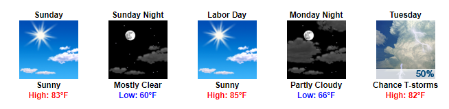
Decent ending to our Labor Day weekend as things dry out Sunday and Monday. Temps will spike back into the 80s with favorable dew points in the upper 50s/low 60s.
By Tuesday, a cold front will dip through Middle Tennessee bringing some showers with it.
GFS Loop Tuesday Morning Through Wednesday Morning
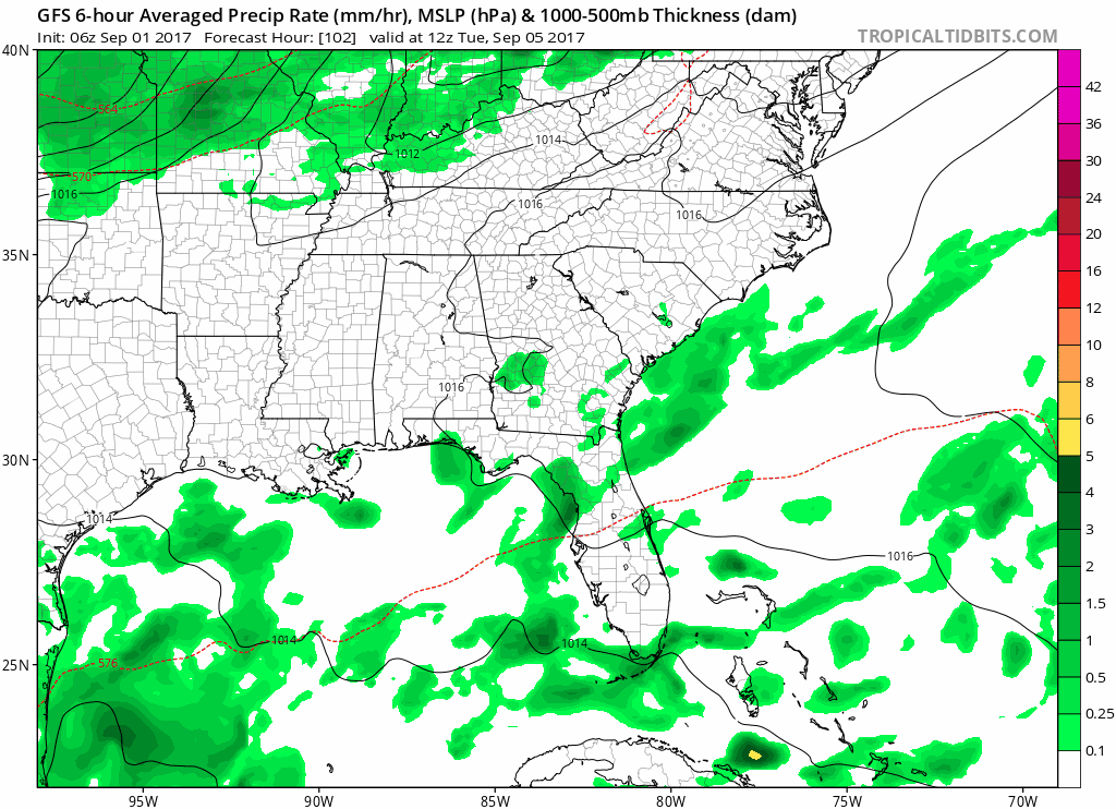
Behind this cold front, highs will be in the low 70s with overnight temps dipping into the upper 50s. Looks like fall is trying to make its first semi-appearance here.
https://giphy.com/gifs/cat-autumn-EDpVRPFK5bjfq

Categories: Forecast Blogs (Legacy)
You must be logged in to post a comment.