
Periscope from 4 pm Detailing Latest Thinking on Rain/Storms
Harvey's Rain and Storm (low tornado) Potential Tonight. Review and discussion. https://t.co/Fo8v6jqeu2
— NashSevereWx (@NashSevereWx) August 31, 2017
Heavy Rain expected to arrive by 8 PM tonight, probably before then.
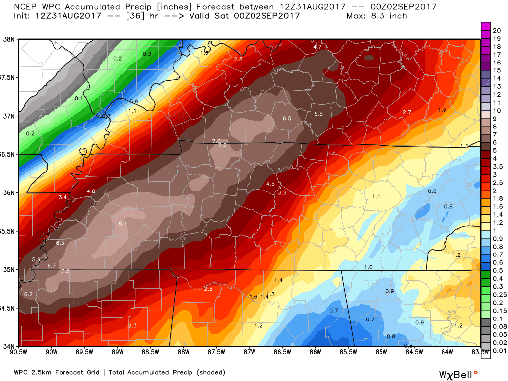
Rainfall totals tonight and overnight will be substantial, with those NW of Nashville seeing the most.
A total of 4″ to 6″ expected tonight through 7 PM Friday.
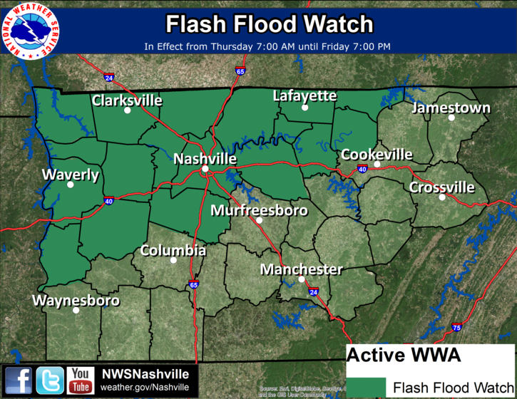
A Flash Flood Watch is in effect until 7 PM Friday.
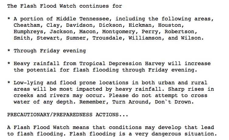
We cannot reiterate enough – do not drive into flooded roadways! Especially at night!
Severe Weather is also possible tonight. Tornado warnings are going up in SW Middle Tennessee. Here, the shear is relatively weak, and models think shear (“spin” in the atmosphere) will drop considerably here after 9 PM. However, a tornado is possible.
Rain is expected to be lighter in the morning and afternoon, gradually ending Friday night as the remnants of Harvey push north into Kentucky.
The Weekend and Labor Day – Drying Out
Saturday, as mentioned, could still bring a few spot showers, but it should be OK for most outdoor activities. Another gloomy day with temperatures in the 70s. Sunday is definitely the pick day of the weekend. Sunshine and temperatures in the low to mid 80s will finally provide good outdoor activity conditions!
Labor Day will also be awesome. Sunshine and an official high of 86ºF.

Categories: Forecast Blogs (Legacy)
You must be logged in to post a comment.