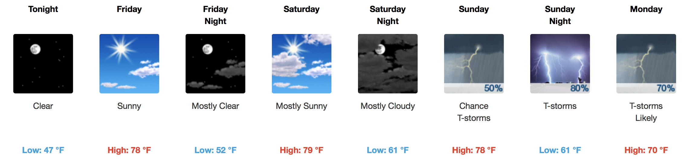
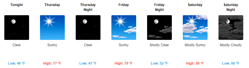
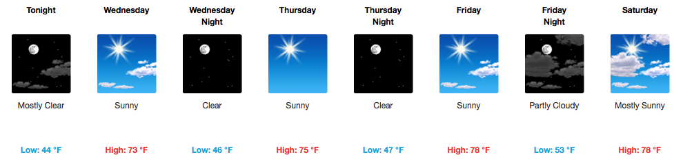
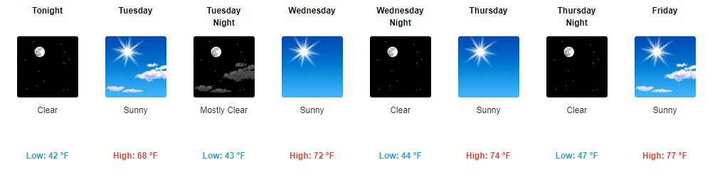
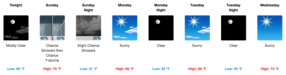
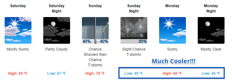
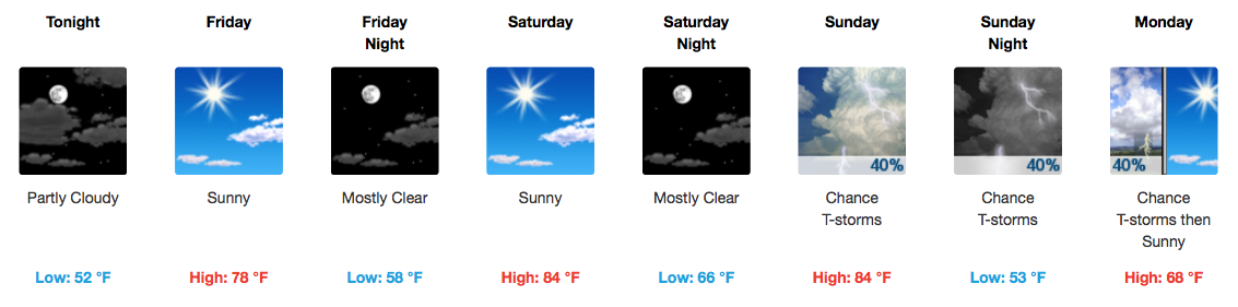
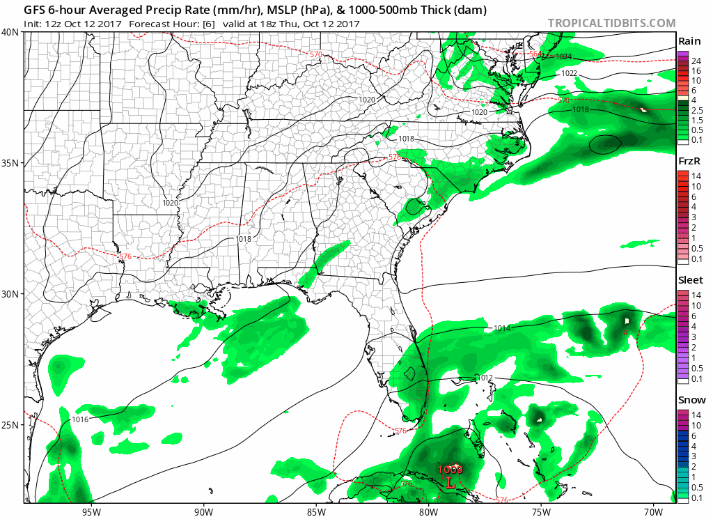
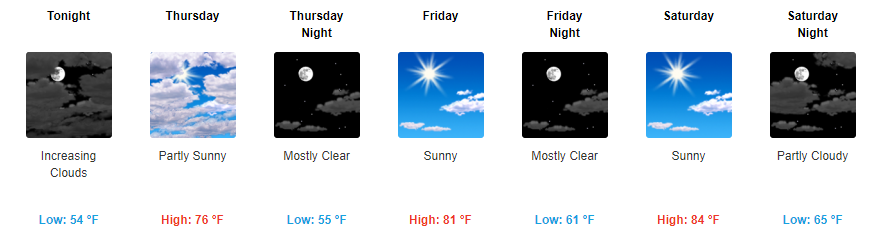
Rain Tomorrow. Snow Looks Unlikely Late Monday Night.

Mon 31°/49° • Tue 34°/43° • Wed 22°/40° • Thu 22°/48° • Fri 31°/56° • Sat 42°/59° • Sun 41°/64°

Cold Rain, Mid-Day Monday

According to the HRRR model, around 9 AM Monday, a rain/snow mix will be crossing the Mississippi River near the Missouri bootheel:

This timing matches well with the NAM3 model, which thinks the rain will be here around lunchtime, and last for a few hours: read more

Nice Today. Rain Tomorrow. Talking Snow Chances Monday Night - Tuesday Morning.

Sunday 50° • Mon 33°/51° • Tue 34°/43° • Wed 22°/41° • Thu 22°/48° • Fri 32°/57° • Sat 42°/60°

Standard Time is Over!

A return to Daylight Savings Time all year long would unite America.

Nice Sunday

This satellite image taken at 8:45 AM isn’t showing clouds over Tennessee. That’s the snow on the ground that went south of us last night. read more

Snow Chances Ending

The snow that formed the basis of tonight’s Winter Weather Advisory has already come and gone.

This afternoon, we wrote that the approaching snow band would get here by 6 PM, and be gone by 9 PM. “If this model is off by 30-40 miles, or by a few hours, we could alot more, or alot less, than this, depending on which way it’s off,” we wrote. read more

On Snow, Forecasting, & the Rest of Today

A Word About The Forecast

Last night, we wrote that the HRRR model predicted a “rain/snow mix” that was to end around 8 AM (this will turn out to be off by 2 hours, and off because it was all snow, no rain). The NAM3 model predicted precip will hold off until mid morning (it had the timing a bit better, but was way off on the precip type). Several models did not have this AM snow at all. read more

Saturday Snow on the Winds of Northwest Flow? Yes? No? Maybe So. Meh.

“Northwest Flow” is weather nerd for winds blowing from the north west. Our rain/mix/snow will be riding NW flow overnight through Saturday night.

Saturday will be cold. We won’t get higher than the low 40°s. read more

Sunny Today, Discussion About Tomorrow’s Winter Weather Potential

About Last Night

Our local National Weather Service Office will be conducting multiple storm surveys today as a result of last nights severe weather. One of the areas that they will be looking into is in Williamson County. Once we learn their findings, we will let you know. read more

Cool Down Starts Now, Saturday Snow?

Severe Weather Threat is Over!

Our severe thunderstorm watch has been cancelled prematurely. Catch some zzz’s to the rain! If you have any further damage reports, please tweet using the #tSpotter.

Quick Look Forecast

Cooler Friday, Snow Chances Saturday Night

Friday

Rain will quickly end Friday morning, and then begins the rapid cool down. A cold north wind will take over on Friday, gusting as high as 20 mph at times. read more

Severe Thunderstorm Watch In Effect

Severe Thunderstorm Watch Until 1AM CST

The NWS Storm Prediction Center has issued a

* Severe Thunderstorm Watch for portions of Middle Tennessee

* Effective this Thursday night and Friday morning from 830 PM until 100 AM CST.

* Primary threats include… Scattered damaging wind gusts to 70 mph possible Scattered large hail events to 1.5 inches in diameter possible read more

Strong, Maybe Severe Storms Tonight; Snow Uncertainty Saturday Night

Quick Look Forecast

Tonight: Heavy Rain, Chance of Strong/Severe Storms

As I write this update, it’s 77°, but our dewpoint is a very-dry 33°. Dewpoints that low aren’t going to fuel any bad storms.

But, storms currently in Missouri will surf a thin wave of higher dewpoints arriving in Middle Tennessee late tonight. read more

Cooler Temps in Sight, Details About Saturday Night’s Wintry Mix Potential

Quick Look Forecast

Sunshine Continues Tomorrow

For those of you who have been enjoying these above-average temperatures, well you are sort of in luck. Tomorrow appear to be the last day, at least for the near future, with our highs climbing into the 70s. read more