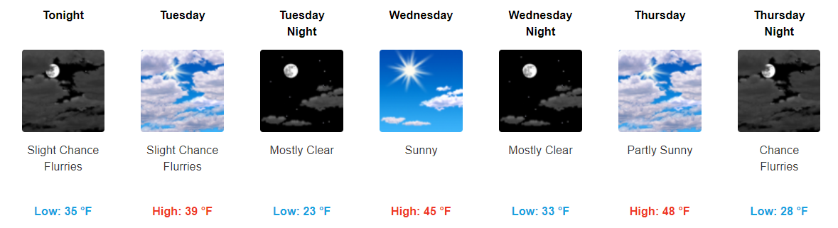
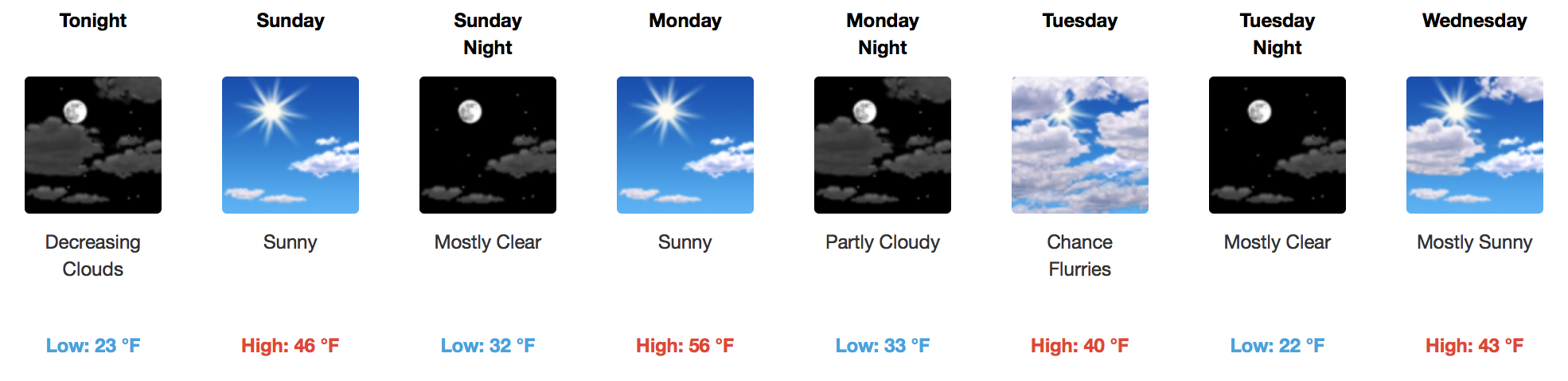
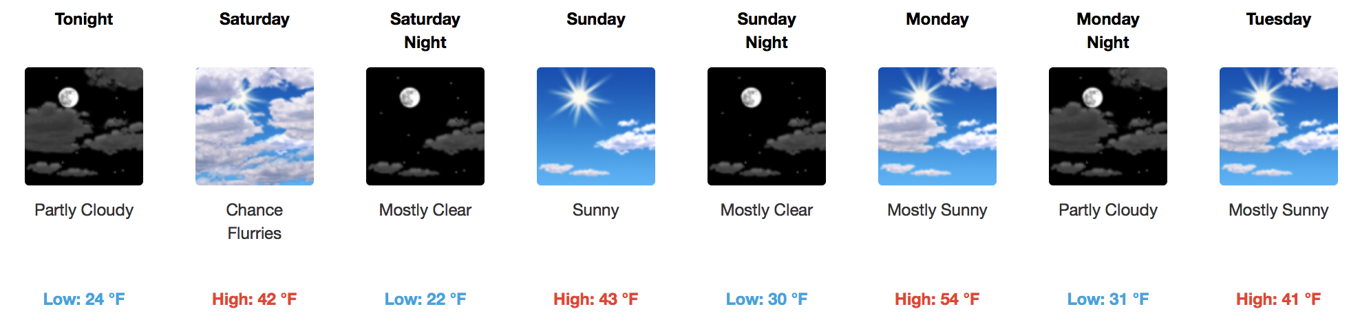
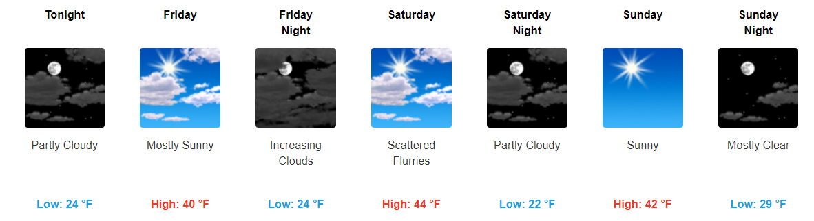
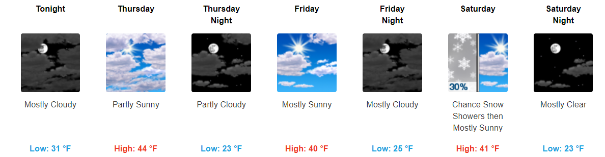
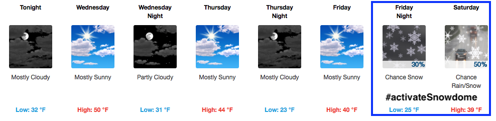
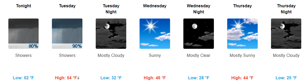
Lunch Update: Windy! Storm ETA 4 PM or so, Heavy Rain, Lightning, Damaging Winds (& Maybe a Tornado)

Severe Weather Threat Today

What: strong to severe thunderstorms with lightning and heavy rain, containing probabilities for damaging winds, localized flooding, and maybe a tornado.

When: Right now, we think 4 PM, plus or mins an hour or so either way. read more

Very Windy, Severe Weather (Hail, Winds, Tornado) Possible Later Today

Severe Weather Threat Today

What: strong to severe thunderstorms with lightning and heavy rain, containing probabilities for damaging winds, hail, localized flooding, and maybe a tornado.

When: We aren’t exactly sure. Expect it to arrive anywhere from mid/late afternoon into tonight. read more

Hot and Windy, Storms on Sunday

Flood Advisory for Stones River Through Tonight

Even Windier Sunday, Cold Front With Storms By Night

A wind advisory will likely be needed for the day on Sunday, with gusts over 40 mph possible. A developing line of showers and thunderstorms will be pushing into western Tennessee by mid-afternoon, making their way in our direction by late evening. read more

Showers and Thunderstorms Possible Later Today, Uncertainties Remains


Flood Advisory Continues for the Stones River

We still have a flood advisory in effect for Davidson County due to the Stones River.

We still remain above the action stage, hence the advisory remaining in effect. Any additional rainfall we see today through the weekend will likely cause us to stay above the action stage. If you come across a flooded roadway, turn around don’t drown. read more

Unsettled, Severe Weather Potential Explained

Flood Advisory Continues For the Stones River

The river is expected to remain at the same level or barely recede by the weekend. If you come across a flooded road, turn around don’t drown.

Stormy Pattern Ensues, Doesn’t Mean We All Get Thunder

Ingredients are coming into play for multiple rounds of showers and thunderstorms, some with heavy rainfall and severe potential, today through the weekend. read more

Our Active Weather Pattern Starts Overnight Tonight


Flood Advisory Continues For the Stones River

We do still have a flood advisory out for parts of Davidson County near the Stones River.

The river is declining; however, it still remains above the threshold for a flood advisory. If you do come across a flooded road, turn around don’t drown. read more

With Rivers Up, More Rain is Forecast

Flood Advisory Extension, Beautiful Day In Store

A flood advisory has been extended for the Stones River, but the good news is that the river stage level is falling:

If you run across areas like Lebanon Road, do not attempt to drive through any amount of water. Turn around, don’t drown. read more

Dense Fog Advisory for Tomorrow Morning, Enjoy the Sunshine Tomorrow While it Lasts


About This Past Weekend

Officially, Nashville received 4.47″ of rain. That is a lot. For radar estimated rainfall across the area, refer to the graphic below.

There is still one flood advisory out for Davidson County concerning the Stones River. read more

One Last Batch of Showers Tonight, Sunshine Finally Returning Tomorrow


Showers Continue Through the Evening into the Overnight Hours

To start, we saw A LOT of rainfall between Friday and Saturday.

read more

Heavy Rain? Gone!

Streams and Rivers Finally Catch A Break

The worst of the rain/storms is gone, but…

A few active flood warnings/advisories are in effect, across the Davidson/Williamson County areas. These are attributed to heavy rainfall causing stream and river rises that could run over into low-lying areas. We’ve already seen evidence of flooding in many spots! read more