The party is premature. Our transition to a fall airmass is currently underway *only at the surface" — aloft, summer/tropical/wet is hanging on. This jerk "overrunning" pattern means rain should redevelop Thu morning and may not end until tomorrow night. /ducks/ pic.twitter.com/NTNRaWUmzN
— NashSevereWx (@NashSevereWx) September 26, 2018
Looking Ahead to This Weekend

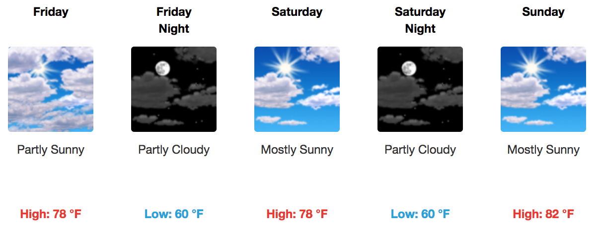
Rain will clear out by Friday as high-pressure begins to dominate our weather pattern. Temperatures will (unfortunately) begin to creep up in conjunction with this pattern change. Still, it is going to feel so much better than it has in recent weeks. Highs will be in the high 70s to low 80s. Morning lows will be near 60º.

Once the high pulls to the east, an impulse of energy will begin to bring Gulf moisture, via a southerly flow, on Monday. Heavier rain might set up across middle Tennessee Monday afternoon, but nothing is set in stone. We are also watching a cold front for next week that may drop our temperatures and finally make it feel like fall for a prolonged period of time.
All in all, much of the weekend appears favorable for any outdoor plans! It is going to feel awesome. Check back to NashSevereWx for updates to this forecast and follow us on Twitter for constant analysis of real-time conditions.
Categories: Forecast Blogs (Legacy)


You must be logged in to post a comment.