
Today
Seasonable, cooler temperatures have arrived in middle Tennessee, FINALLY! We are looking at a high of 77º in the city as clouds being to clear out and the additional sun is introduced into the forecast.

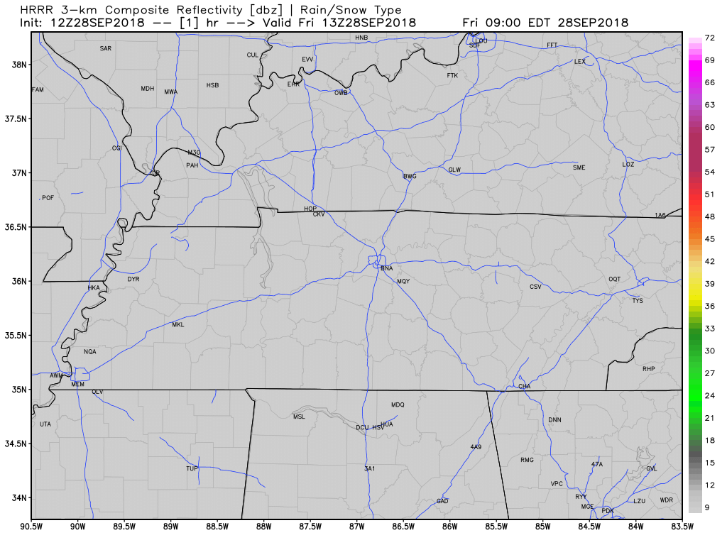
All of the models keep rain out of our area today. Below, is the HRRR. Not a drop in sight within Nashville.
This Weekend
High temperatures will fail to reach the 80º mark again tomorrow in Williamson and Davidson Counties. Expecting widespread low to mid-70s. No rain again on Saturday. Outdoor plans look awesome weather wise.
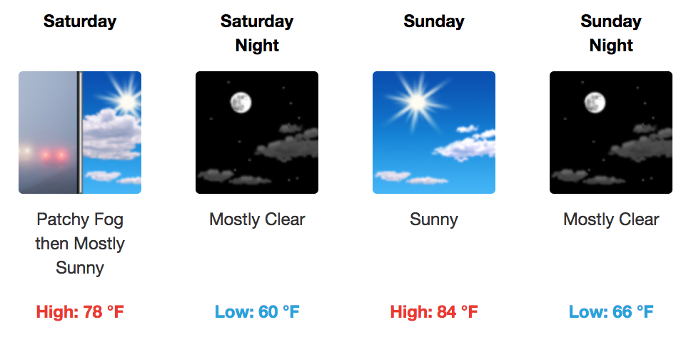
The northerly winds, which are bringing us this fall like weather, will turn more southerly on Sunday. This will maker temperatures and dew points creep back up with morning lows in the 60s and afternoon highs in the low 80s. For Sunday though, no rain is expected in the Nashville metro; the only real chance for rain is over the Plateau and east Tennessee. It’s a great weekend to see the Titans take on defending Super Bowl champs the Philadelphia Eagles! Titan’s radio won’t need to call us to fill and rain delays…
Next Work Week
Rain chances will return to the Nashville area on Monday as a weak low-pressure system will become the dominant weather feature. Cloud cover and isolated showers and storms will become more prominent Monday afternoon. A similar story will play out on Tuesday before high pressure takes over again on Wednesday and Thursday.
By Friday, a cold front will approach the area and give us decent rain chances for next weekend. Of course, still a lot of time between now and then, we are watching.
Temperatures in the afternoon will be in the low to mid-80s through the week.
Stay clicked here and on Twitter @NashSevereWx for updates!

Categories: Forecast Blogs (Legacy)
You must be logged in to post a comment.