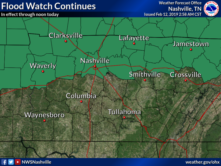
Summer Time Pattern Persists for the Holiday Weekend

More Summer Time Storms

Ok, everyone on 3… 1, 2, 3, Summer! Time! Pattern! Today is another day in the hot soupy mess. Temperatures will be approaching 90º for a high today with dew points in the 70º range. It will be hot, even in the shade today. read more

Clouds Keeping Temps Lower Today/Tomorrow; Next Week is Hot & Humid

Clouds will be pretty widespread today, keeping high temps in the upper 80s. Dewpoints are oppressive, in the low 70s, a normal for late-August.

Morning showers over Nashville left our atmosphere with plenty of moisture and instability that could kick off afternoon showers and storms. Any storms that go up aren’t expected to reach severe levels. read more

Higher Rain Chances Today, Continuing Through the End of the Week

The sweat machine rolls on today… expecting highs in the low 90s today with dew points in the 70s (oppressive range).

The upper ridge (high pressure) that has brought us the hot and humid weather the past several days will begin shifting eastward as weak cold front moves southward into the Tennessee Valley, opening the door for rain. read more

Rain Chances Increase Wednesday. Rain Most Likely Thursday.

High temps will climb into the low/mid 90°s today. Dewpoints continue to stay within the low 70°s making temps feel closer to 100°.

We could see a popcorn shower/storm or two over Nashville today. The HRRR model shows storms going up during the hottest time of the day. You could see a quick downpour and hear a few rumbles of thunder, but that’s pretty unlikely. Showers should be scattered far and wide. read more

Hot & Humid All Week; Rain Chances Increase Wednesday

Temperatures will increase today, tomorrow, and Wednesday, stopped only by the arrival of clouds and rain beginning sometime Wednesday. Expect high temperatures to be in the low to mid-90s with morning lows in the mid-70s. read more

Hot & Humid; Rain Chances Increase Wednesday

This morning, the HRRR model predicted this afternoon’s showers and thunderstorm, which poked through high pressure like a hernia through a tummy.

If you were north of the 24/65 split, near Skyline and Madison and Goodlettsville, you could not ignore it. It tossed lightning and prompted NWS-Nashville to issue an Areal Flood Advisory and a Significant Weather Advisory. read more

Quiet (well, mostly quiet), Hot & Humid. Better Rain Chances Return Wednesday PM.

Last week’s cool snap is a memory.

High pressure is parked over the entire southeast. Weather nerds call this a “ridge,” a large clockwise rotating airmass that’s pushing down on us, trying to keep clouds from lifting and making it rain or storm. Behold the ridge at 18,000 feet (seen below). read more

Decreasing Clouds and Increasing Temps

The Heat Returns Today

The general forecast for today is for the clouds to recede and temps to rise to the temps we’re used to  seeing this time of year.

Tonight

Something going on outside tonight? Not sure. read more

Heat, Humidity, Rain Chances Return

Image result for friday gif

Here Comes the Heat

Did you get a chance to step outside this morning? It was hard to believe it was still summer! However, by this afternoon you’ll have no doubt it is still mid August. 

A High pressure system, the weather feature that was giving us this relatively cool and tranquil period, is beginning to shift to the east, making way for temperatures and dew points to rise. Humidity will remain comfortable for the time being as it will take a day or two for the dew points to rebound into the uncomfortable and oppressive range. read more

Beautiful Today; August Heat and Humidity Return For The Weekend

Pleasant temps for another day!

Mid 80s for the high temps today. Northwesterly winds continue to push dewpoints down into the low 50s. Long story short, it’ll be a beautiful day!

We’ve got clear skies overhead as a surface high is located just to our north. A few clouds from a disturbance out west could wander into Williamson and Davidson counties sometime today, but no rain. read more