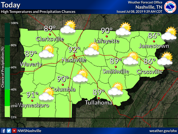
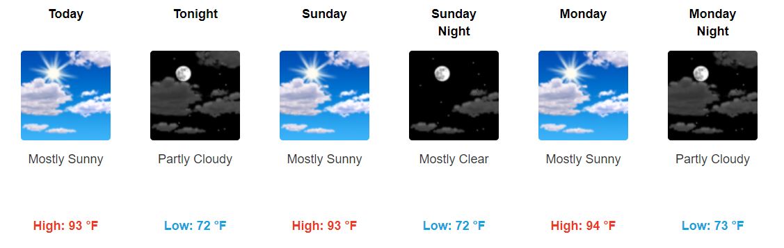
The Storm Prediction Center has us placed within a Marginal Zone (1 out of 5) of severe storm activity for this afternoon.
6:39 PM update: there’s another line of storms to our west.
The latest Mesoscale Discussion mentions these storms:
Cold air is pouring in from the north, making for a breezy day. Wind chills will go no higher than the upper 20s this afternoon, with breezy winds driving the wind chill into the upper teens after sundown.
Normal high temps for the end of November are usually in the mid-50s!. High could crawl close to 35° even though we’ll see more sun through the day.
Some flurries are possible but no impacts are expected. Just be careful if you see a wet road, there may be a thin layer of ice.
Overnight temps will fall even further into the low 20s. This is due in part to clouds breaking up, cold air and calm winds. Here’s what NWS Nashville has to say:
"CAA [cold air advection; fancy term for cold air moving from one place to another] today will also bring drier air with dewpoints in the teens, and with winds calming down a bit tonight, there won't be anything to keep temps up."
The kids say “rn,” efficiently meaning “right now.” Hey, it’s your tomorrow. It means everything.
48° and foggy rn. pic.twitter.com/nswJ3CPraI
— NashSevereWx (@NashSevereWx) November 25, 2018
Few Thanksgivings in recent memory have been as nice weather-wise as yesterday. With a high of 61°, it was perfect for David’s Turkey Bowl, which he described yesterday.
So, every year I aim to leave 30% of the plate visible once I load it up with food. Each year I fail miserably. The problem is this: Once 70% of the plate is full, there’s still 30% of the buffet remaining left to visit. It’s simple math. But, that was yesterday. This is today.