
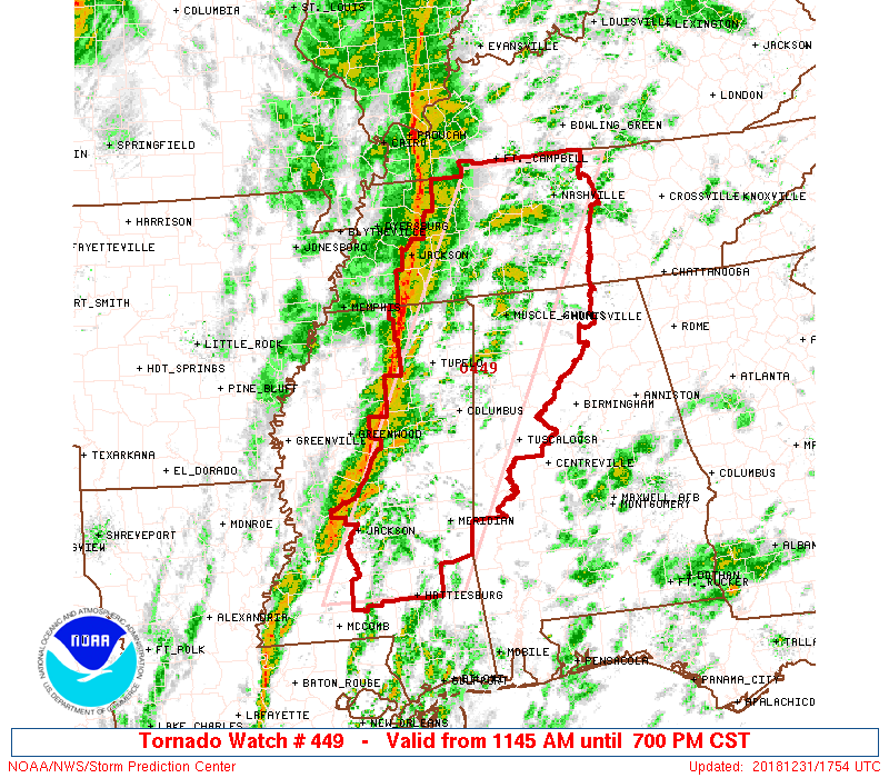
From the Storm Prediction Center:
Primary threats include…
- A couple tornadoes possible
- Isolated damaging wind gusts to 70 mph possible
A Watch covers a large area and means Be Ready, conditions are favorable for a tornado.
A Warning covers a smaller area and means Immediately Take Action/Shelter, a tornado is occurring or imminent inside the warned area.
For more on tornado terms and safety, click here.
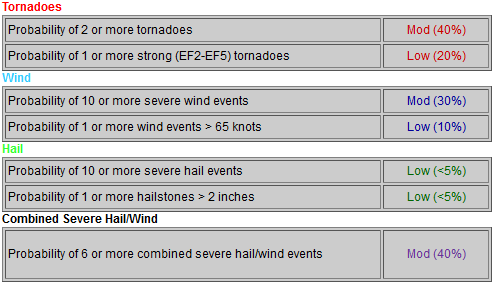
Below are probabilities for tornado, damaging winds, and hail anywhere inside the large Tornado Watch area, which includes us:
ETA
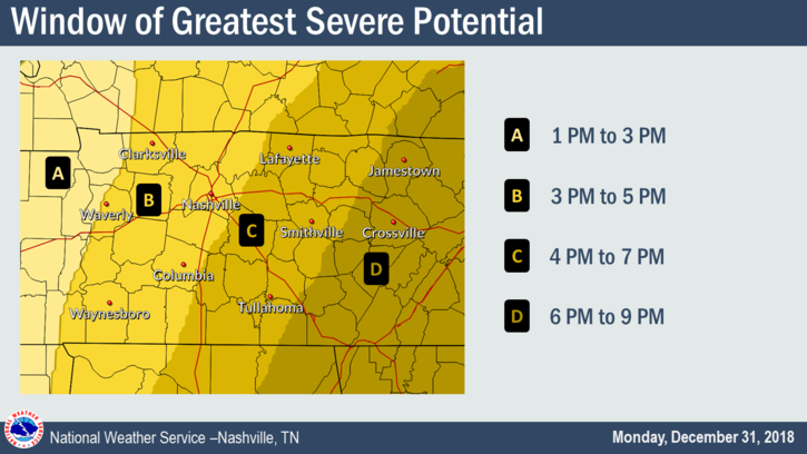
Official NWS-Nashville ETA is 3-5 PM.
I like the early side of that ETA for a few reasons.
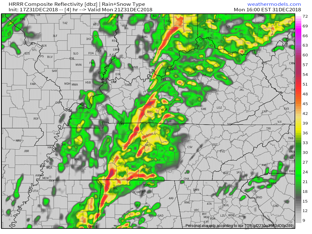
First, the line already passed Jackson TN at noon and I don’t think it’ll take 5 hours to get here.
Second, the latest run of the HRRR model puts the line into Nashville and Williamson County between 3 PM and 4 PM. Below see the HRRR model predicting the radar at 3 PM. This model has been pretty consistent with this ETA all day.
Check back frequently this afternoon for adjustments to the ETA. Storms may arrive sooner than 3 PM.
Updates throughout the day can be found on Twitter @NashSevereWx. If there’s a warning, Andrew will be live on Periscope; we will tweet that link.

Categories: Forecast Blogs (Legacy)
You must be logged in to post a comment.