


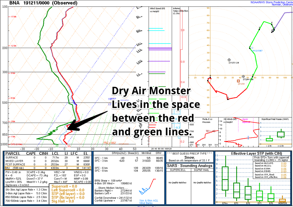
Today snow fell at 10,000 feet and 5,000 feet and even at 2,000 feet but before it could reach us on earth along came the Dry Air Monster. He ate it all up.
Here’s how the Dry Air Monster operates.
Suppose you’re standing at a sink holding a hand towel and a shot glass of water. Put the hand towel between the shot glass and the sink. Then pour the water onto the towel. The water is absorbed into the towel. The water never makes it into the sink.
The towel is the Dry Air Monster. The shot glass of water is your snow. We live in the sink.
The towel absorbing the water is, in this analogy, evaporation.
The D.A.M. is defeated if you have enough water to soak the towel. A wet towel absorbs nothing, the water poured on it makes it to earth.
Sometimes the D.A.M. shows up as a paper towel. Pour a little water on it and it’ll break through.
Today the D.A.M. arrived mid-morning. By this afternoon it was one of those super thick towels folded up, absorbing everything. By then, there wasn’t much snow in the shot glass. Some of the water poured down the sides of the towel, but the sink stayed mostly dry. The towel was folded a bit thicker in Nashville, a little thinner near and south of I-840.
D.A.M. is still out there tonight. The 6 PM weather balloon revealed the Dry Air Monster still in place, reinforced, a massive, superthick towel absorbing everything from the ground to about 10,000 feet up. Dude at all that snow today and is even hungrier now. But there is no more snow to eat.
If you want the tee, here it is:

It wasn’t cold enough.
Surface temps never made it to freezing. The sleet and snow is now south and east of us; while it was here, it encountered a north wind consistently blowing just under 10 MPH (drying roads), but mostly the sleet and snow that made it did the splat/melt thing. Air stayed above freezing, and the ground was warmer than that.
The models did…OK. Not great.
Very Cold Overnight…Black Ice?
Black ice tonight was a concern going into this event but I haven’t seen evidence of any roads wet enough to form black ice overnight despite very cold temps on the way.
After 6 PM the temp is 34°F and slowly dropping. Soon we will reach freezing. After midnight we’ll drop well below freezing and bottom out in the mid 20°s before sunrise Wednesday (some areas may be even colder). I suppose black ice is possible tonight along wet bridges and overpasses at elevation along and near I-840, but is any pavement wet?
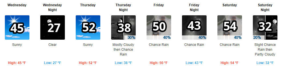
Warmer Wednesday
Up to mid 40°s with sun after a very cold morning.
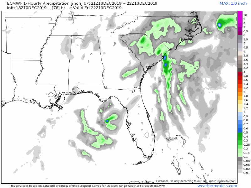
Iffy Rain Chance Late Friday – Saturday Morning
Another system swings by late Friday into early Saturday but it’s weaksauce and may pass completely east of us, missing us. Below is the Euro model from Friday night into early Saturday morning, meh.
A More Impressive Rain System Monday the 16th?
Below NWS-Nashville does the heavy lifting on this very-far-away potential event.
All long term models are showing relatively good agreement on a developing strong Plains trough Monday and some decent rain amounts Monday through mid day Tuesday. Right now models show 1 to 2 inches of rain, with some slight chances for snow at the end of the event for the Plateau. Still too early yet to determine snow potential but models do agree on the strength of this trough and the cold front associated with it, so seems like a good bet on getting another good soaking rain event next week.
NWS-Nashville, Afternoon Forecast Discussion, 12/10/19
Temps/Comic Strip

Categories: Forecast Blogs (Legacy)
You must be logged in to post a comment.