
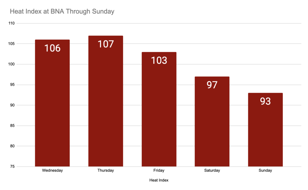
Heat advisory in effect for us today and tomorrow 11am-8pm CDT. What does this mean exactly? Heat indices ranging from 105 up to 109…. pretty miserable. Reason for caution if you’re planning to be outside. Plenty of fluids, shade, and A/C are your best friend. Important to know signs of heat exhaustion/stroke, so please give the graphic below a quick once-over.

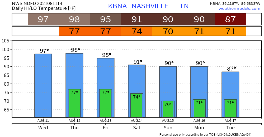
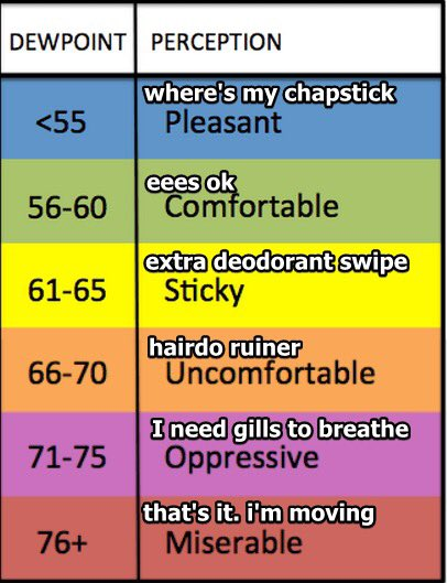
Historically warm couple days ahead. For reference, average high and low temps for Aug. 11 are 89 and 69, respectively. We’re going to exceed both by a hefty margin. Not quite record breaking, but HOT nonetheless. Still going to see dewps in the low 70s.
When Will it Stop?!
Right now it appears Friday will be slightly cooler (relative to today and tomorrow)… still forecasted to see highs in the mid 90s and dewps around 70. But relief (relative again) is on the horizon when a cold front is expected to roll through late Friday/early Saturday. With it come more typical August heat indices (highs around 90 and dewps in the upper 60s). Little sneak peek of how heat index will change over the next few days below.
Side Note: Rain
Pretty easy to overlook any rain when it feels like you’re walking into a sauna anytime you leave the house. Pop-up storms are possible (but unlikely) in the afternoons. Models aren’t picking up on them well… so there’s not much certainty. Most will be east of I-65. Not expecting any severe weather. Chances are low, so don’t count on anything widespread. Increased T-storm coverage possible with the cold front later.
Categories: Forecast Blogs (Legacy)
You must be logged in to post a comment.