Today’s weather is not going to be ideal. Here’s what’s up.
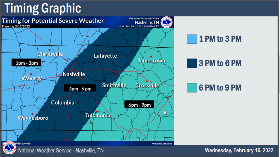
The main action for us starts around noon (note: it might happen before noon for those of you north of I-40, this ETA may change so check our twitter before “relying” on any one ETA).

Today’s weather is not going to be ideal. Here’s what’s up.
The main action for us starts around noon (note: it might happen before noon for those of you north of I-40, this ETA may change so check our twitter before “relying” on any one ETA).
Tonight’s 0z run of the HRRR model thinks beginning Tuesday after lunch an atmosphere somewhat capable of producing a tornado or two, damaging straight line winds, and maybe even hail will settle in. The severe storm capability should linger into the evening and end before bedtime if current model data has it right.
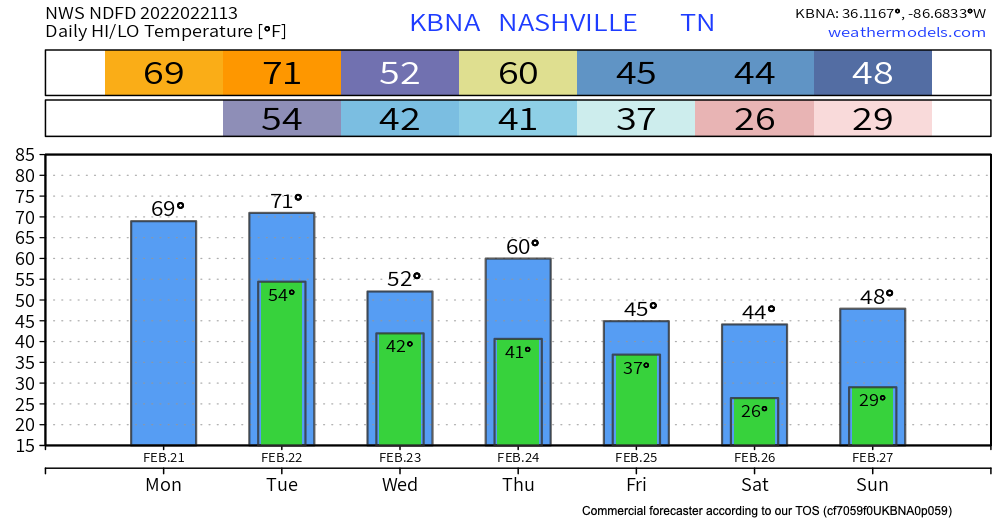
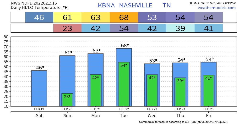
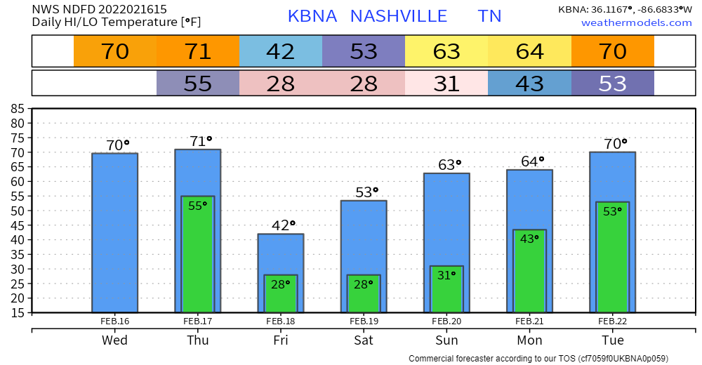
Temps are above average today with highs almost reaching the 70 deg mark. Might feel a tad sticky with the moisture that will roll in today.
A wet week is ahead with rain all throughout the work week. There will be two main rounds that we see this week.
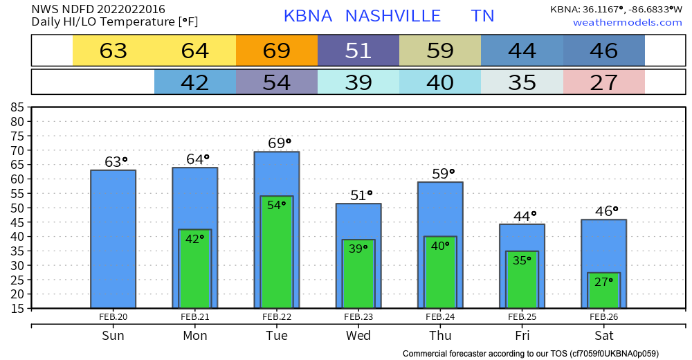
Today we hit the low 60’s jackpot, sunshine, and no rain. Great finish to the weekend.
The rest of the week will not be this pretty. Get ready for rain.

The rain this week will come in two rounds: #1 Monday night through Tuesday night & #2 Wednesday night into Thursday night.
Nothing crazy happening today . Temperatures will reach the mid to upper 40’s. The HRRR is rain free.
Uh oh! Sixties Sunday, Monday, and Tuesday in February. Something’s up.
It will be rain central next week. Not fun at all. There is the threat of flooding.
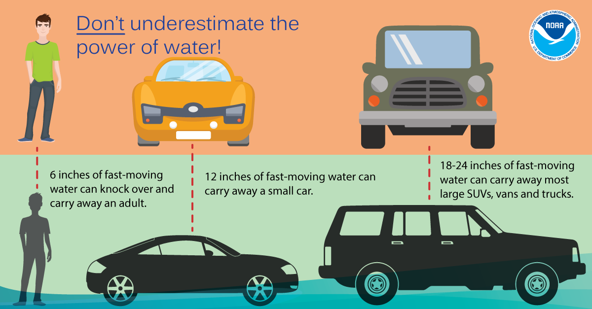
Those of you who live near fast rising creeks and streams, and near low-lying usual spot flood areas, need to spend the weekend getting ready for two potential flooding events next week (Tuesday-Wednesday & Thursday-Friday).
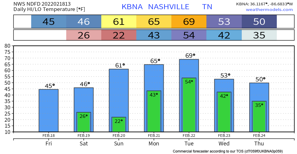
After yesterday’s storms and the passing of a cold front, we can expect some chilly temps this weekend. Lows drop into the low 20s tonight and Saturday night, so make sure plants and pets are accounted for.
Here’s the main takeaway for today: wind is guaranteed, tornados are not. You’ll want to secure any loose objects on your porch, and avoid parking your car under unstable trees or tree branches. If you have a weather radio, today is a great day to use it. Our damaging wind probability is 30%. Our tornado risk percentage down from 10% to a 5%.
A MIGHTY WIND
Before the storms expect south winds sustained 20-30 MPH, with gusts to 45 MPH. Loose objects will be relocated.
MORNING RAIN
This should not be a big deal. Insufficient CAPE to power storms will be the reason.
Storms are fed by instability. The question for tomorrow’s potential severe event: will there be enough storm food to fire up storms AND sustain themselves? CAPE values are relatively low, but recent model runs show a slight uptick (which could be just enough).
You must be logged in to post a comment.