
This morning, skies are overcast with temps in the low 80s. Very humid.
Later this morning and into the afternoon, a few small showers or even a thunderstorm could pop up due to daytime heating and a boundary stretched across Tennessee.

This morning, skies are overcast with temps in the low 80s. Very humid.
Later this morning and into the afternoon, a few small showers or even a thunderstorm could pop up due to daytime heating and a boundary stretched across Tennessee.
Slight chance of rainfall and storms today, but we will probably stay dry. Mostly cloudy most of the day.
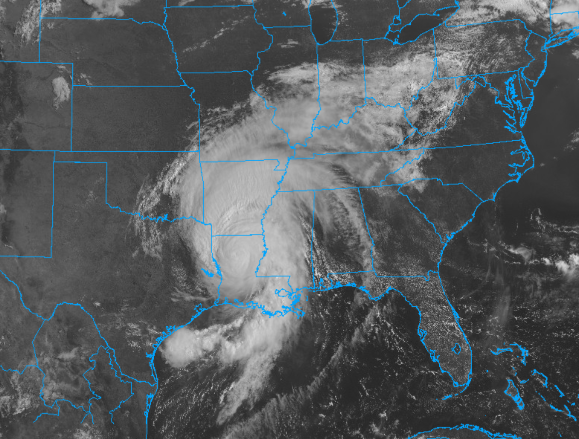
High temp of 92° with a heat index of 100°. Humidity is high as Laura pulls thick, humid air off the Gulf of Mexico and into Middle Tennessee.
This weekend is starting off with mostly cloudy skies and nice, comfortable temperatures in the mid 70s.
We are getting another heat break today with a high temp of 82! #ThanksClouds
Showers and thunderstorms are possible this afternoon, but not for everyone. Looks kinda widely scattered, so the chances of most of y’all getting something are pretty low.
Temperatures this morning are currently at 86 degrees. Expected to rise into the low 90’s. Partly cloudy skies.
A few showers and thunderstorms are expected this afternoon along with a weak cold front. These would occur mainly between 2pm and 8pm. No severe weather is expected.

A thunderstorm cluster is in Western Kentucky moving southeast toward us, but the models think it’ll fizzle out before it gets here.
More storms may redevelop for a few of us this afternoon. Severe weather is not expected. There might be lightning or even a few pretty big downpours, but not for everyone.
To start off this lovely Tuesday, we are looking at overcast skies with temps in the low 70s.
That’s right, low 70s! We are finally getting a break from the heat thanks to a short wave trough passing through this morning carrying some cool air.
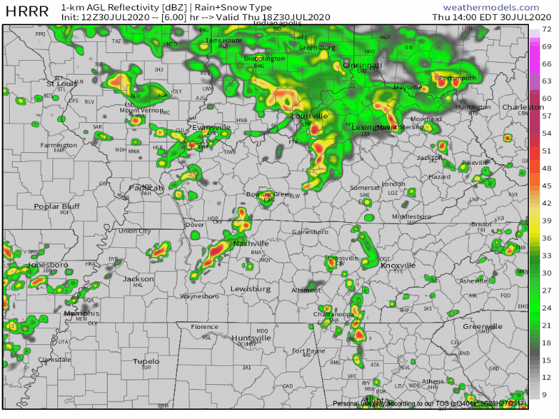
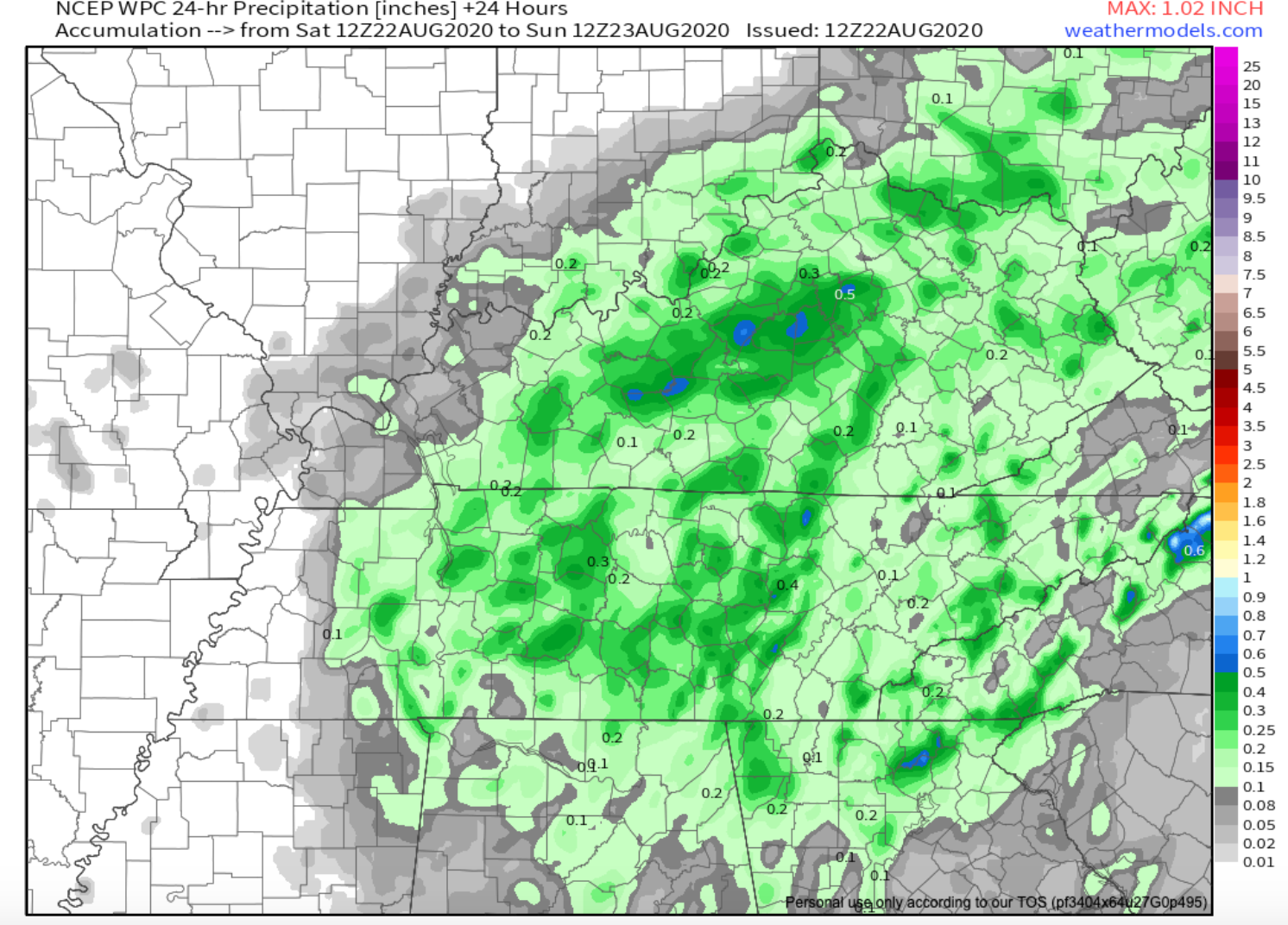
At 10 AM a heavy rainstorm was moving across Nashville south of I-40 and all of Will Co. This morning’s weather balloon showed over 2″ of precipitable water content, setting us up for Day 1 of what should be a soggy trio of days ahead.
Another typical summertime forecast. It’s miserably hot and humid with high temps today in the mid 90s.
Afternoon storms are bit more likely today. Showers/storms will break out across the region around 1 PM and will come and go. Some storms could contain strong winds and heavy downpours. Will you get one? Who knows, models do not do well predicting the “where,” although they do OK with the “when.”
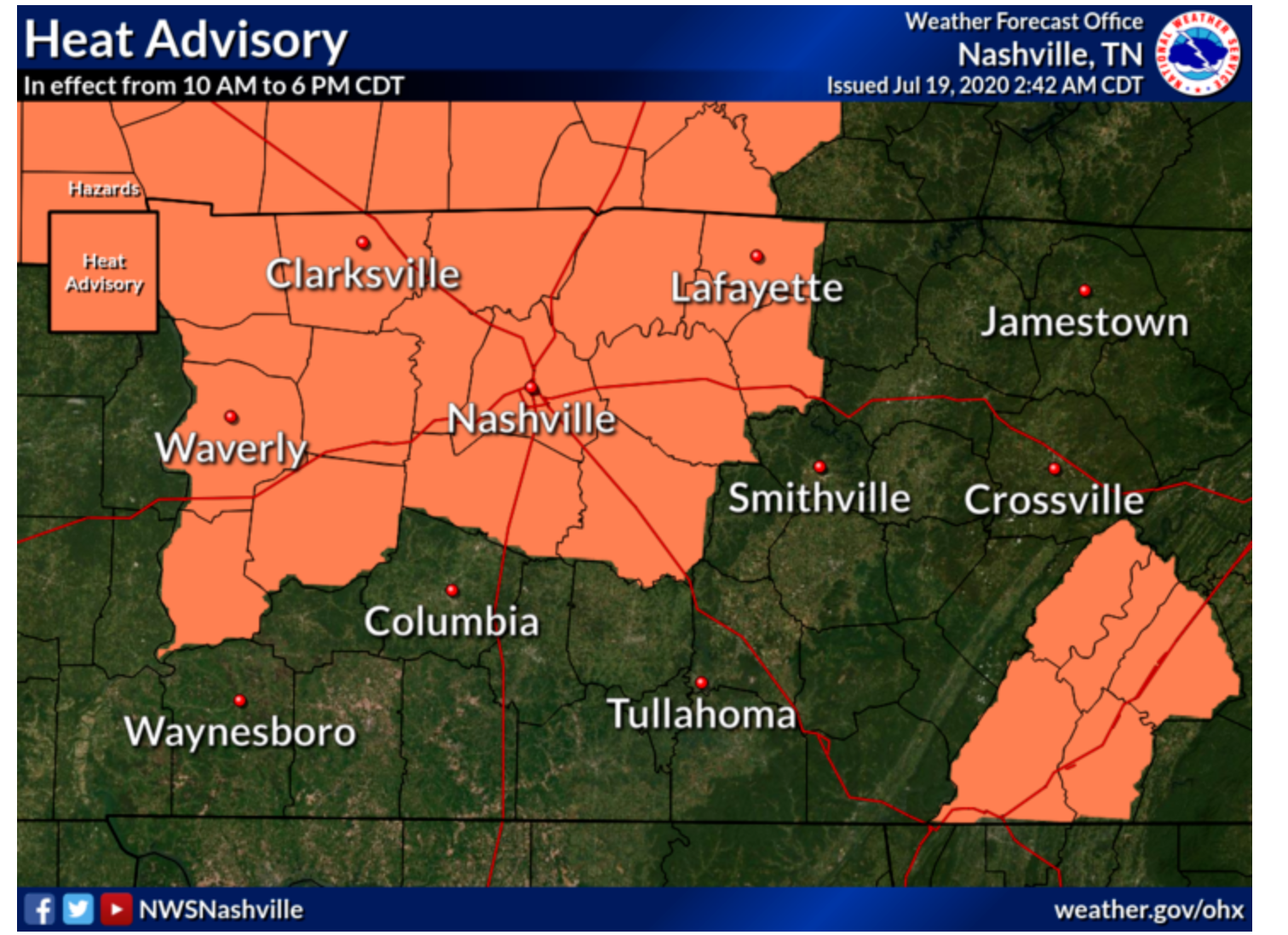
The National Weather service has issued a Heat Advisory from 10 AM to 6 PM. Dew points in the low 70s and temperatures to 98° will send the heat index value as high as 105°. A Heat Index is issued when the NWS thinks the heat index will get to 105°, the level NWS thinks will cause you problems.

Today we are starting off with sunny skies and temperatures in the low 80’s. As the day matures, you can expect those temperatures to spike once again into the high 90’s.
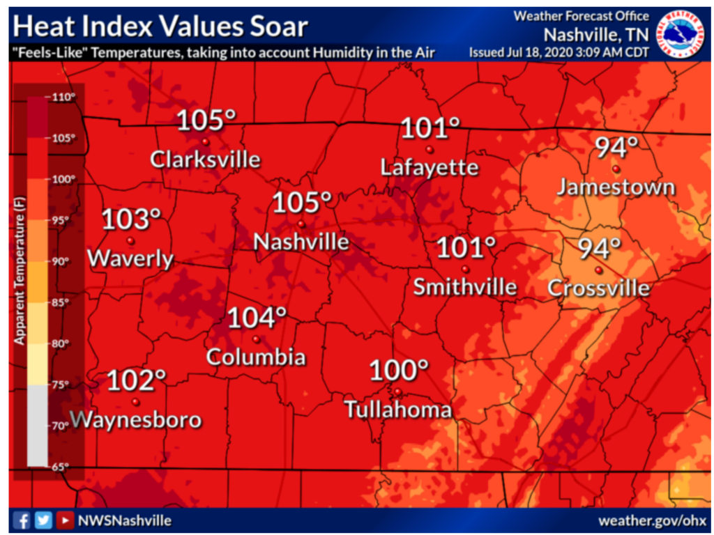
As shown in the forecast graphic above, the heat index will reach 105 today. If you plan to be outside today, don’t over exert yourself and drink plenty of water! Also, keep in mind how much hotter the interior of your car will be while you are out and about. Especially if you h;ave children or pets with you. Don’t leave them behind!
You must be logged in to post a comment.