Editor’s Note: On this day in 1917, Nashville received 7 1/2 inches of snow. Give yourself about 30 seconds to immerse yourself in that scene, then proceed with reading this awesome forecast.
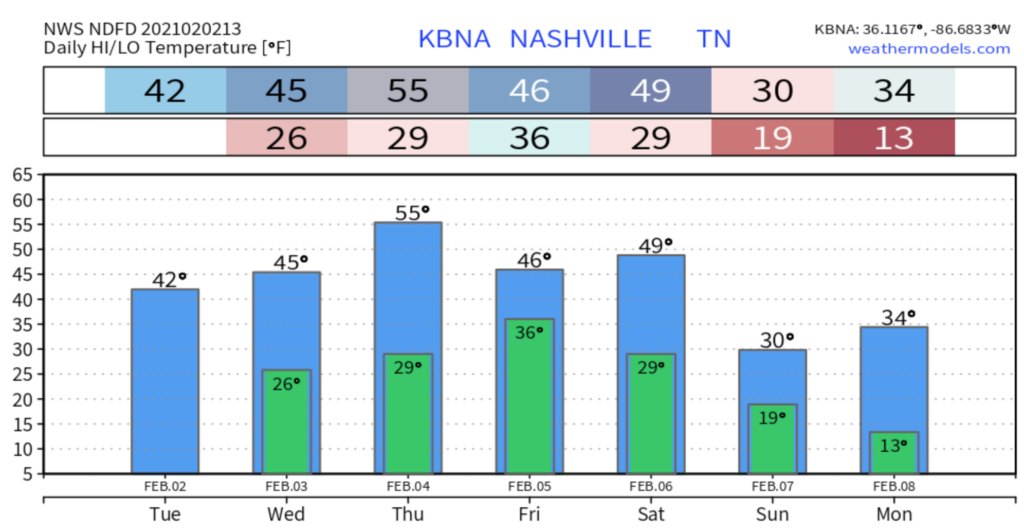
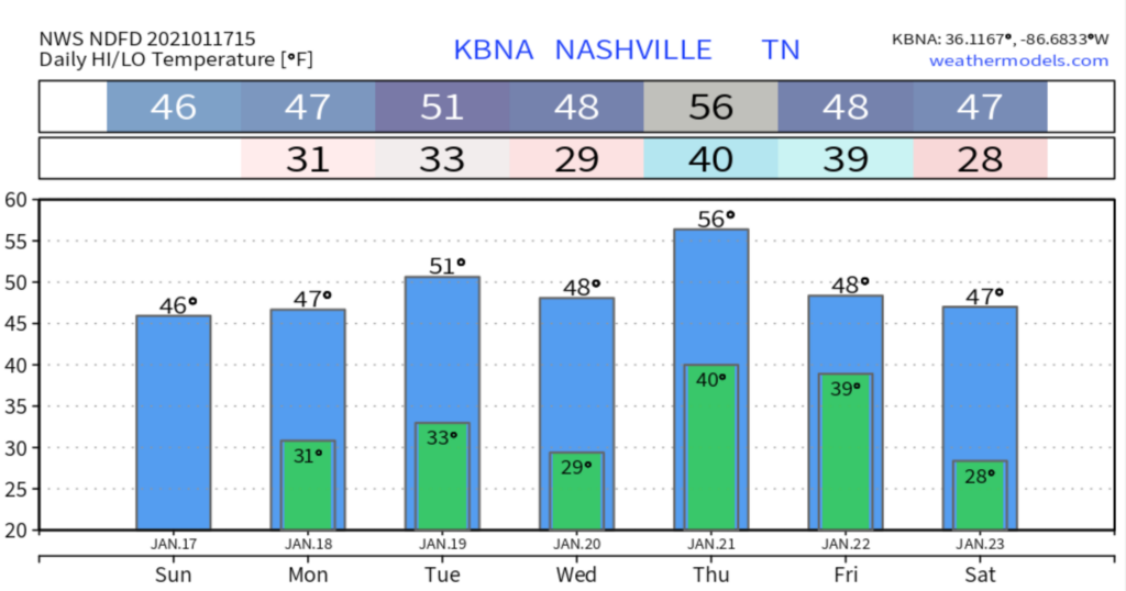
Warming up nicely out of the 40’s today with lots of sunshine. read more
Impacts so far have been on vegetation/elevated surfaces on the hills and ridges in both counties. The chance of seeing more widespread icing on outdoor objects increases once you go up into Fairview or Joelton. read more
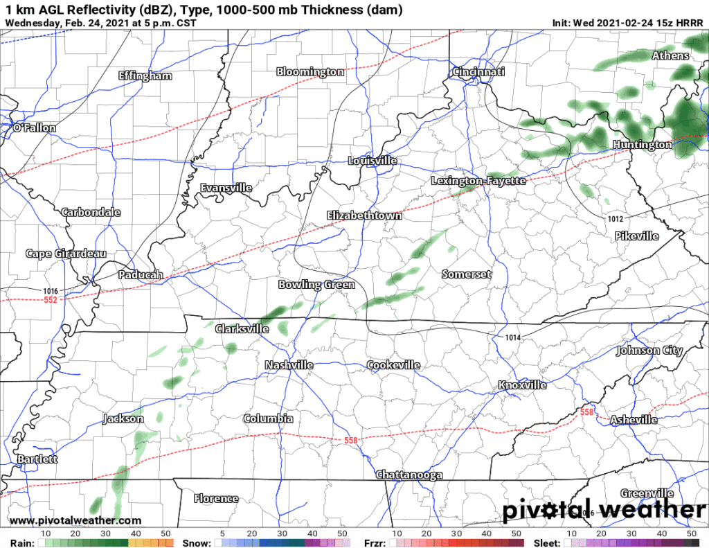
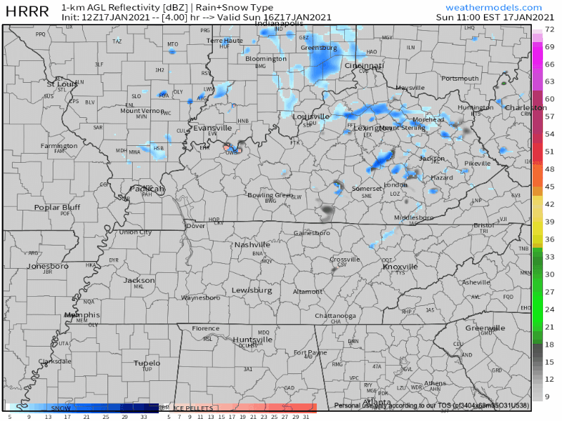
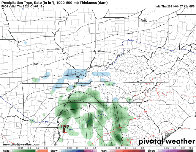
A quick blast of snow is possible around midnight. HRRR model below:
HRRR Model from 11am today-4am Monday
This event shouldn’t threaten your Monday morning travels or inconvenience you in any other way.
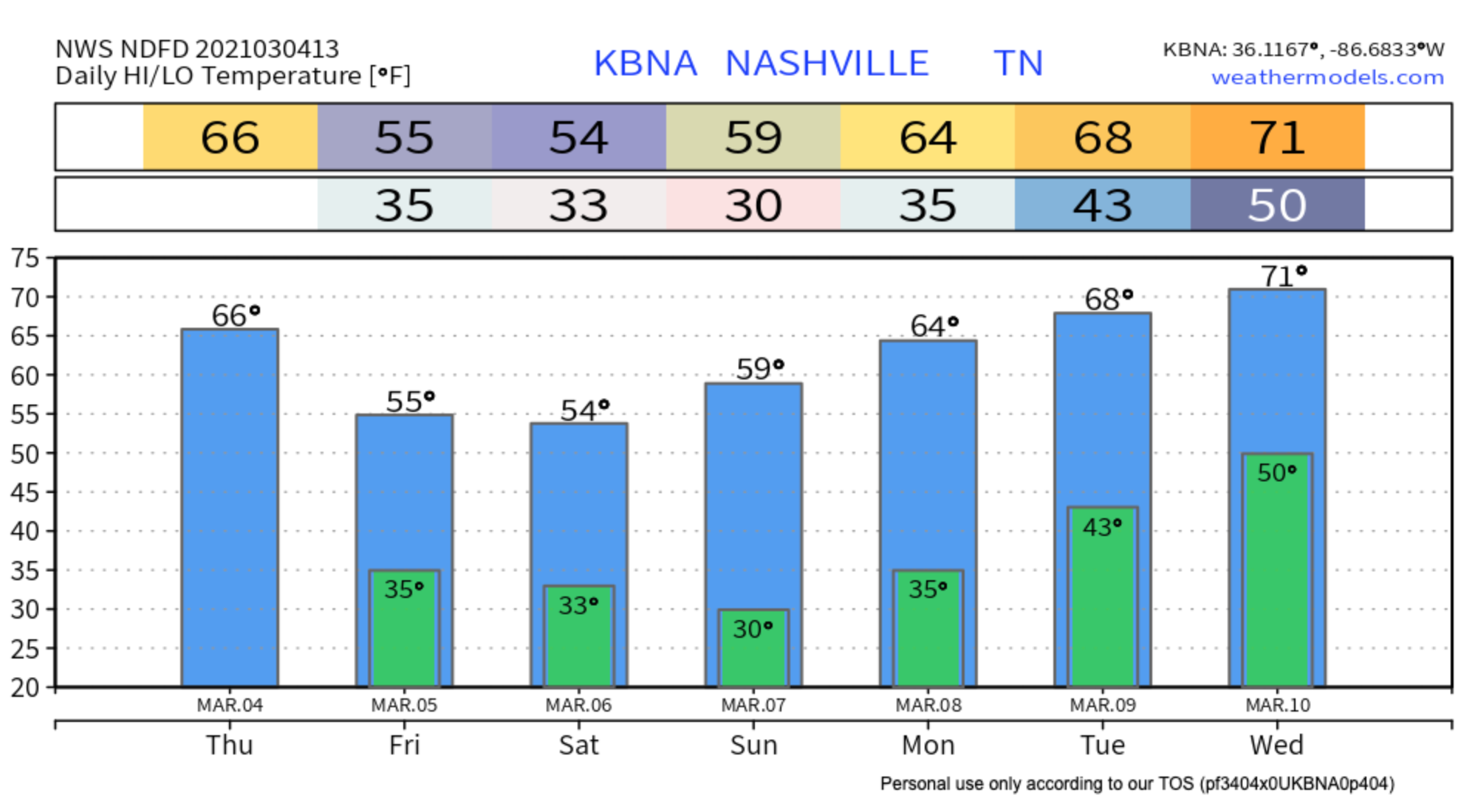
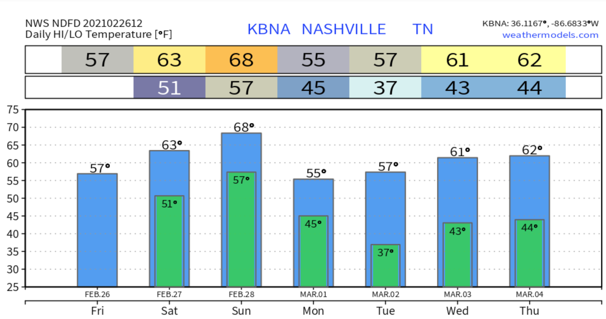
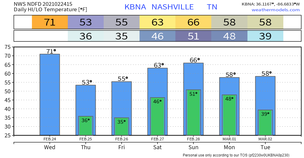
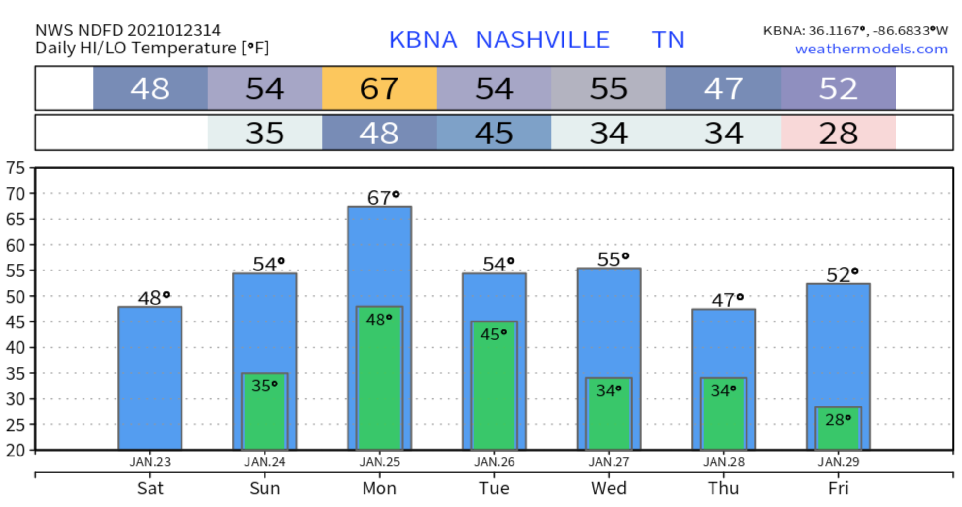
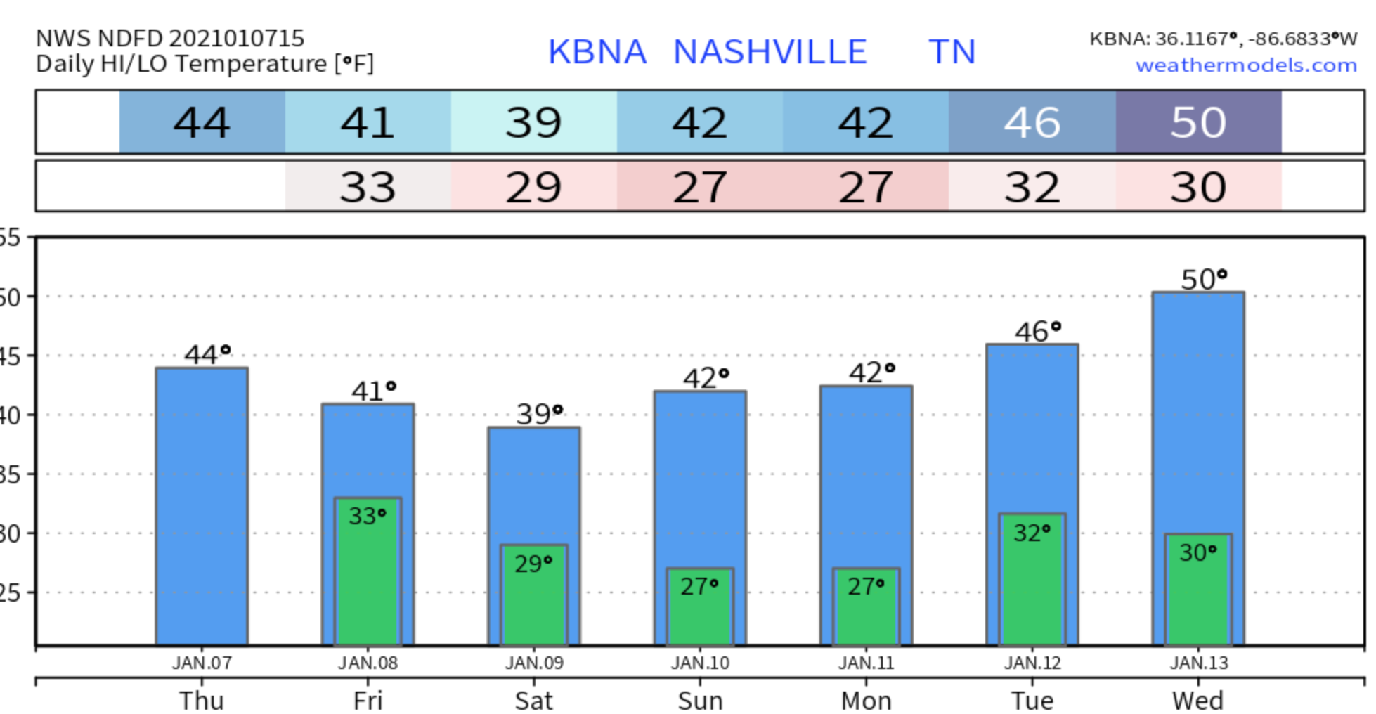
The forecast for the rest of the week is a confusing mess.
Forecast is of low confidence as models continue to be all over the place as they struggle with the upcoming fast, split flowupper level pattern.read more
The real story here is that rain will begin pretty soon. JK the real story is that there is a non-zero chance of snow tonight and tomorrow morning. Let’s dive in…
After the afternoon rain event today (mainly after 5pm), temperatures will drop below freezing and that rain will transition into a rain/snow mix.
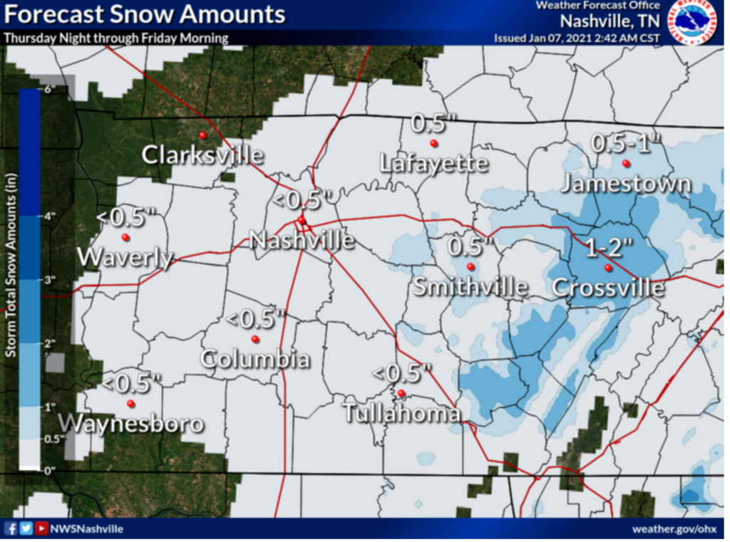
Nashville, although, is only expected to see less than half an inch. If anything, we will just get a dusting.
Official NWS Snowfall Accumulation Map
In general, impacts remain low. Temps should hover just a little bit above freezing at the surface in Nashville, but in the hollers, if it’s colder, bridges and overpasses could be impacted. Regardless, if you plan on traveling anywhere tonight or tomorrow morning, be cautious!
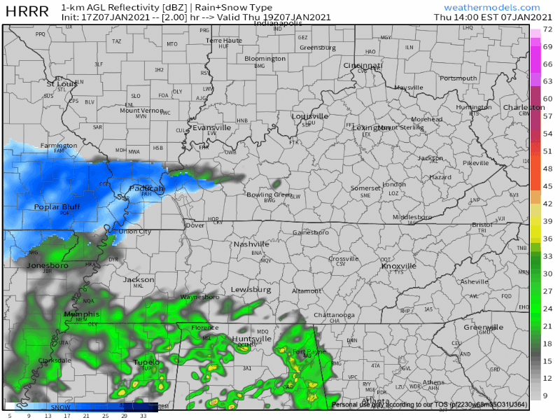
Let’s take a look at forecast models.
HRRR Model from 2pm Thursday – 6am FridayEuropean Model Overnight Into Friday
The Euro model (above) shows the snow Friday staying to the east. Other models show lingering moisture and weak lift which should be enough for some areas to see flurries.
Here’s what the NWS says…
IT STILL LOOKS LIKE THERE MAY BE A BRIEF PERIOD OF MIXED
PRECIP THIS MORNING ON THE LEADING EDGE OF THE PRECIP WEST OF I-65
AND LOOKS TO BE ALL RAIN THROUGH THE DAY THEREAFTER. AFTER
SUNSET, TEMPS WILL DROP TO THE MID 30S BEFORE 9 PM, AND PRECIP
WILL CHANGE FROM RAIN TO A RAIN/SNOW MIX, FOLLOWED BY ALL SNOW
JUST AFTER MIDNIGHT. HIGHER ELEVATIONS INCLUDING THE PLATEAU MAY
COOL OFF A FEW DEGREES SOONER, AND SEE ALL SNOW BEFORE MIDNIGHT.
SHOULD TEMPS COOL OFF A BIT SOONER AREA WIDE, WE MAY SEE MORE
SNOW, AND IN THE OTHER DIRECTION, SHOULD TEMPS STAY WARMER, SNOW
WILL BE DELAYED AND AMOUNTS WOULD DECREASE. read more
Subscribe to Blog via Email
Privacy & Cookies: This site uses cookies. By continuing to use this website, you agree to their use.
To find out more, including how to control cookies, see here:
Privacy Policy


You must be logged in to post a comment.