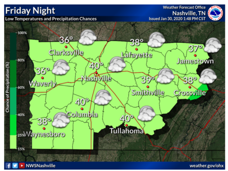
Rain Today, Transition to Summertime Weather This Weekend

Wednesday

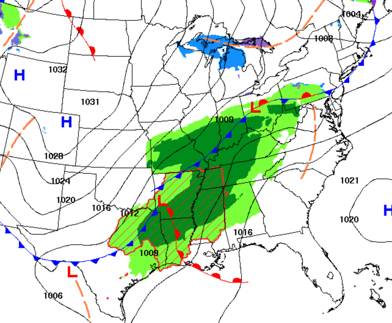
It’s raining this morning, obviously, although most of the rain is heading into Nashville. Will Co will get some rain this morning, just not as much as those further north.

By 1 or 2 PM, rain should clear out. That’s what the HRRR model thinks . . .

. . . although it is possible for a few lighter showers to appear later this afternoon or early tonight.

Just rain today. Can’t completely rule out lightning but think that’s unlikely, so if you want to take a walk in the rain, go for it. No damaging winds and certainly no severe weather. For severe weather, you have to go pretty far west:

Thursday

Mostly sunny, afternoon high 84, but windy. Gusts could reach 25 MPH.

windy fall GIF

No one thinks it’ll rain, but with dewpoints sliding closer to 60F, no promises.

Friday & the Weekend

It’ll start to feel like summer.

Friday will start off cloudy, then showers and scattered thunderstorms will develop in the afternoon. Will they scatter over your head? Impossible to predict. Welcome to the summertime afternoon pop up storm lottery! High of 85.

Saturday & Sunday are unclear. One model, the GFS, sends in a cold front, sparking rain and a few thunderstorms Saturday morning maybe lasting into the afternoon. However, NWS-Nashville thinks a tropical wave developing off the coast of Florida this weekend will keep that cold front from getting to us, keeping us rainless until Sunday afternoon. If that happens, expect high afternoon temps to approach 90.

Settings Records for Latest Freeze this Weekend?

Today

Rain will continue this morning into the mid/late afternoon with winds around 15mph.

The rain will clear out and temps will drop into the 30’s overnight.

Above is a short range forecast from the NWS of the extent of precipitation we will receive in the next 12 hours.

Tonight/Saturday morning

Friday’s rain will result in a cold front that will bring the frost we are expecting Saturday morning. A freeze warning that has been issued by the National Weather Service from 1am until 9am Saturday.

The low is expected to be around 34 degrees tonight. Some areas will experience frosting Saturday morning after 4am. As the day progresses, temps will rise into the sunny, low 60’s.

Frosting in May?

Frosting isn’t something that we expect this time of year. With that being said, we could break the record for the lowest temperature recorded for this day of the year.

36 degrees is the lowest temperature ever recorded for May 8 according to xmACIS. So if the low’s do reach 34, or even 35, the record will be broken!

Sunday and Into Next Week

Saturday night into Sunday morning we could experience more patchy frost after 5am until 9am. Sunday will be a nice sunny day with temperatures in the 70’s. Those will drop back into the low 40’s Sunday night.

Monday and Tuesday will be nice, cooler days with little to no chance of precipitation. Highs will be near 65 both of these days. Rain could possibly return Wednesday with a 20% chance of precipitation and a high near 74.

Winter Weather Advisory 9 PM Thu to Noon Friday.

Snow is Coming

Rain will develop in West Tennessee early tonight. From there it’ll move into Middle Tennessee. Temps aloft will fall below freezing, transitioning a light rain to a light sleet, then a light snow. Models agree snow will come out of the sky before midnight, tapering off and ending around sunrise.

UPDATE: WINTER WEATHER ADVISORY.

Winter Weather Advisory covers Nashville and Will Co.

Snow should begin between 9 PM and midnight:

Uncertainty #1: How Much Snow?

Models vary how much snow will fall, and exactly where it’ll go.

The official forecast from the Winter Weather Advisory shows less than 1″.

Some models have a large area of snow covering up everyone.

Euro model Thursday night at midnight.
HRRR at midnight Thursday night.
HRW WRF at midnight Thursday night.

NWS published this graphic shortly after issuing the Winter Weather Advisory. Less bit more than a half inch far north Nashville, less than a half inch everywhere else.

Uncertainty #2: Will It Stick?

We’ve had a warm week. The ground is far from freezing. Early this afternoon the temp is 41F and falling, but it’ll take several hours before we hit freezing, and it’s unclear if we will even hit freezing overnight.

It’s possible that when the snowflakes fall, just before they hit the earth, the flakes encounter an above-freezing layer of air that causes the flakes to splat:melt on contact.

Sticking snow at least needs 32F or colder temps, and it needs those freezing temps for at least a few hours, and even then it’ll be hard to accumulate on anything other than decks, garden gnomes, mailboxes, and more importantly, bridges, overpasses, and elevated areas/hills (colder than those below them). The ground will still be relatively warm.

Even by 3 AM, models disagree on whether it’ll be 33F, 32F, or 31F:

That said the Euro model – widely respected – predicts 32F at midnight and 31F at 6 AM. So it might be cold enough for long enough to accumulate some of this light snowfall and/or create black ice on area roadways.

Takeaways

  1. We think it will rain then transition to snow.
  2. Snowfall will be light and unevenly distributed, so you may get less than those 5 miles down the road.
  3. Initial flakes will melt. The snow might stick, it might not.
  4. Bridges, overpasses, decks, and elevated areas atop hills will ice/accumulate first. Be very careful on these surfaces overnight! It’s possible, but not likely, there will be minor travel impacts on trafficked roads.
  5. This forecast will probably change tonight, so stay connected for updated information.
  6. Anywhere from nothing, to a dusting to a half inch of snow is possible.

Avoid Confirmation Bias — where you ignore information that contradicts what you hope will happen.

Avoid Recency Bias — the assumption that what happened recently is what will happen this time.

It won’t be this much snow!

Friday

After sunrise Friday morning, temperatures will rise above freezing heading for an afternoon high of 40. Mostly cloudy throughout the day. Friday night temps will drop back into the low 30’s. Another shortwave will swing through bringing another chance of precip, and maybe another even lighter shot of snow, but no impacts are expected right now with this one.

The Weekend

Saturday will remain pretty cool with a low of 30 and a high of 46. Luckily the sun will make an appearance throughout the day here and there to bring those temps out of the 30’s and above 40.

Sunday will warm up with a high near 60 along with clear skies and sunshine. Then, more rain on the way!

Next Week

Rain will return for Monday and Tuesday possibly progressing into storms by Wednesday. Luckily we will not be experiencing rain AND cold with temperatures averaging a high of 57. Average low of 47.

Excessive rainfall will be a concern this time next week.

Rain Moving Out For a Pleasant Weekend

Friday Night

As we head into the weekend, rain will dissipate into early Friday afternoon and leave us with overcast skies and a slight chance of precipitation. Temperatures in the low 40’s Friday night.

Weekend:

Overcast cloud deck will begin to weaken and allow some sunlight through on Saturday. Temps will reach a high of 50 and a low of 39. A slim chance for showers.

But no fear! Sunday will be much nicer than Friday and Saturday with sunny skies and a high near 65 with a nice breeze from the southwest.

Next Week:

Monday will be sunny for the most part with temps similar to Sunday with a high of 66. With showers expected Monday night, this will carry into Tuesday with a 60% chance of rain and thunderstorms possible into the night. Precipitation is predicted throughout the rest of the week with mainly overcast skies.

Above is the (probably a bit too early to worry about, but not insignificant) WPC QPF graphic showing how much rain we could get next week.