
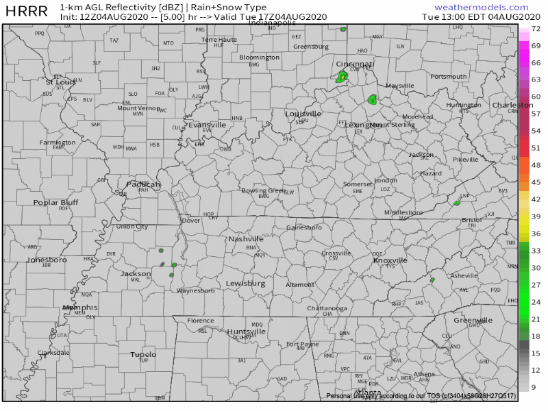
To start off this lovely Tuesday, we are looking at overcast skies with temps in the low 70s.
That’s right, low 70s! We are finally getting a break from the heat thanks to a short wave trough passing through this morning carrying some cool air.
This trough is bringing a weak cold front with it this morning that will cause a few scattered showers and thunderstorms.
Moisture, instability, and sheer are minimal in this system, but it will provide enough lift to give us a few pop up showers or storms.
After today, we are looking at minimal rain for the remainder of the week.
Tomorrow
Wednesday’s temps will be much like today’s in the mid 80s. Partly sunny skies expected with little chance of precipitation.
Although, a shower or storm could pop up in the afternoon, it should stay to our east.

This Week Continued
Thursday and Friday will be fairly nice days as well.
Unfortunately temperatures will heat back up into the upper 80s-low 90s, but it’s going to be sunny with little to no chance for precipitation.
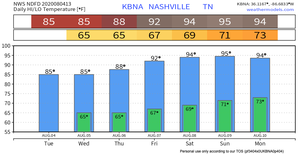
As the graph shows, we will get back to those hot summertime temps we’re use to by the weekend.

Categories: Forecast Blogs (Legacy)
You must be logged in to post a comment.