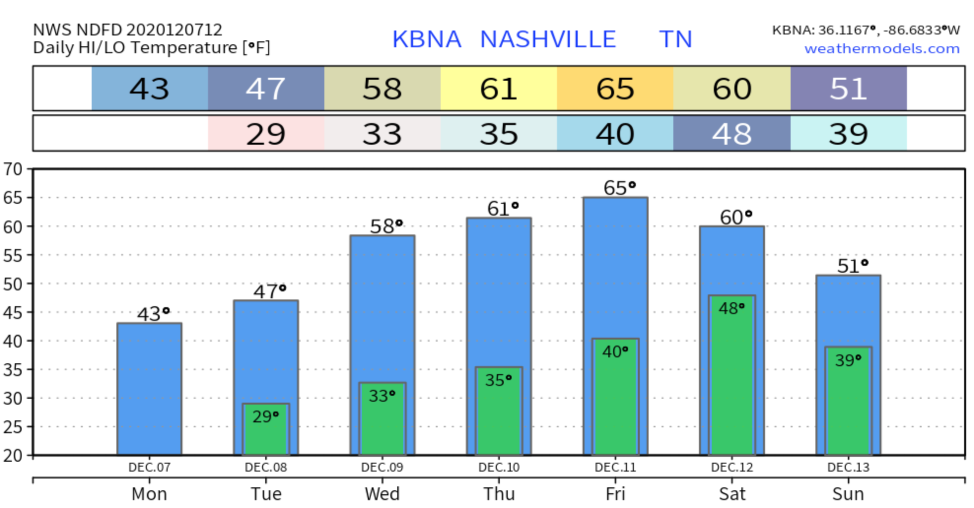
Clouds and cooler temps for this Saturday afternoon until rain chances increase for tonight.
Light rain showers could begin this evening begin after 7pm and may continue until 5am.
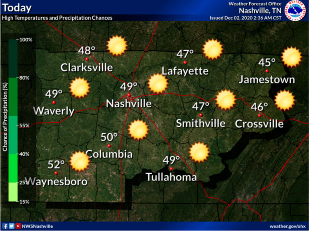
High today is 51 degrees.

Clouds and cooler temps for this Saturday afternoon until rain chances increase for tonight.
Light rain showers could begin this evening begin after 7pm and may continue until 5am.
High today is 51 degrees.
The morning weather balloon showed winds just off the surface at 50 knots. Some of that wind will find its way to the surface by mid day. Expect gusts to 33 MPH around noon, slackening off tonight. Morning temperatures in the 50’s will reach 65° this afternoon. That’s about 20° above climatological normal.
It’s Hump Day!
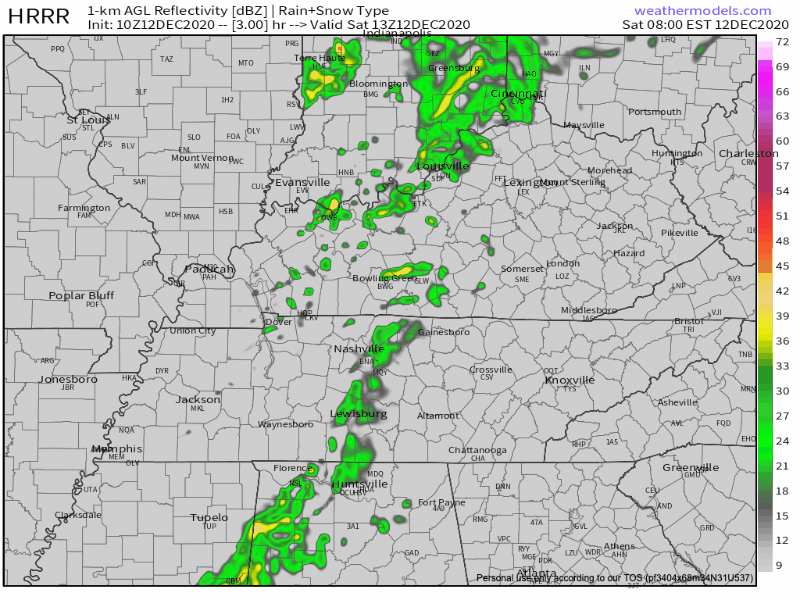
Light rain continues across the region this morning with temperatures in the low 40’s.
This system should be moving out around lunchtime/noon.
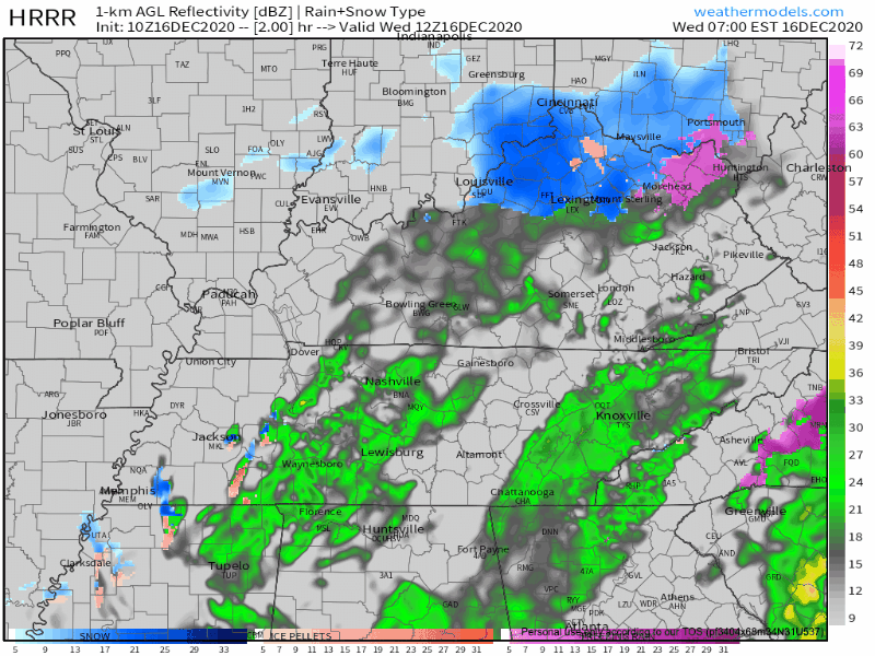
Those temperatures aren’t going to warm up very much as the day goes on with only a high of 44.
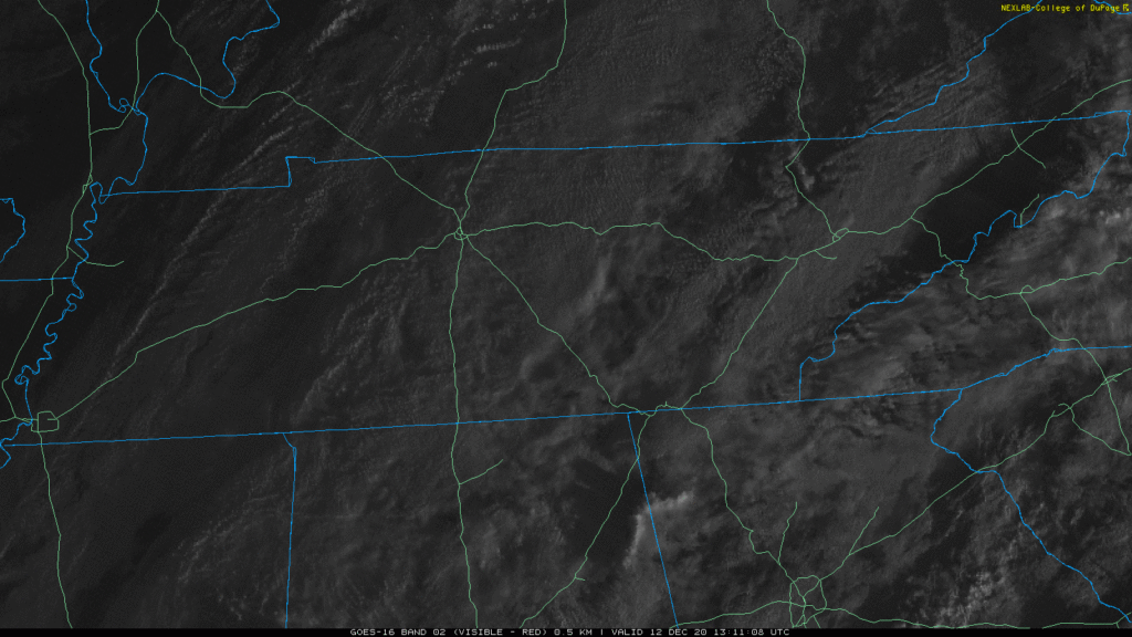
Our morning light rain will have ended before lunch.
Sunday morning and early afternoon will be clear and dry. High only 54° with a cold north breeze. Clouds will arrive around late afternoon.
It’s going to start raining Sunday night. Rain will end early Monday morning. Euro model:
It’s quite chilly this morning with temps in the low 30’s, and we are only going to warm up to 43.

Skies are partly cloudy and will stay that way all day. A few flurries were caught in a north wind mid-morning, blowing into Middle Tennessee from Kentucky. These are of no consequence and will melt upon arrival.

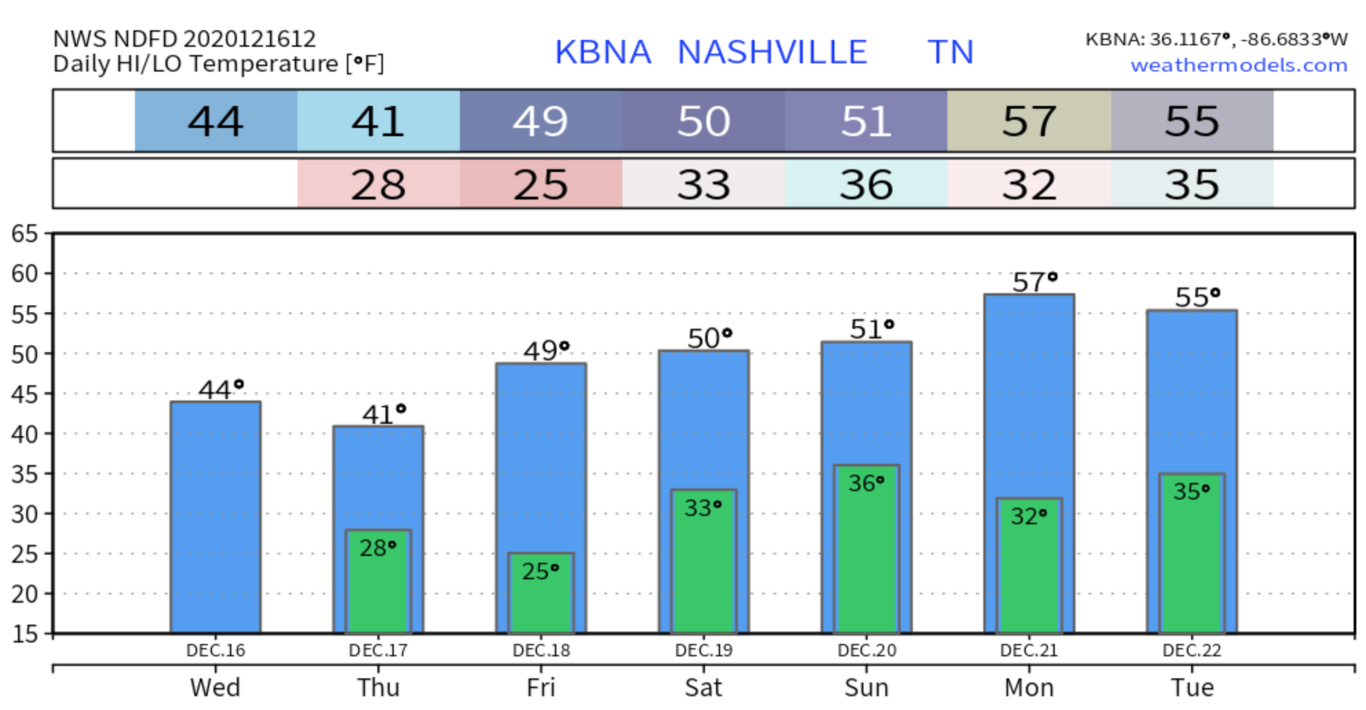
Clear and cold today, but those temperatures will warm up out of the 20’s fairly well for a high of 49.
The sunshine will help keep you warmer today as well!
Thursday morning and early afternoon will be rain-free, but mostly cloudy.
A cool, pleasant day ahead with high temperatures reaching low to mid 60’s and mostly sunny skies.
It’s a bit breezy today with a south wind at 10-15 mph gusting as high as 20 mph.
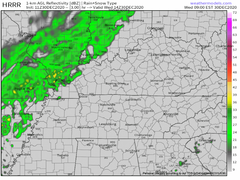
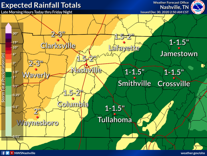
A warm front will lift across Middle Tennessee early Wednesday. Meanwhile, a strong low pressure system will move north of Middle Tennessee late Tuesday night into Wednesday, dragging a cold front through our area by Wednesday night. This sets up a rain and potential strong/severe storm event.
It’s Friday Eve! We’re warming up today with a high 69 degrees and clear, sunny skies.
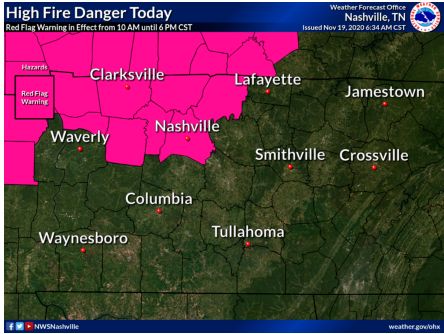
It’s quite windy today due to a south wind at 10-15mph gusting as high as 35mph.
Due to these dry and windy conditions today, fire danger is high putting Davidson County in a Red Flag warning from 10am-6pm.
Our first rain chance in a week comes to town today.
Light, short lived showers could come about at anytime this afternoon due to continued warm air advection bringing dew points into the upper 60’s.
TGIF! It’s a picture perfect day out there with just a few clouds and sunny skies. What better way to kick off the weekend!
High today will be near 75, dropping into the upper 40’s tonight.
You must be logged in to post a comment.