

The Ice Event Has Arrived…Mostly For Those At Elevation
A Winter Weather Advisory is in effect from NOW until 6pm for the possibility of freezing rain accumulations.
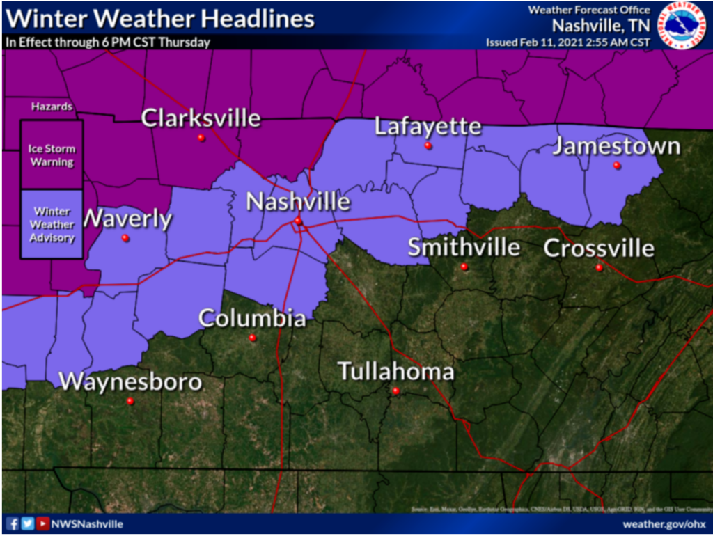
Impacts so far have been on vegetation/elevated surfaces on the hills and ridges in both counties. The chance of seeing more widespread icing on outdoor objects increases once you go up into Fairview or Joelton.
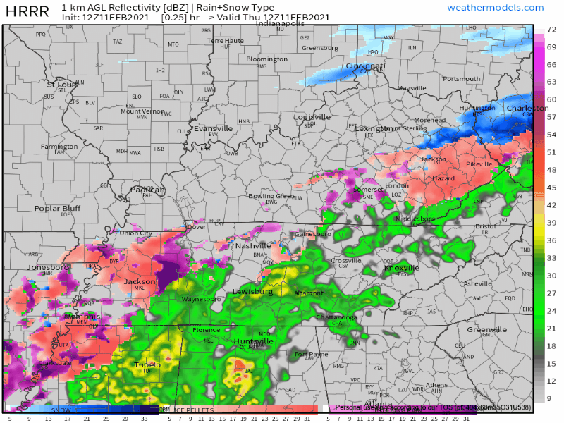
The HRRR shows most of our impacts took place this morning, but additional minor accumulations can’t be ruled out.
So far we are not hearing of any icy roads or other significant ice problems, but still be cautious when traveling, especially as the sun starts to set.
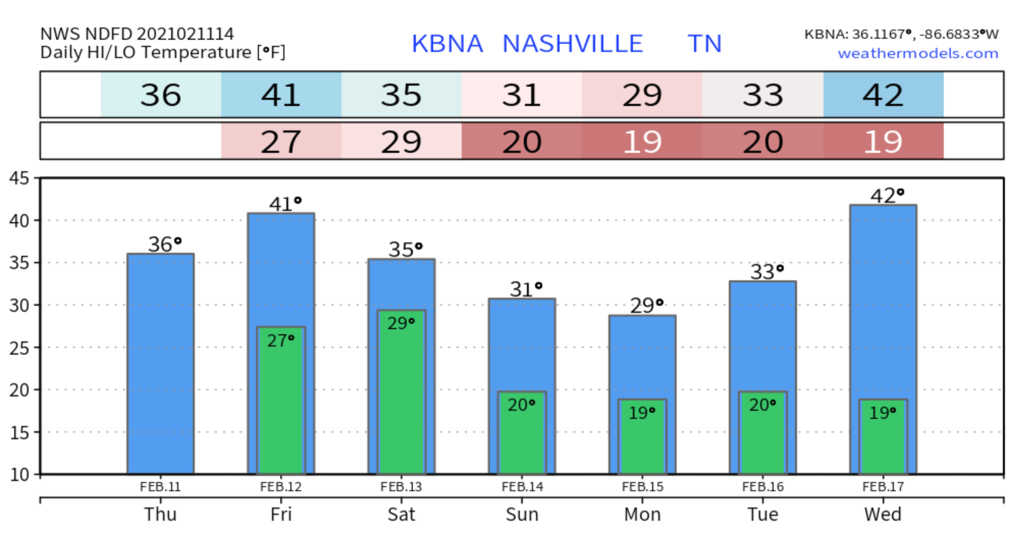
Later tonight, possible freezing mist could impact roads and traveling for the night time hours, and some areas could see freezing fog. A decent warm-up Friday will melt off whatever ice we see, with temps climbing above freezing around 9:00 am.
Round Two
Friday morning and afternoon looks to be dry, but still cold and cloudy.
Although Friday night into Saturday morning, another system will move though bringing us the potential of some light freezing rain again.
With this event, we could also see some light travel impact in the morning on Saturday. By the afternoon temps will be above freezing and warm up any ice on the roads.
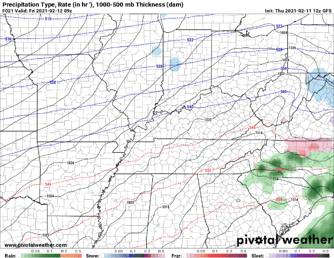
[Editor’s Note: Some models, like the GFS below, keep the precip to our SE, missing us entirely. So, it’s possible the atmosphere could support freezing rain, but if there’s no rain to freeze, well…let’s hope for that.]
Andddd Round Three
ANOTHER system is expected to move through Sunday night and go all the way to Monday night.
Some of the models give this system some teeth with all precip types on the table. Time will tell as higher resolution data begins to come in. We’ll have our eyes on this one.
Categories: Forecast Blogs (Legacy)
You must be logged in to post a comment.