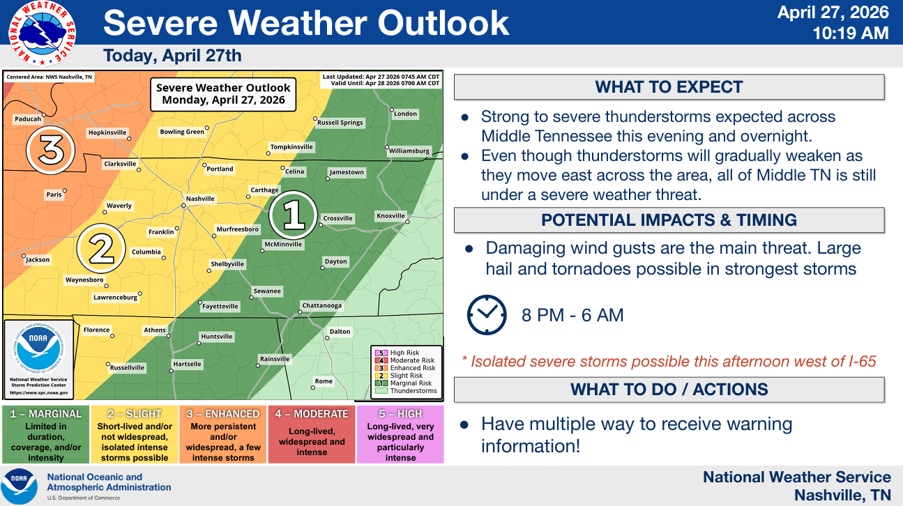
When it rains, it pours.
Additional severe weather is possible again this afternoon/evening.
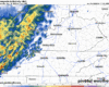
The Storm Prediction Center has both of our counties outlooked with the following probabilities, valid within 25 miles of a location:

When it rains, it pours.
Additional severe weather is possible again this afternoon/evening.
The Storm Prediction Center has both of our counties outlooked with the following probabilities, valid within 25 miles of a location:

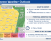
TL;DR:
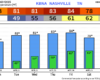
Our eyes are on our severe threat for this evening, continuing into the overnight hours.
We are outlooked with the following probabilities from the Storm Predicition Center, all valid for within 25 miles of any given point:

Great weather today. Plenty of sun with temperatures peaking in the low 80s.
During the day on Monday, we’ll also be treated with nice weather. Dry with highs in the mid 80s.
Starting Monday evening, we’ll be dealing with the potential for severe weather.

Mostly dry today. Cannot rule out a stray shower or (non-severe) thunderstorm this afternoon though – that’s something we’ll have to keep an eye on. For those with outdoor plans, proceed optimistically but keep an eye on the radar. When thunder roars, go indoors.
If you have outdoor plans today, the trend has been your friend.
Models have trended drier and drier over the past couple days. It appears likely that most of our plans during the day today will get away with being dry. Still can’t totally rule out a stray shower or storm, especially as we get into this evening, so keeping the rain gear handy is a good idea.
More great weather today, highs in the low to mid 80s. Plenty of sun, no rain chances.
Friday:
I feel pretty good about the majority of the day Friday being dry. Rain chances will creep up a tad as we head closer to the afternoon/evening hours – but I think up thru sunset has a decent shot at staying dry.
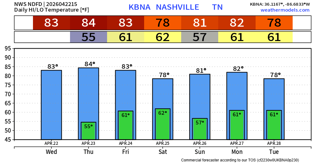
We continue to enjoy our nice Spring weather today and Thursday. Highs in the low to mid 80s, tame dew points and no rain will lead to great conditions for any outdoor plans you may have.
The Storm Prediction Center has outlooked our area with a 5% chance of severe weather within 25 miles for Friday. The threats look to be confined to just low-end damaging straight-line wind and/or hail. Not seeing anything that would suggest a tornado threat.
Our very nice weather will continue through Thursday.
Our forecast will essentially be a copy + paste thru then, with highs in the low 80s, plenty of sun and no rain chances. Humidity levels will remain low, great weather for any outdoor activities you may have.
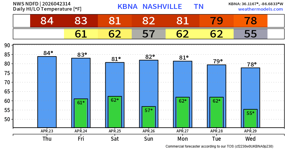
Very nice weather this work week, at least up until Friday.
Temperatures will gradually warm up throughout the week, returning to the low to mid 80s. Humidity levels will be tame, so it’ll be a fairly tolerable low to mid 80s.
Well, those storms last night were something. Thanks for all the reports!
Today we are hot and dry. We’ll make a run at 90° – which if we do get there, it would be tied for the second earliest 90° day on record. Our average first day to hit that mark isn’t until May 27.
You must be logged in to post a comment.