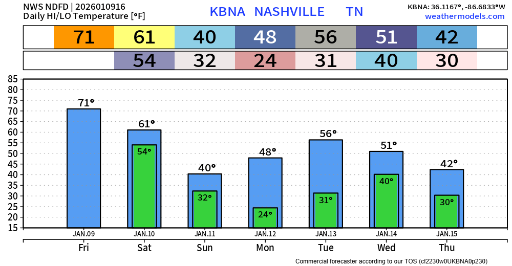
If you’ve stepped outside today, you’ll notice a big difference in the temperature compared to the low 70s we got a couple of days ago. The pesky NW breeze isn’t helping anything either.

If you’ve stepped outside today, you’ll notice a big difference in the temperature compared to the low 70s we got a couple of days ago. The pesky NW breeze isn’t helping anything either.
Some additional drizzle will be possible thru the afternoon today. Clouds are likely to stick around for most, if not all of the day.
A cold front will move thru Sunday morning, marking the beginning of our colder temperatures. The also means some gusts around 20 mph will be common throughout the day tomorrow.
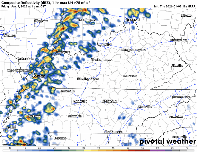
We no longer are outlooked for any severe weather probabilities for today. The question of “will any CAPE (storm fuel) show up?” has been answered – and the answer is no.
We’ll be dry thru this early evening – likely we’ll see some decent sun as well as we try and tie the daily record high of 71° today.
Some of our thinking has changed for this upcoming event, particularly regarding the round of storms arriving early Friday morning.
“Round One” – 3a thru 8a Friday Morning
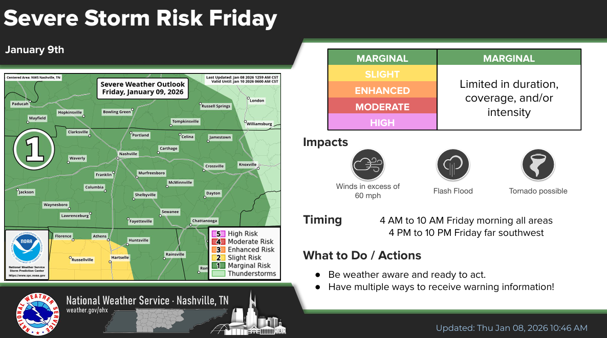
Now that the high-res models have come into range, it appears that this first round of storms may end up carrying a low-end severe threat.
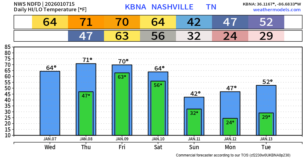
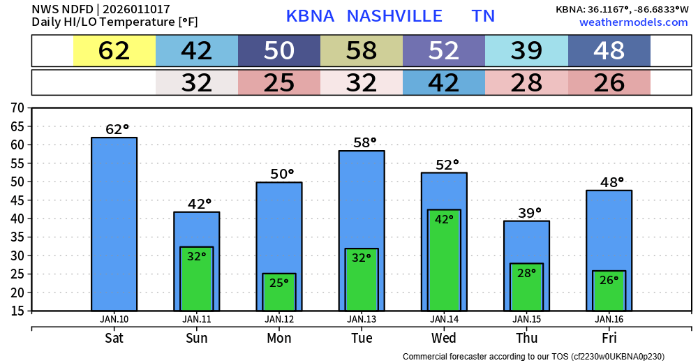
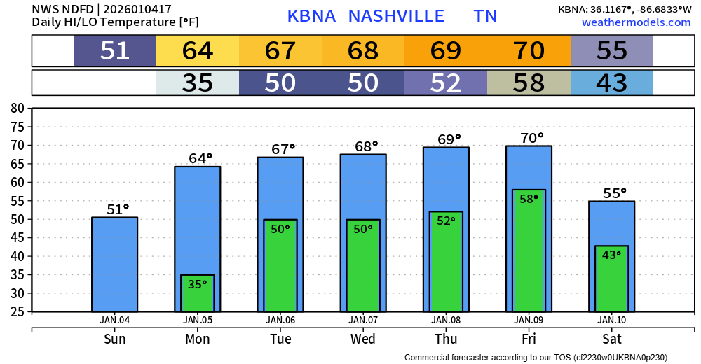
Before we jump into the heavy rainfall and maybe severe weather talk, I would like to highlight the well above average temperatures we’ll see today thru Friday. Our record daily high for Thursday and Friday is 71°, so we’ll likely either tie or come very close to breaking it both days. Our low of 63° on Friday is expected to shatter the daily record warmest low temp of 59° set in 1880.
Clouds will be fairly pesky today, lingering for a while. Regardless, we’ll still have comfortable temperatures as highs warm into the mid 60s.
Temps well above average will continue thru Friday. We’ll get close to our daily record high Thursday and Friday (71°).
Today marks the beginning of our warm stretch of weather. Highs in the 60s thru Friday, well above average for this time of year.
Rain chances return on Thursday, more likely so during the back half of the day. No hazardous weather expected on Thursday.
Today is the last somewhat chilly day for a while, although we’ll be slightly above average.
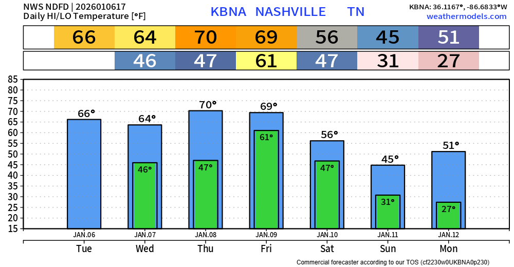
Monday thru Friday we’ll be nothing short of warm – even near record warmth Wednesday, Thursday, Friday (record high is 71° all of these days).

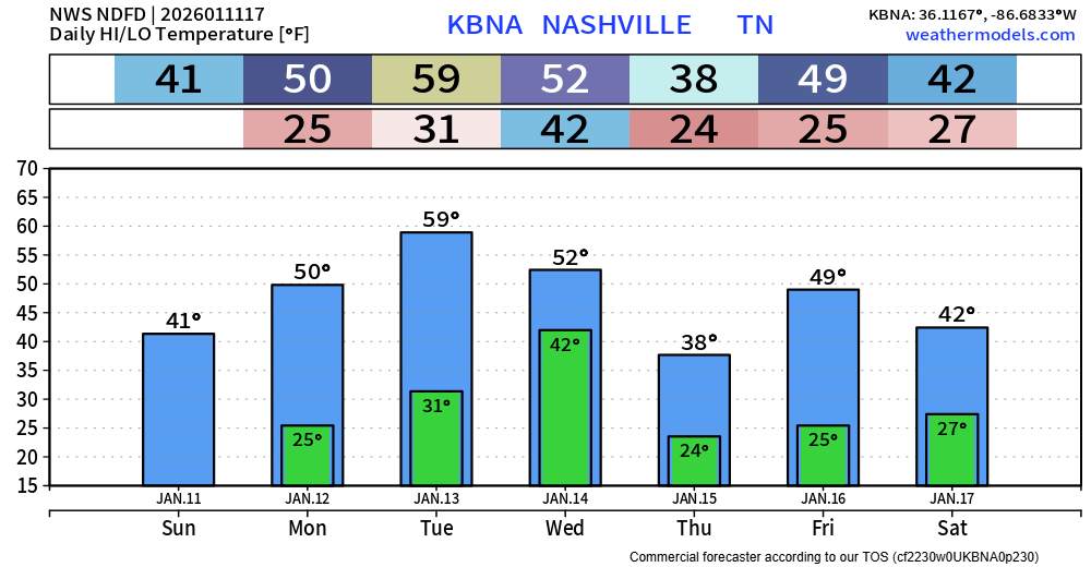
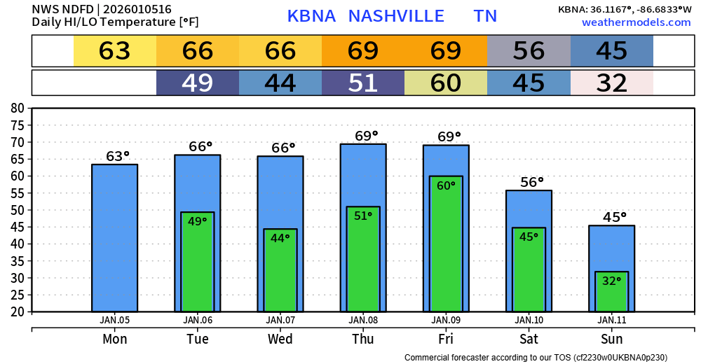
Sunday will be the last “cool” day for the foreseeable future. I use the word “cool” lightly, the high of 50° will still be above average (47°).
Highs will be in the 60s to near 70° Monday thru Friday – around 20° above average.
Today we have showers returning to the forecast by this afternoon/evening. This looks to be fairly light rain, no thunder or anything hazardous. A rain jacket or umbrella will do the trick as you head out for any plans later today. Rain should be gone by sunrise on Saturday.
You must be logged in to post a comment.