
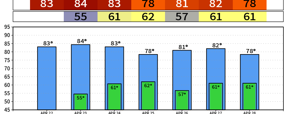
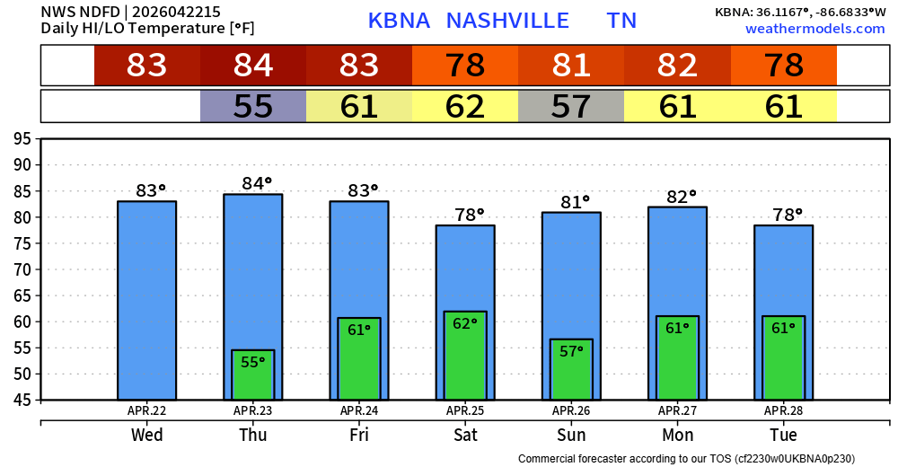
We continue to enjoy our nice Spring weather today and Thursday. Highs in the low to mid 80s, tame dew points and no rain will lead to great conditions for any outdoor plans you may have.
The Storm Prediction Center has outlooked our area with a 5% chance of severe weather within 25 miles for Friday. The threats look to be confined to just low-end damaging straight-line wind and/or hail. Not seeing anything that would suggest a tornado threat.
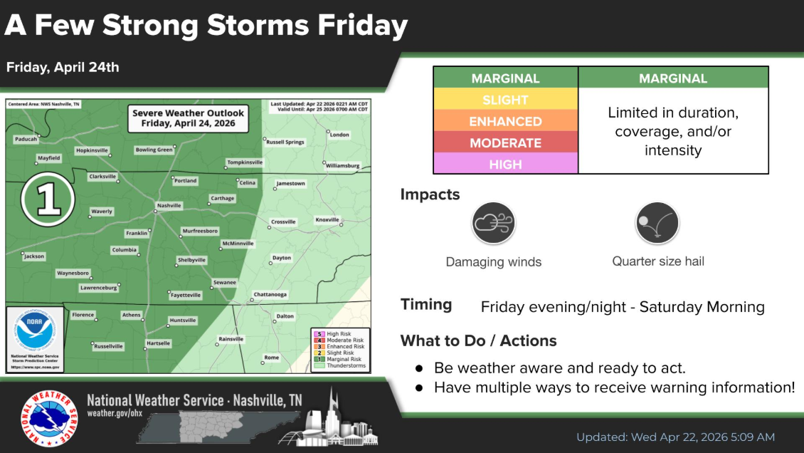
I think the majority of Friday will be OK. Rain chances really look to hold off until closer to the evening/overnight hours.
As of right now, the most likely scenario appears to be that a line of storms will move into the area, bringing a low-end chance of some damaging straight-line winds and maybe hail.
Looking over some model solutions, it’s still too early to get into any specific timing considering the model disagreements. Another thing to note will be just how much energy these storms have left to work with. A few model solutions show very little CAPE (storm fuel) left, which would be good news for us.
Another thing to watch will be just how long the showers/storms stick around. A slower progression would mean that we could see some rain hanging around for portions of the marathon on Saturday. Again, far from any guarantees here, but this is something we’ll keep an eye on.
We may end up getting lucky(ish) on both Saturday and Sunday, with models currently suggesting both of them stay mostly dry. Certainly, do not want to rule out the possibility of a stray shower/storm on either day – particularly during the afternoon and evening hours. However, those with outdoor plans should keep have a backup indoor plan in mind but remain optimistic.
Monday remains the day that we will especially be keeping an eye on.
We continue to be included in a 15% chance of severe weather within 25 miles. The exact lines have changed a bit, and they probably will continue to change with it being 6 days out. Timing still looks uncertain – other than just “Monday PM.”
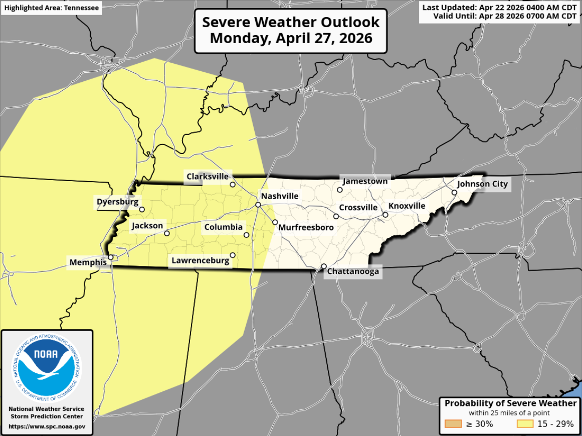
While a lot of details still have to be ironed out, models continue to suggest the ingredients necessary for severe weather will be present in at least some sort of fashion. It’s also important to note that how our severe weather threat plays out will be dependent on how the severe weather threat in the Plains on Sunday plays out.
“All to say, the current setup favors an all-hazards severe threat for Monday, but there is still a lot of time between now and then for things to change. The most important thing you can do now is stay tuned for updates as the forecast evolves.” – NWS Nashville
I think the quote above from NWS Nashville above sums things up the best. Please stay connected to the forecast as things will change between now and then. Our severe weather season has been fairly slow up to this point (minus last Thursday) – now is as good of a time as ever to refresh yourself on your severe weather plan.
The good news from all of this is that we’ll finally get some much-needed rain. Rainfall totals look to be between 1 and 2″ over the next week or so. This should put a good dent in our Severe Drought.
Categories: Featured Blog