
Well, those storms last night were something. Thanks for all the reports!
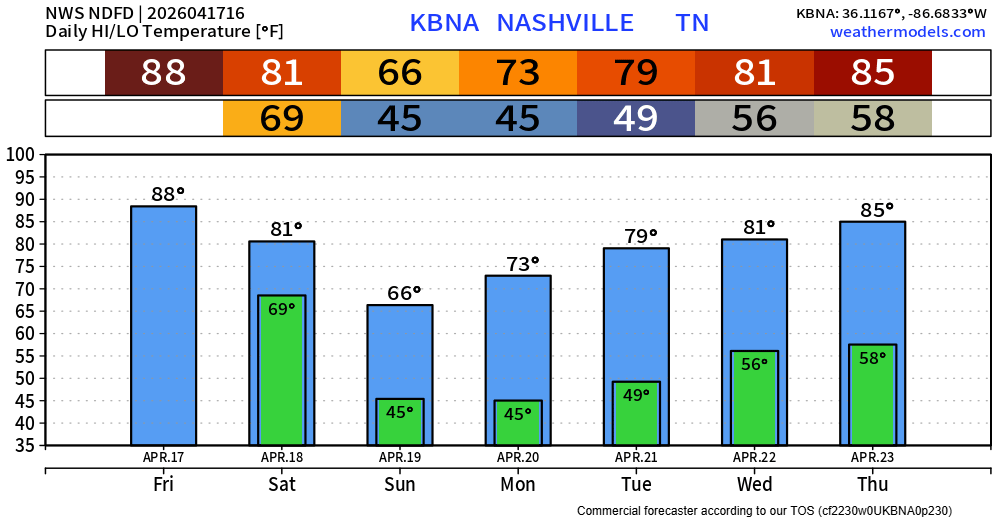
Today we are hot and dry. We’ll make a run at 90° – which if we do get there, it would be tied for the second earliest 90° day on record. Our average first day to hit that mark isn’t until May 27.

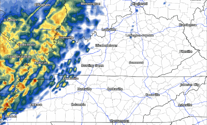
Our next rain chances arrive Saturday. Thankfully, just some rain – no severe weather concerns.
Models have moved up the expected arrival of our showers, now a bit closer to noon.
The HRRR model gives it a go, thinking we see scattered showers, perhaps a rumble of thunder, thru the afternoon and evening.
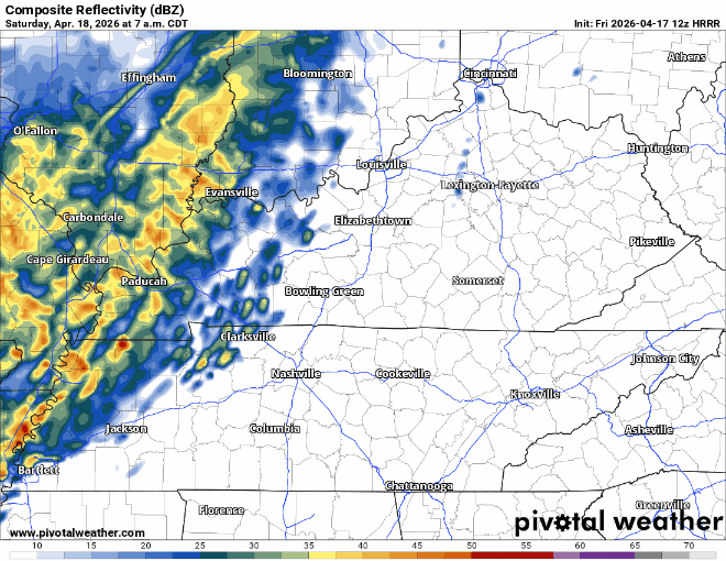
It seems like a good bet that any outdoor activities from lunch onwards should have an indoor backup plan. Not that this looks like a total washout (with totals only around 0.5″) but better safe than sorry.
The cold front will not only bring us some rain (although not enough to put a significant dent in our drought) but also will bring some closer-to-average temperatures.
Walking out the door early next week will require a light jacket, but you won’t need it for long. Temperatures return right back to the 80s by the middle of next week.
Categories: Featured Blog