
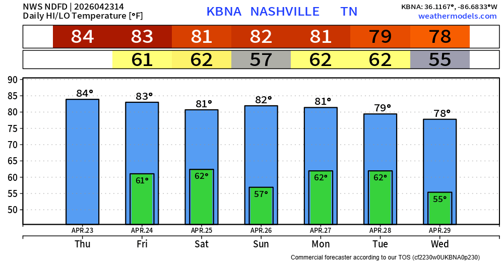
More great weather today, highs in the low to mid 80s. Plenty of sun, no rain chances.
Friday:
I feel pretty good about the majority of the day Friday being dry. Rain chances will creep up a tad as we head closer to the afternoon/evening hours – but I think up thru sunset has a decent shot at staying dry.
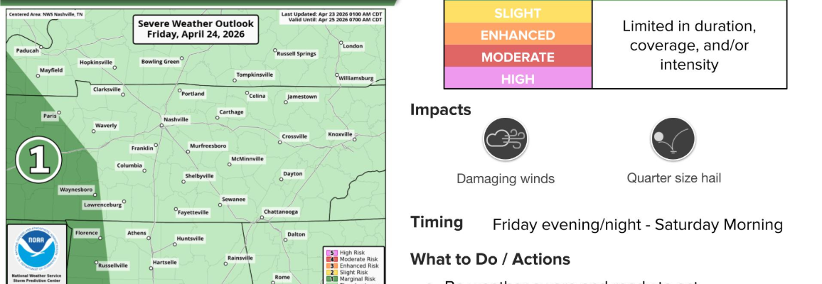
As of right now, the timeframe with the highest rain chances looks to be Friday night thru Saturday morning. None of the models seem to really have a handle on things, as there’s a good bit of disagreement with all of them.
However, the most likely solution at this point seems to be a wave of showers/storms that moves towards our area. As it does, it’ll lose steam thanks to weakening instability levels (storm fuel). It’s possible it completely falls apart prior to arrival, although if it holds together enough, some thunderstorms could be possible with some gusty winds and heavy rain.
The Storm Prediction Center has removed us from any severe probabilities for Friday, which makes sense looking over the model data – just doesn’t look like the ingredients will be there, with the better chances confined to the west of us.
Hopefully as more model data comes in, we’ll have a better handle on things. For now, stay connected for any updates.
Marathon/Saturday/Sunday:
While some showers may be lingering around by the start of the Marathon, I still feel pretty good about most of it being dry. This could change, so stay connected! Temperatures at the start will be in the mid 60s, warming up into the low to mid 70s by lunch. It’ll feel pretty muggy with dewpoints in the low 60s.
The rest of the day Saturday and Sunday continue to look dry, although staying muggy. I remain optimistic about your outdoor plans during this time being able to proceed as normal. I still would keep the backup indoor plan in the back of your head though.
Monday:
We continue to watch model data as it comes in for Monday.
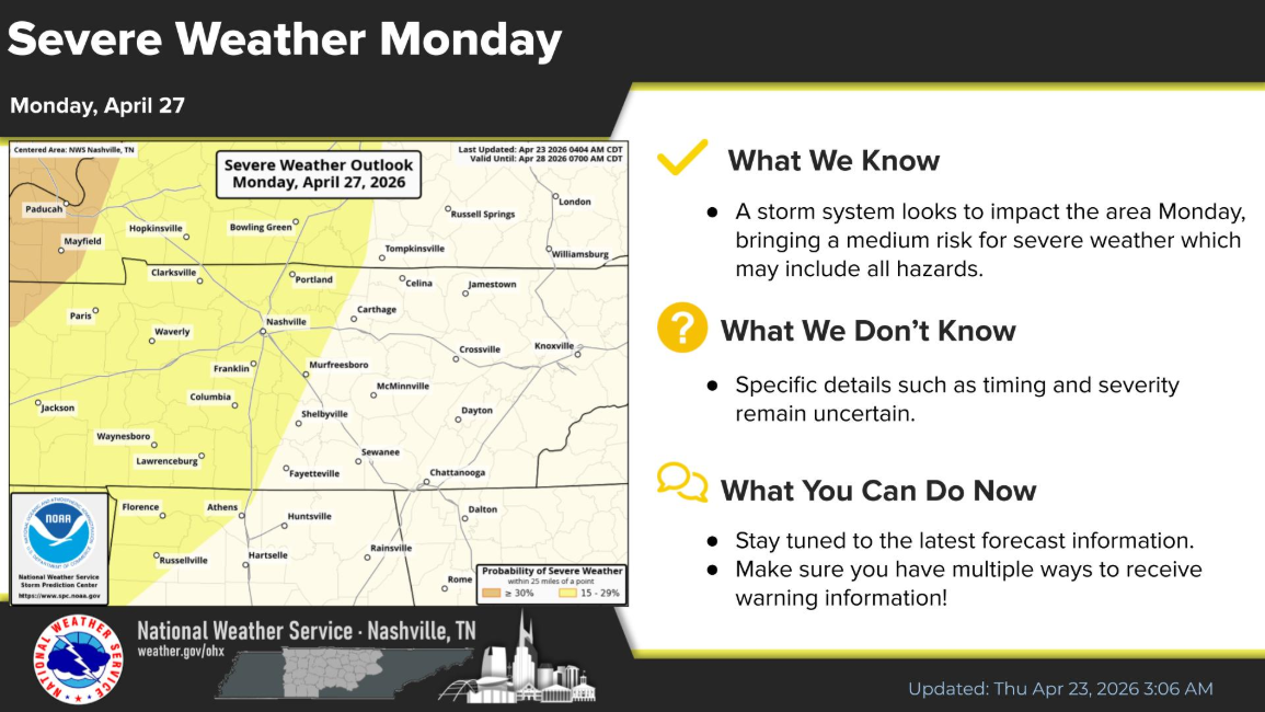
Our two counties continue to be outlooked with a 15% chance of severe weather within 25 miles.
Models continue to suggest our environment will be capable of supporting severe weather, with all hazards being possible.
However, there are still quite a few details that need to be resolved. A lot hinges upon how the severe weather threat to our west plays out on Sunday – which we won’t really know until…Sunday.
Confidence will certainly increase over the next several days, especially as we get into this weekend and our high-res model come into range. It’s important to not get too caught in where the “lines” are drawn or looking at one single run of a model and running with it.
Bottom line: Severe weather is possible on Monday PM, stay connected as the forecast changes and new info comes in. For what it’s worth – the higher probabilities are to our northwest right now.
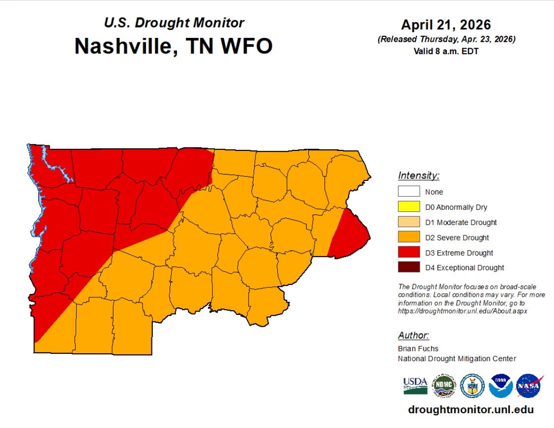
While we could go without the severe weather, we do need the rain.
New Drought Monitor came out today and shows both of our counties in Severe to Extreme Drought. 2-3″ of rain will be possible over the next 7 days – which won’t completely wipe out the drought, but it’ll certainly help.
Categories: Featured Blog