
TL;DR:
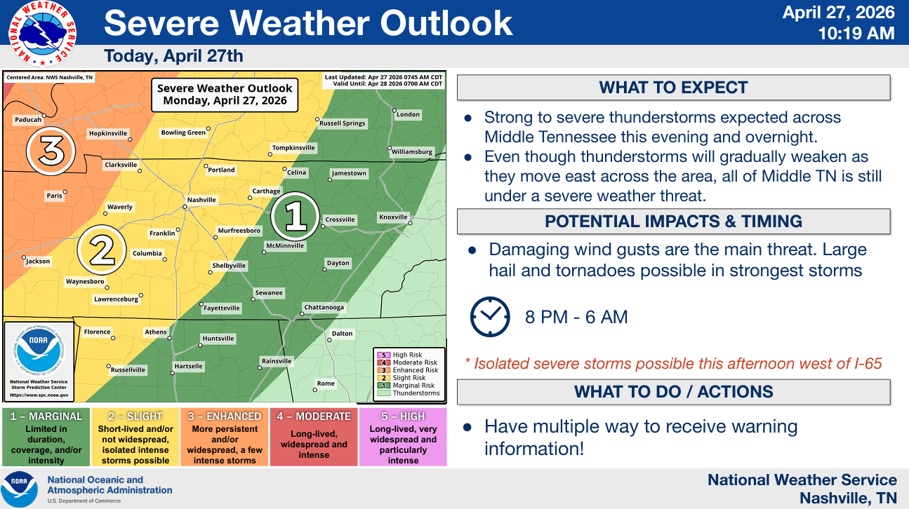
- All modes of severe weather will be possible this evening, continuing into the overnight hours, with damaging straight-line winds being the main threat
- Current expected ETA is 11p – 2a tonight, but things could begin as early as closer to sunset
- Additional severe weather is possible Tuesday evening and night
- Stay connected for any updates!
Our eyes are on our severe threat for this evening, continuing into the overnight hours.
We are outlooked with the following probabilities from the Storm Predicition Center, all valid for within 25 miles of any given point:
- 15% chance of damaging straight-line winds (58mph+)
- 5% chance of large hail (1″+)
- 2-5% chance of a tornado
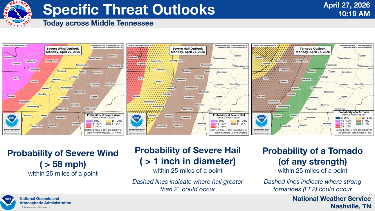
The main threat will be damaging straight-line winds – but hail and a spin-up tornado cannot be ruled out.
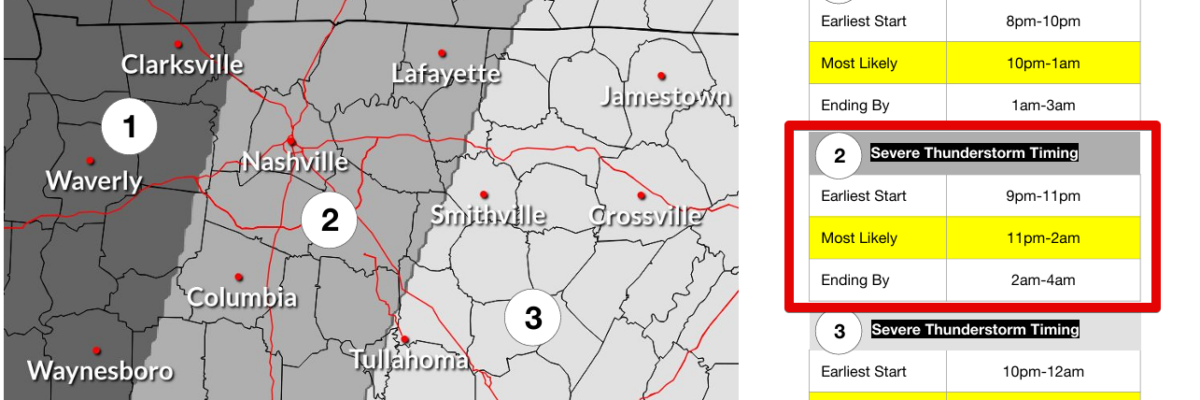
Timing:
Expected ETA of our line of storms has moved up slightly.
Best guess is currently 11p to 2a, although if storms were to fire ahead of the main line, they could impact us closer to sunset this evening.
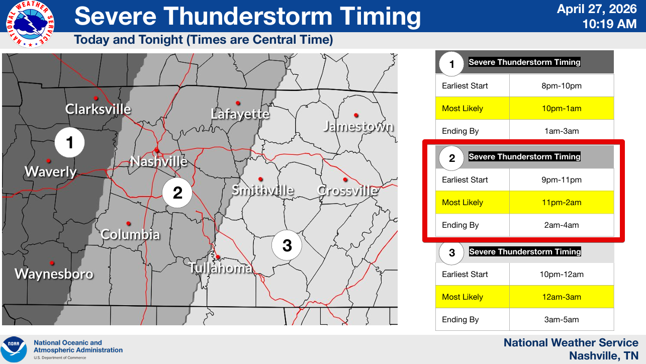
The ETA is fluid and could very well change as we go from looking at models to real-time observations. Please stay connected throughout the day!
High-res models are in decent agreement on how things will unfold later. But – models are guidance, not gospel. It will soon be time to put them down and start focusing on real-time analysis. For now, here’s what the latest HRRR model thinks:
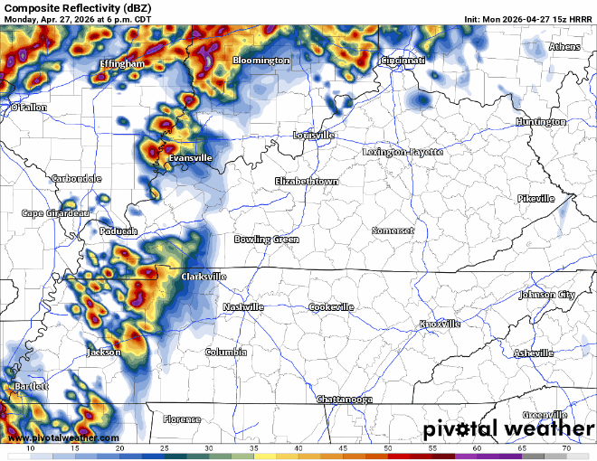
Yes, overall, this does look fairly messy. However, one model run is not enough for you to let your guard down.
Have multiple ways to receive warnings. With this being an overnight threat, having a way to wake up if a warning is issued for you will be very important. Wireless Emergency Alerts on your phone (make sure they are turned on), a NOAA Weather Radio, a wake-me-up app, all great ways. Do not rely on sirens to wake you up, they are not meant to be heard indoors.
This is a low probability of a high-impact event. While odds for severe weather are much higher to our NW near St. Louis, this is still a time to be prepared. We have a great link here with more information on what to do: What To Do: Tornado Watch vs. Warning – Nashville Severe Weather
We’ll be sending out updates all day on all of our socials. We’ll also go live on our YouTube channel at 6p with a forecast update. And as always, if a warning is issued for any portion of our two counties, we’ll go live as well.
Andddd there’s more.
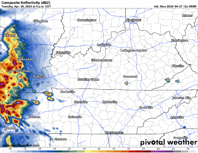
Additional severe weather chances will exist on Tuesday, mostly confined to the afternoon/evening hours.
The SPC has us outlooked with a 15% chance of damaging straight-line winds and/or large hail, within 25 miles. We are currently not included in any tornado probabilities.
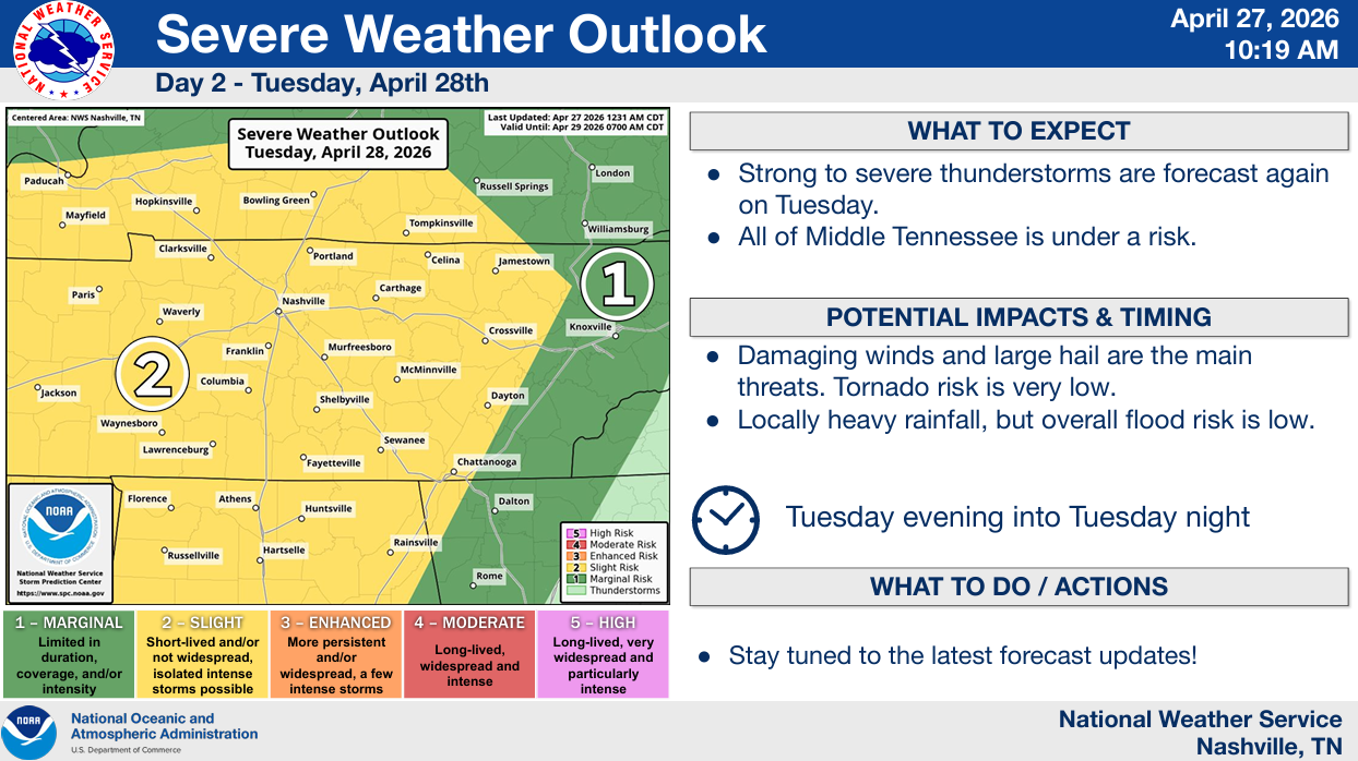
A cluster of storms will move into our neck of the woods, from the west sometime Tuesday PM.
A lot of how Tuesday plays out will depend on the evolution on our system tonight. Much more on this tomorrow morning.
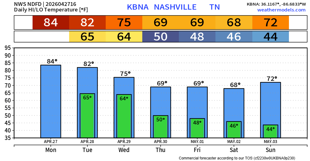
We start to dry out starting Wednesday and will be left with cooler and drier weather for the rest of the week. Closer to 2″ of rain is expected over the next several days – which is much needed.
Categories: Featured Blog