
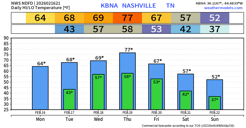
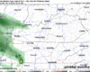
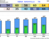
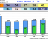
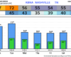
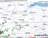
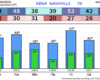
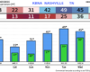
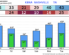
High temperatures will get near the 70° mark today thru Friday, even into the mid 70s on Thursday – pushing the daily record high of 76°. That’s around 20-25° above average.
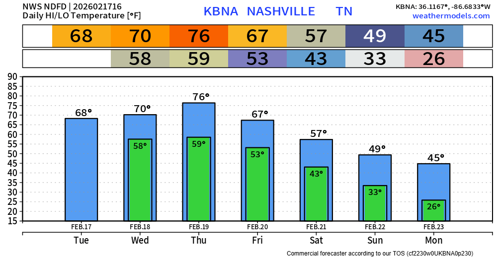
These Spring-like temps won’t last forever. We cool down a good bit after our cold front pushes thru on Friday, starting next week off slightly below average. Long-range models suggest warmer temps return by the middle of next week.
You must be logged in to post a comment.