
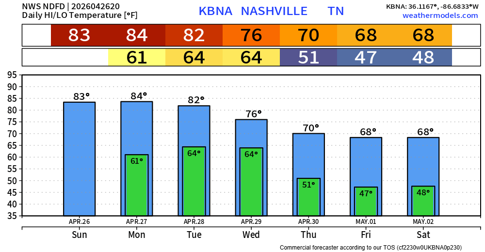
Great weather today. Plenty of sun with temperatures peaking in the low 80s.
During the day on Monday, we’ll also be treated with nice weather. Dry with highs in the mid 80s.
Starting Monday evening, we’ll be dealing with the potential for severe weather.
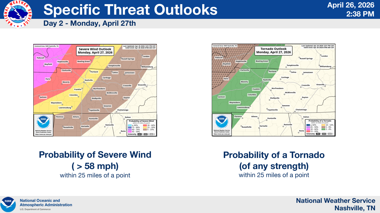
The Storm Prediction Center has outlooked our area in a 15% chance of damaging straight-line winds and a 2% chance of a tornado, both within 25 miles. We are not included in any probabilities for hail.
Timing:
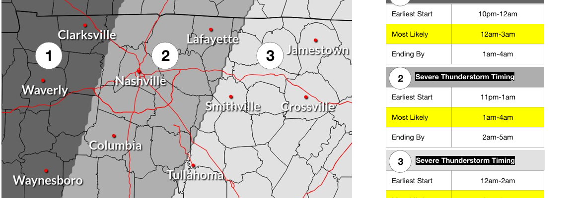
Unfortunately, this looks to be an overnight event.
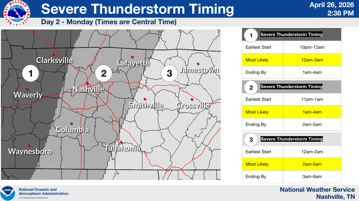
The most likely timing is 1a – 4a early Tuesday morning. Although things could get going as early as 11p Monday night.
The main threat will be damaging straight-line winds as the line of storms moves thru, with the possibility of a quick, spin-up tornado embedded in the line. Although currently not expected, it’s possible that storms could fire out ahead of the main – if they do form, these would especially have to be watched.
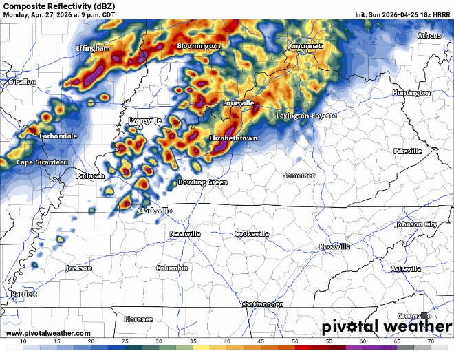
The 18z HRRR run gives an idea on how things could play out – but not meant to be taken literally.
With this being an overnight threat, now is the time to make sure you have multiple ways to receive warnings. Wireless Emergency Alerts on your phone (make sure they are turned on), NOAA Weather Radio, wake-me-up apps, the more the merrier. Do not rely on sirens to wake you up.
We’ll be watching this all the way thru, posting updates as needed on our socials. Stay connected!
And if that isn’t enough, we are also watching Tuesday for the potential for severe storms.
Yet again, we are outlooked with a 15% chance of severe weather within 25 miles.
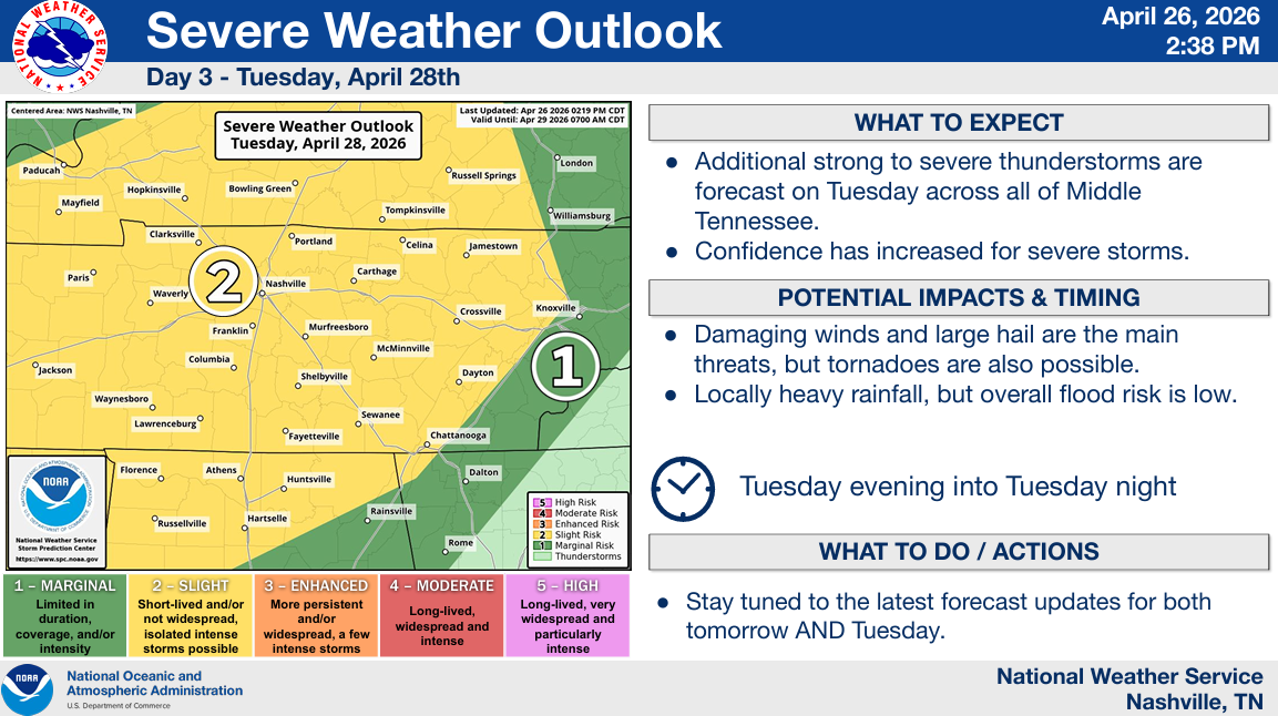
Although confidence in the chance for severe storms has increased over the past few days, there is still a fair amount of uncertainty. A lot of Tuesday’s threat will be contingent upon how much our atmosphere can recover from the storms Monday night.
An early look at models suggests an environment capable of supporting a large hail and damaging wind threat, but perhaps a tornado threat as well. We’ll get the specific hazard probabilities from the SPC starting tomorrow.
Current best guess at a timeframe is Tuesday evening into Tuesday night. The coffee pot will be putting in OT over the next few days.
This is still an evolving forecast. Stay connected for future updates on both Monday and Tuesday’s threat. We’ll be here every step of the way.
The positive is that we’ll be getting much-needed rainfall from this, 2-3″ still expected thru the middle of next week.
We start to dry out Wednesday and will be left with more mild temperatures for the rest of the week.
Categories: Featured Blog