
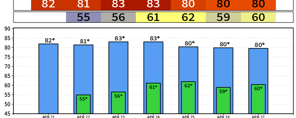
Our very nice weather will continue through Thursday.
Our forecast will essentially be a copy + paste thru then, with highs in the low 80s, plenty of sun and no rain chances. Humidity levels will remain low, great weather for any outdoor activities you may have.
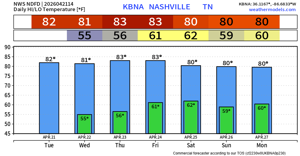
Our attention turns to our active weather pattern that begins on Friday.
Showers and storms return to the forecast that afternoon/evening. For now, this looks like a scattered, pop-up variety of storms. We are still too far out of range to look into any specific timing. Although a storm or two may be strong, not seeing a legit severe weather signal for Friday.
Medium to high rain chances look to continue Saturday morning thru the PM hours. Unfortunately, still too early to try and get more specific than that due to model disagreements. We should start to see more agreement in the coming days. If you have any outdoor plans this weekend, it’s not time to cancel them yet, but I’d start thinking of indoor backup plans.
We may get a break from the rain on Sunday; models turn down the rain chances a good bit.
Monday will be the day we especially keep an eye on.
The Storm Prediction Center has already outlooked us with a 15% chance of severe weather within 25 miles. With this being a Day 7 outlook, it will change plenty between now and then.
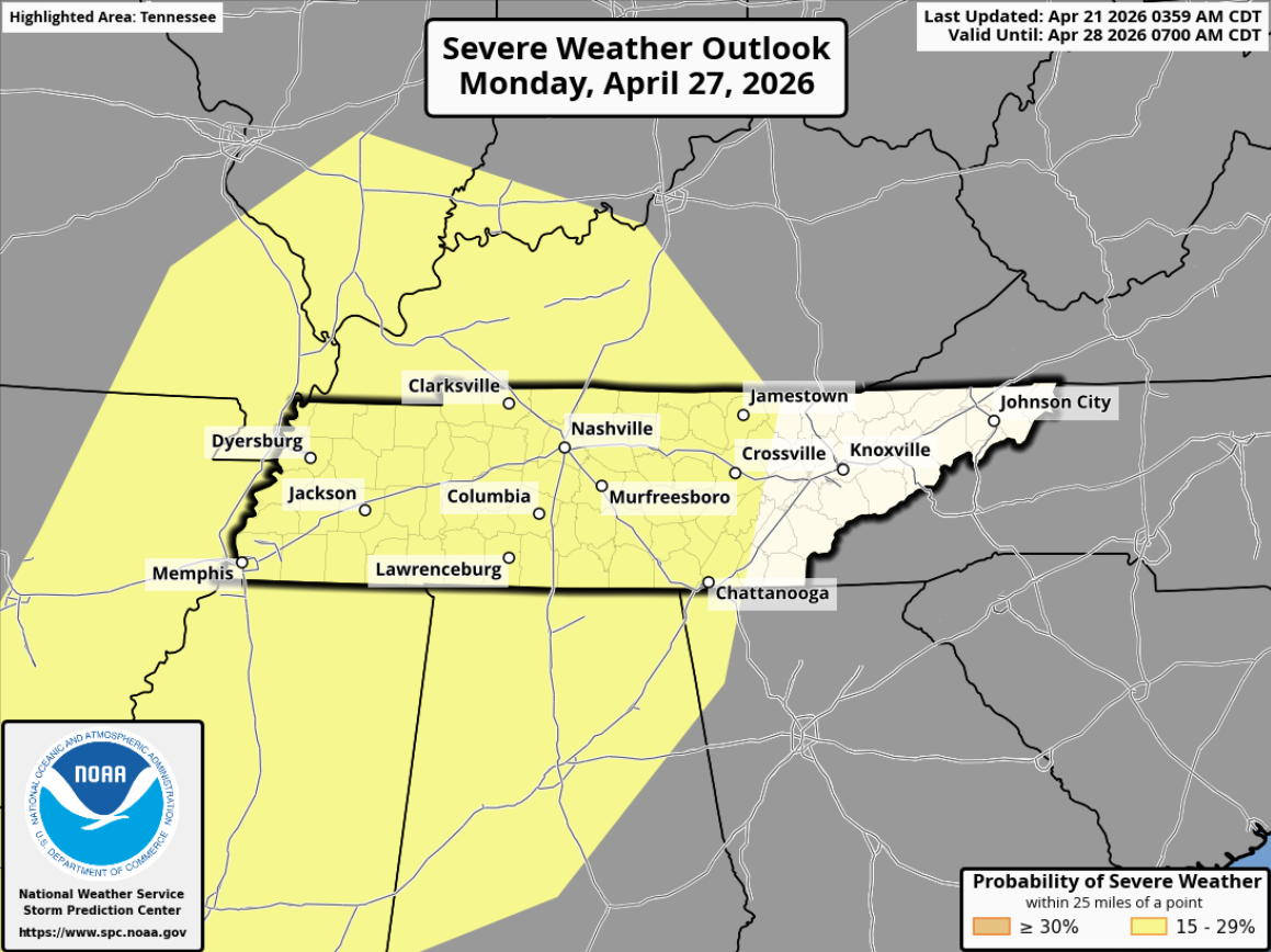
Far too early to start diving into the specifics, but pattern recognition and long-range model guidance tells us that severe weather could be possible.
We’ll be watching this and keeping y’all updated with all the new info as it comes in. Be prepared, not scared!
Categories: Featured Blog