

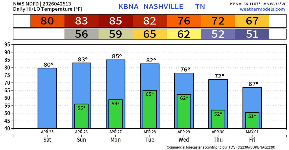
Mostly dry today. Cannot rule out a stray shower or (non-severe) thunderstorm this afternoon though – that’s something we’ll have to keep an eye on. For those with outdoor plans, proceed optimistically but keep an eye on the radar. When thunder roars, go indoors.
Really nice weather for Sunday. Dry with highs in the low to mid 80s.
We continue to watch the potential for severe weather on Monday.
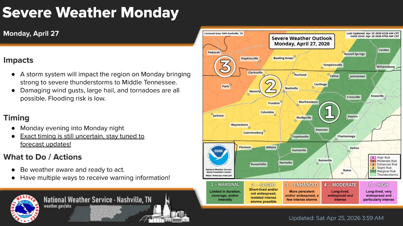
The Storm Prediction Center has both of our counties outlooked with a 15% chance of severe weather within 25 miles.
Exact timing is still uncertain, but the most likely timing looks to be Monday evening/overnight. Right now, I’d lean more towards the overnight side, but things can certainly change.
The most likely scenario (as of Saturday morning) seems to be a line of storms moving into the area sometime during the aforementioned timeframe. All modes of severe weather appear possible, with damaging straight-line winds being the main threat.
I still want to hold off until Sunday before we really start diving into the details. There is still some uncertainty (as expected), but the high-res models coming into range starting today should be able to help increase confidence.
For now, stay connected and watch for future updates. The good news is that the highest risk for severe weather is off to our northwest.
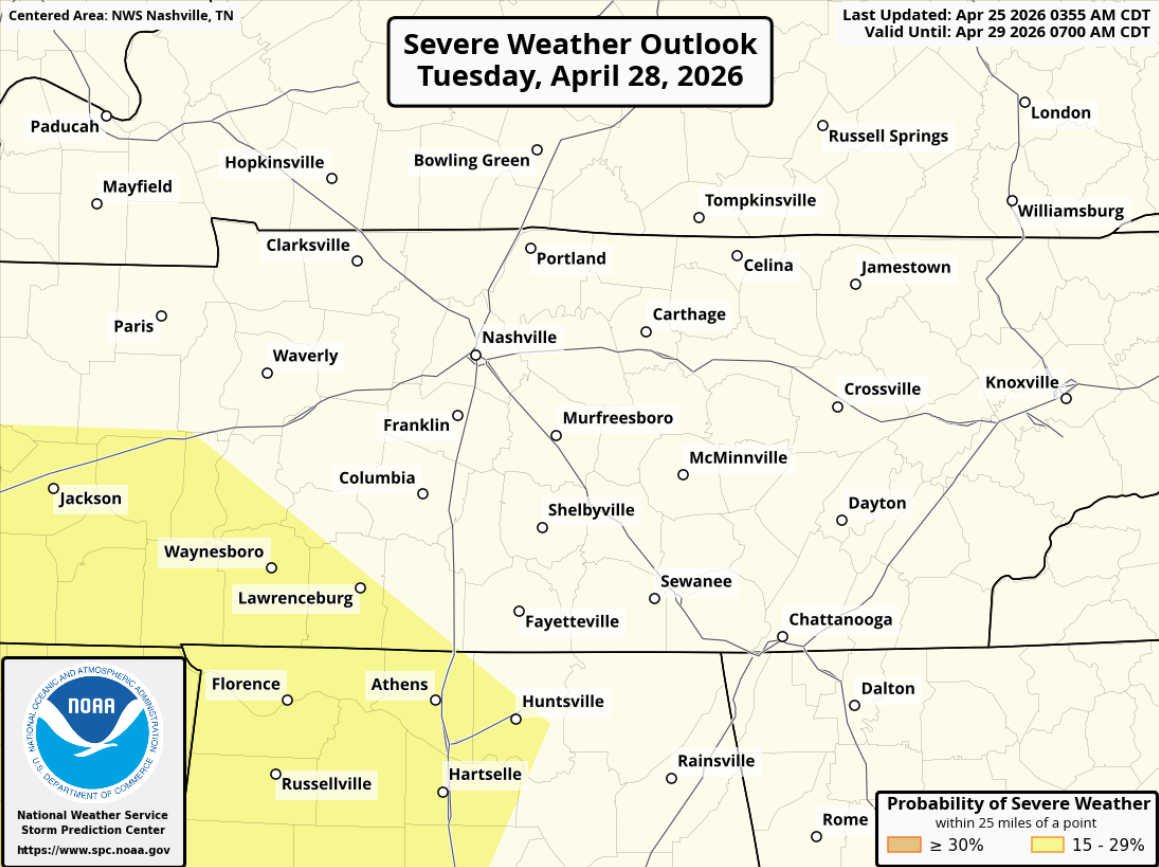
While we currently aren’t included in any probabilities, we’ll have to keep an eye out for Tuesday as well. Places just off to our SW are included in severe probabilities.
Minus the severe potential, we need the rain. Still expecting 2-3″ of rain over the next seven days. Flooding concerns will be very low due to how dry we are.
Temperatures stay mild, cooling down a bit by the end of next week.
Categories: Featured Blog