
When it rains, it pours.
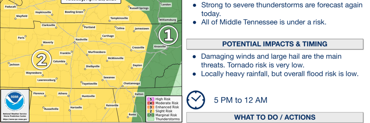
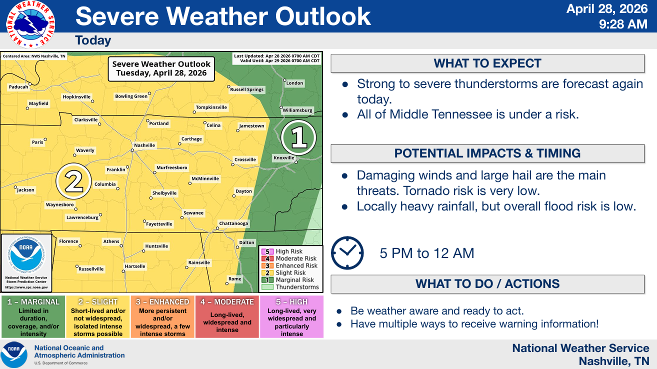
Additional severe weather is possible again this afternoon/evening.
The Storm Prediction Center has both of our counties outlooked with the following probabilities, valid within 25 miles of a location:
- 15% chance of damaging straight-line winds (58 mph+)
- 15% chance of severe hail (1″+)
- 2% chance of a tornado
A lot of how today unfolds will hinge on just how much our atmosphere can destabilize. Models think we can fairly well, but models are often wrong (like we saw yesterday). It’ll be something we watch throughout the day and keep an eye on the mesoscale analysis. We may send up another balloon this afternoon to get an idea of what our atmosphere looks like.
Timing:
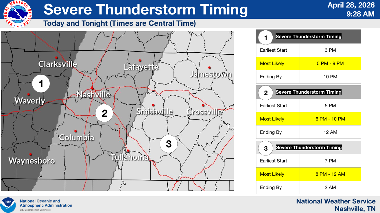
The most likely ETA for this appears to be 6-10p this evening. Thankfully, this does not look like an overnight event. We’ll be able to sleep peacefully after the storms move out.
This will likely be a cluster of storms that moves in from the W. We’ll be able to see it as it is moving our way to get an idea of what to expect. It also wouldn’t totally shock me to see a cell or two fire out ahead of the main cluster, which would mean a slightly earlier ETA.
The main threats look to be large hail and damaging straight-line winds. The threat for a tornado is very low, but it isn’t zero.
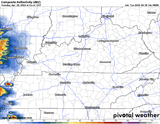
Latest HRRR model gives an educated guess, far from perfect:
We’ll be watching things all day today and will post updates as needed on all of our socials. If a warning is issued for any portion of our two counties, we’ll go live on YouTube.
Stay connected and informed throughout the day!
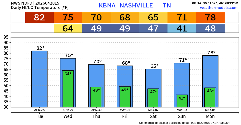
We’ll start drying out Wednesday. Only additional rain chances this week will be relatively low chances Friday PM/Saturday AM – doesn’t look like much. More information on that tomorrow. Temperatures will also be noticeably cooler.
Categories: Featured Blog