Saturday
Happy weekend everyone!
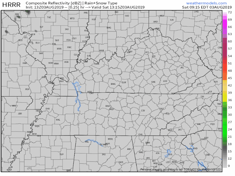
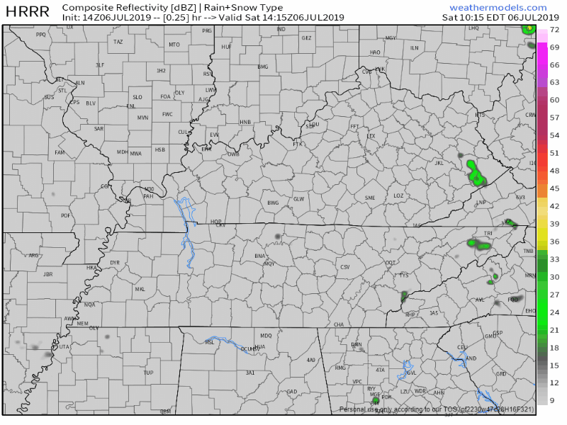
We start off our Saturday mostly sunny through the morning and early afternoon, until storms begin to develop, especially along/west of I-65. The latest HRRR model has these storms popping up sometime after 1PM:

Happy weekend everyone!
We start off our Saturday mostly sunny through the morning and early afternoon, until storms begin to develop, especially along/west of I-65. The latest HRRR model has these storms popping up sometime after 1PM:

Happy Friday!
Editor’s Note:
The end of our work week is going to be a wet one for some of us. Isolated to scattered pop-up storms will be possible this afternoon, mainly after 3PM. Not all of us will see rain, but a few of us could potentially see a couple downpours by the time the evening rolls around.

A pretty typical summer afternoon ahead for us today in Middle Tennessee. We’ll start off the first day of August with near normal temperatures, capping at 89° for the high, and of course, the humidity will play a factor in how it actually feels outside. Dewpoint values will be upper 60s as we progress into the afternoon.
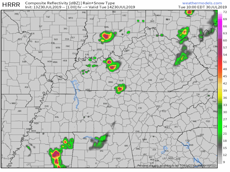
A weak cold front is coming in from the west. It may spark a few showers and storms. Rainfall totals won’t be much. It’s possible you won’t get any rain at all.
The latest HRRR model has showers developing 2 PM – 4 PM, but not everyone gets one:

We’ve got another sunny afternoon ahead of us today! As this high pressure continues to move off to the Southwest, we’ll be in great shape to reach the low 90s this afternoon. A bit warmer than earlier this week, but near normal for this time of year. Humidity increases a bit as well along with the temperatures, into the mid 60s, or at the top of the “sticky” section of our dewpoint perception chart:

Another beautiful and sunny day in store for us in Middle Tennessee this afternoon!
Rain chances? None. All sun and lower temperatures? Definitely!
Today’s high will be near 84°, around 5 degrees below average for this time of year. Dewpoints also will be fairly comfortable, up to 60°.
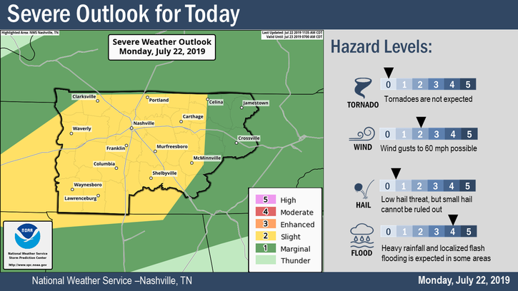
Remnants of Tropical Depression Barry will continue to affect our area today and the next couple of days. A band of broken showers and storms will move through late this afternoon into the early evening, sometime after 5 pm. A few storms could be on the stronger side, The Storm Prediction Center currently has the western edge of Davidson County under a Marginal risk (1/5) for some of these storms to become severe.
Happy Friday everyone! Classic July afternoon today.
A hot and humid afternoon, high of 91° with sweltering dewpoints in the low 70s.
Heat index will be in the upper 90s again so hydrate.
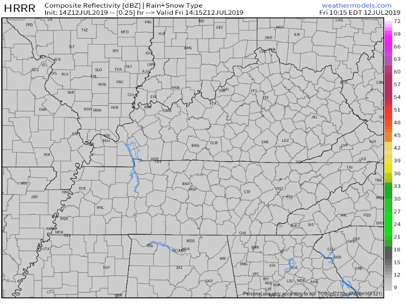
There’s a small chance of a couple pop-up showers, especially south of I-40. HRRR model predicts most showers south of the city:
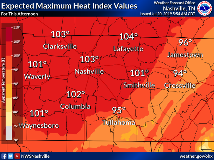
Today and the next few days are going to be hot. As high pressure continues to move over our area, we’re going to steer mostly clear of showers this afternoon area wide. Temperatures will be up in the mid 90s, mostly sunny. We’re going to need to keep an eye on the heat index values. The high temperatures accompanied with the dewpoint values in the low 70s, heat index values will creep above 100°, even to just below the 105° range. Heat precautions are going to be needed so keep these tips from the NWS in mind:
If you’ve been around Middle Tennessee the past few days, you probably have a good idea of what today is going to look like. We’ll start off partly sunny through early afternoon, temperatures quickly rising to a high of 89°. Grab the hairspray for your plans as well, dewpoint values will be in the mid 70s so it’s sure to be a very sticky one outside.
You must be logged in to post a comment.