Author Archives

Brendan Schaper

Rain and Clouds Exit, Sunshine and Above-Average Temps Make A Comeback

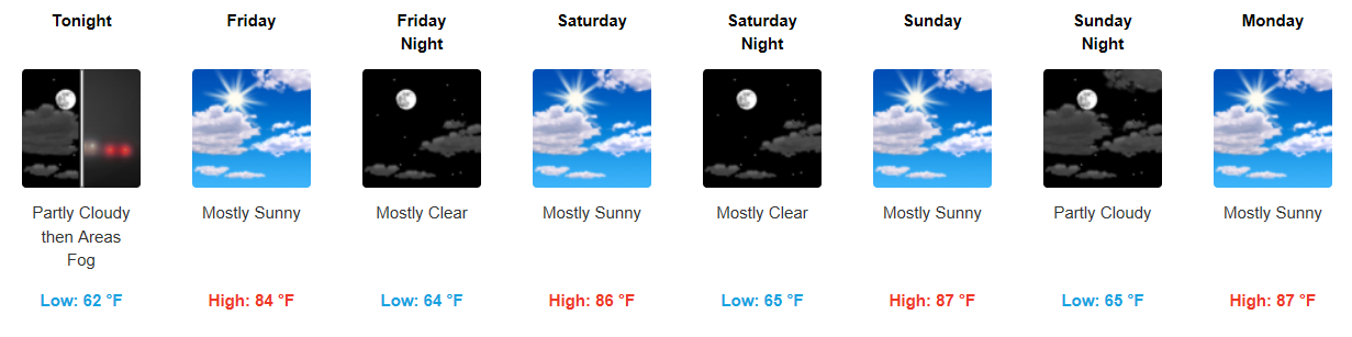
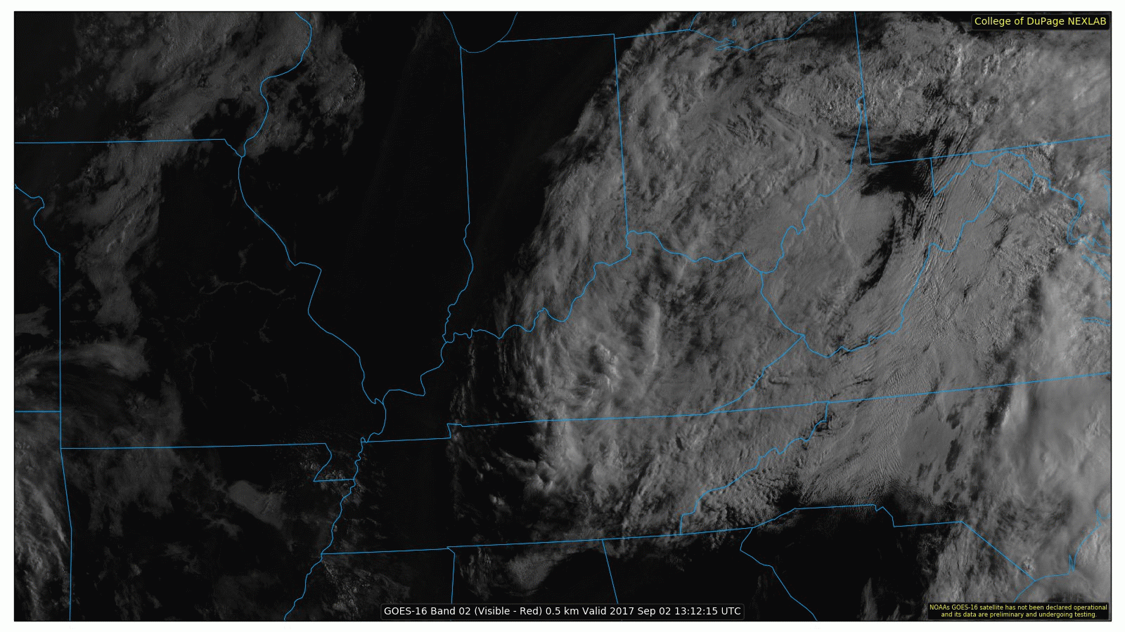
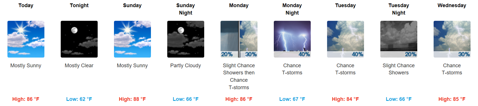
Cloud Cover and Showers Pushing East

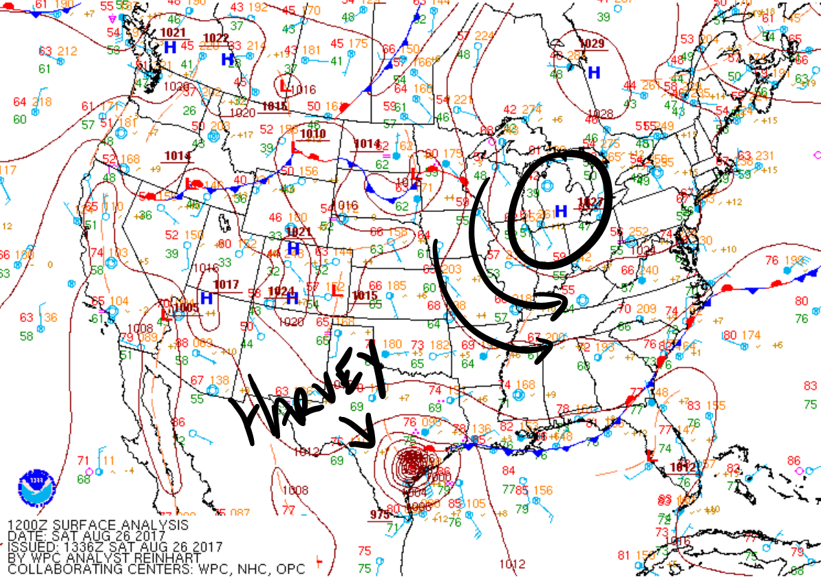
GOES 16 Visible Loop

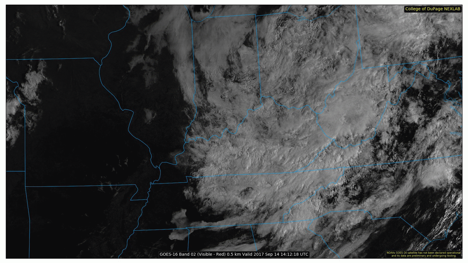
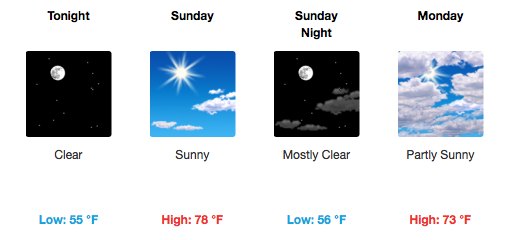
A few showers continue this morning, but the good news is that we expect sunshine to return this afternoon! Temperatures will react appropriately, nearing 80°F for a high today. The remnant low pressure system over the Ohio Valley will take clouds and rain with it to the northeastern U.S. this weekend. Below is an image of GOES 16 water vapor, where the reds/oranges are high water vapor content and the gray areas are dry air. read more

Showers Through Wednesday PM, Clearing and Warming By Friday

Scattered Showers Continue, Dreary Through Wednesday Night

Latest HRRR Loop – Updated 6:30 PM CDT

…by the way, where are we today temperature-wise in comparison to seasonal averages? Almost 20 degrees below average!


Irma’s remnant center of low pressure is expected to kick northeastward tomorrow, but bring in another swath of moisture and likely rainfall. Again, not a complete washout but definitely another dreary day on tap. read more

Clearing and Below-Normal Temps Ahead

Feeling Like Fall!

GFS 250mb Winds through Sunday (Jet Stream)

The beginning of this loop is today’s storm energy moving through, with a cold front behind it.

High temperatures the rest of the week will remain in the 70s, gradually warming by the weekend. Northerly flow will keep our daytime temperatures nearly 10-15 degrees below normal for this time of year. Additionally, with mostly clear skies each night, our overnight lows will be exceptionally chilly…somewhere in the low to mid 50s through next Sunday! read more

Mainly Dry Today, Harvey’s Remnants Moving Our Direction

Rain Stays North Today, Isolated Shower May Sneak In

Latest HRRR Model Loop

A weak upper level impulse will slide further south today, sparking showers and an isolated storm in Kentucky and along the KY/TN border. One or two of these may meander far enough south into Davidson County, but the chances are low. Temperatures will stay in the mid 80s for afternoon highs. Otherwise, expect some cloud cover around…as already evidenced by GOES this morning (also, note the fog around Nashville): read more

Spectacular Late-August Weekend, Unsettled Next Week

Gorgeous Weather For the Weekend

Canada is good for bacon, hockey, and lots of other things…including high pressure!

West-northwesterly flow, thanks to the Canadian high, will continue to filter in through the remainder of this weekend. Dry conditions will prevail, with sunshine bumping afternoon temperatures Sunday into the upper 80s. Overnight lows will be a bit cool, hovering in the low to mid 60s. read more