Showery Stretch Ahead, Updated Info For Snow Potential Fri. PM-Sat

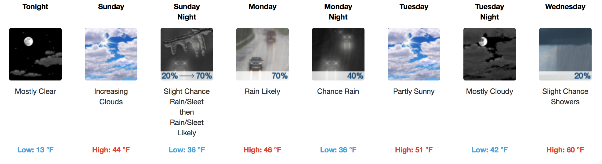
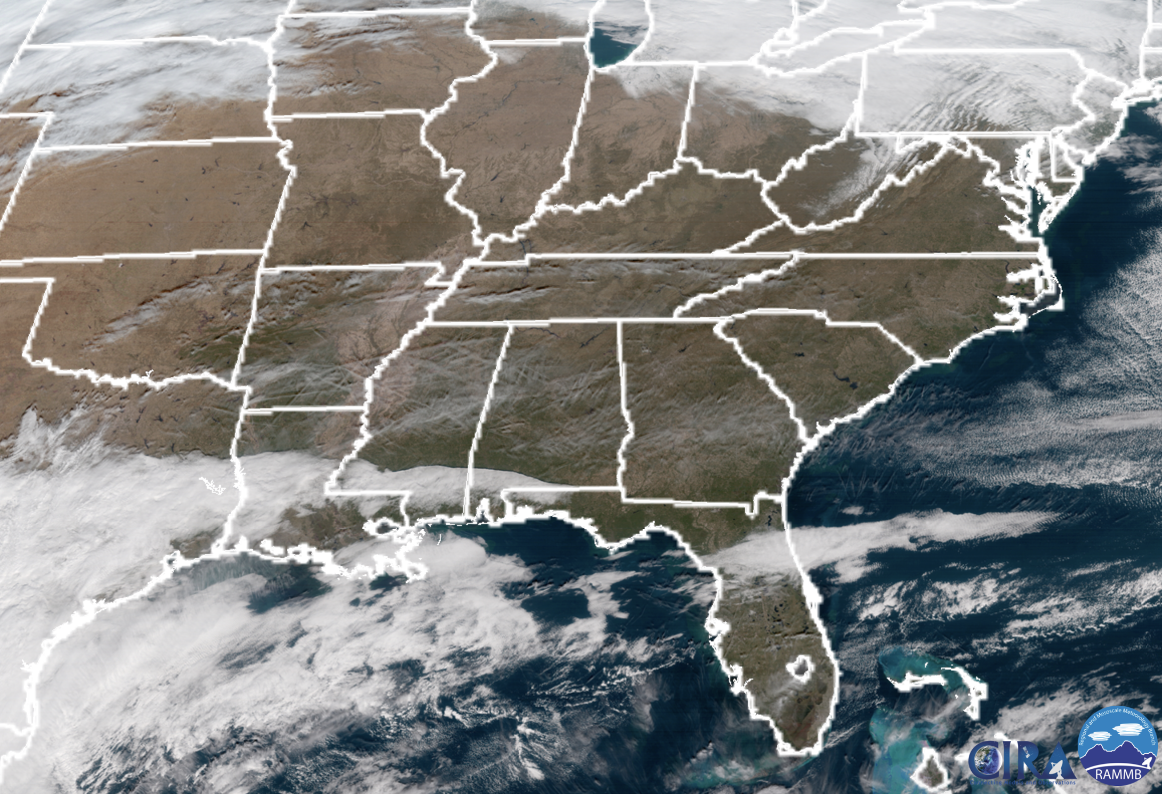
Patchy Fog Early Wednesday, Then Cloudy

Wednesday will be a close repeat of today, with (potentially dense) fog early. The main difference? Temperatures reaching the lower 60s during the afternoon…a great treat!

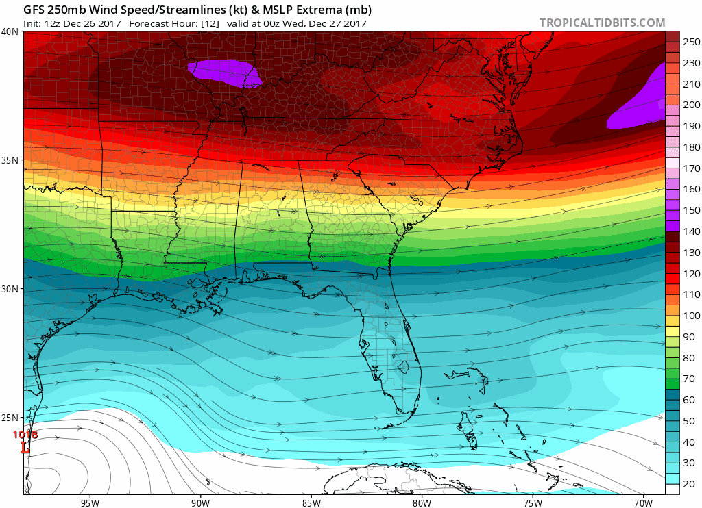
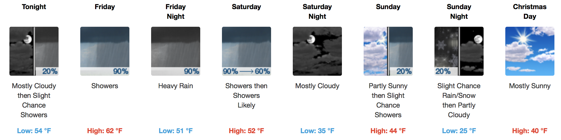
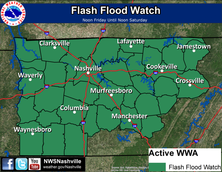
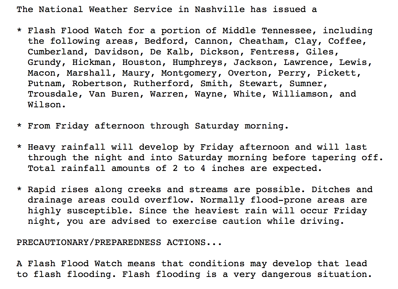
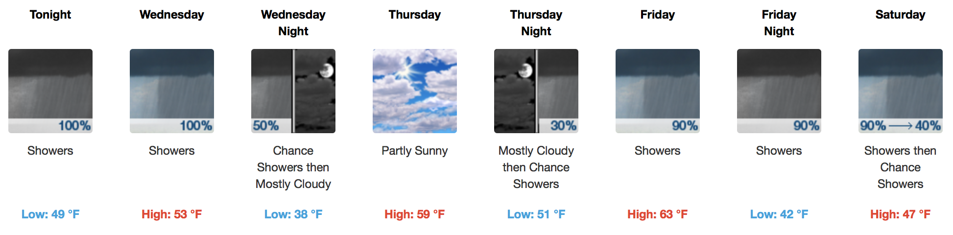
Soggy End to the Week, Plus Chance of Snow Fri-Sat

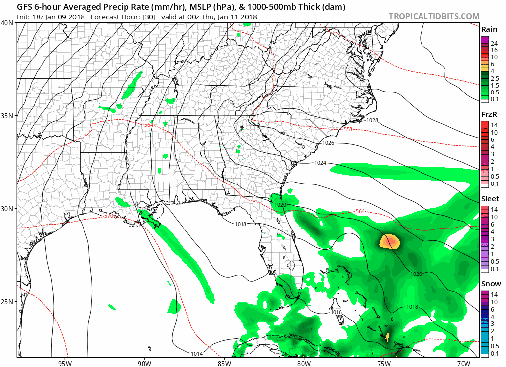
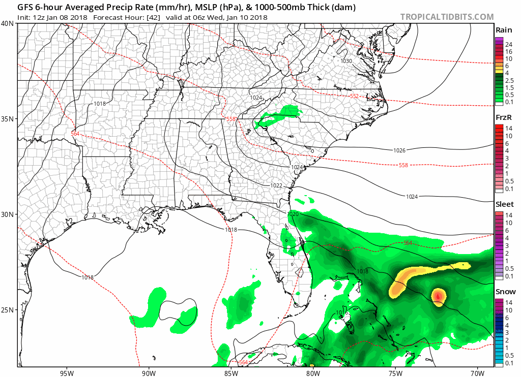
UPDATED GFS Loop through the weekend read more

Showers Ending This Afternoon, Drier and Warmer Tuesday

Rain Ending Later Today, Warmer But Intermittent Showers This Week

Latest HRRR Model Loop

Wet weather will come to an end later this afternoon, just in time for the evening rush hour. Temperatures will be unseasonably cool in the 40s, dropping into the upper 30s overnight. read more

Brisk Day/Night, Then Wintry Mix and Warmer Temps

Below 32ºF Today, Above 32ºF Tomorrow…Wintry Precip. Possible

Cloud cover will be intermittent today, with cold temperatures being the main story. Most places around Davidson/Williamson Counties will struggle to reach the upper 20s!

One last, brisk night is in store with forecasted lows in the teens, followed by a “warm up” Sunday and beyond. There’s just one speed bump in the way… read more

More Brutal Cold In Near-Term, Warming Trend Next Week?

Wind Chill Advisory Expires at Noon

GOES 16 Loop from this morning

If you were out the door early, WOW was it cold. Some Middle Tennessee locations set local low temperature records, like Crossville at 1ºF. Sunshine should help our area rebound into the middle 20s today, and winds will be dying down. Thus, the Wind Chill Advisory ends at noon. read more

Direct Message From the Arctic: How Low Can You Go?

Arctic Cold Front Today, Even Colder Temps Ahead

As it turns out, we can go pretty low. Believe it or not, today’s official forecast high of 36ºF will be the highest temperature of the entire forecast period. Yikes!

European Model – 850mb Temperature Pattern Through Next Sunday read more

Cold, Cold, Cold. No Definite Precipitation Chances to Speak Of

“Coldest Morning In Nearly A Year” – NWS Nashville

Most thermometers were reading in the teens this morning, but thanks to dry air, we will warm up into the middle 30s this afternoon. A few passing clouds are expected throughout the day, with a steady increase in cloud cover by Friday afternoon and evening. Saturday, temps will begin their nose dive in the mid-30°s, too cold for paintball or any other reasonable outdoor activity, then Saturday night we’ll plunge below freezing and stay there for the next four days. read more

Cold and Mainly Dry Until the Weekend

All Signs Point to a Lasting Cold Pattern

GFS Model Loop – General Jet Stream Pattern

Temperatures will fall tonight as more dry, cold air digs into Middle Tennessee. Highs on Wednesday will struggle to reach the freezing mark, so make sure to bundle up! read more

Flash Flood Watch Issued, 3-4″ of Rain Anticipated

Lots of Rain On the Way, Flooding A Concern

Since writing the blog this morning, NWS Nashville has since gone ahead and issued a Flash Flood Watch for Friday and Saturday:

To provide a general overview of how things are expected to play out, here’s a solution by the latest GFS model: read more

Lots of Rain In the Coming Days, Some Flooding Possible

Rainy Period Ahead, Starting As Early As Tonight

Latest HRRR Model Loop

\

The latest hydrologic outlook from NWS Nashville says it all:

Rain will likely start after sunset tonight and continue through the day on Wednesday. Rain will finally come to an end, but only briefly, early Thursday morning. read more

Generally Warmer Temperatures, Chances for Rain This Week/Weekend

Beautiful and Warmer Today, Rain Sunday

Side note: GOES 16 is back as GOES EAST!

Preliminary satellite this morning shows a few passing clouds over Tennessee, but nothing to keep the sun from shining. Temperatures this afternoon will soar into the 50s, a nice warmup for mid December. read more