Ramping Up Rain Possibilities, Decent Temps For August

Welcome to August 2017 — the month of the Solar Eclipse!

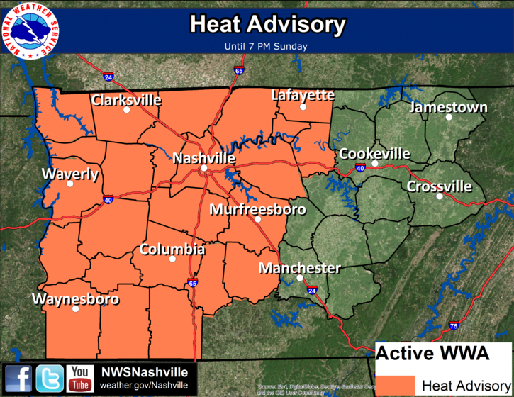
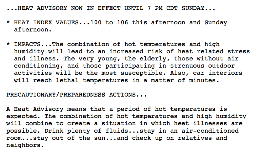
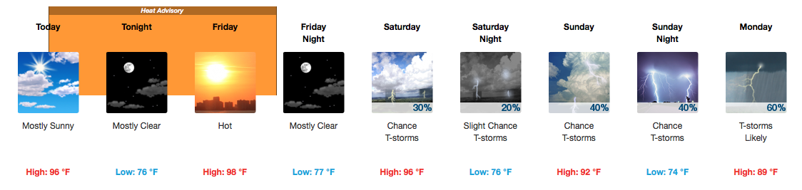
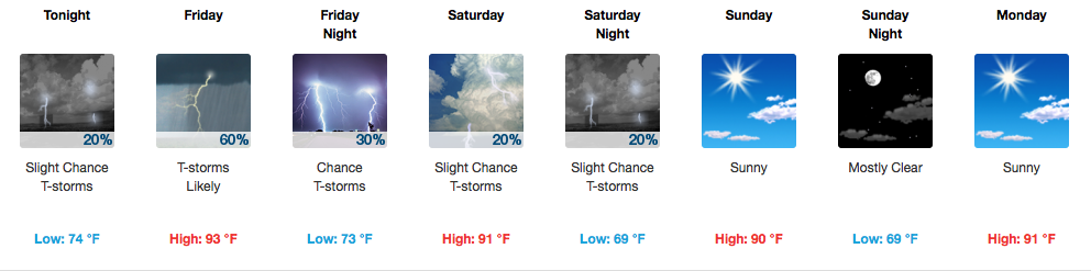
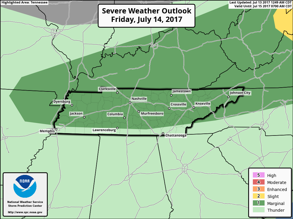
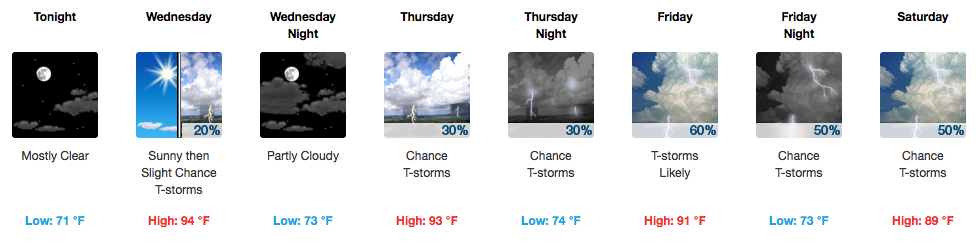
This Week — Not a Washout, But Some Rain For the Lawns

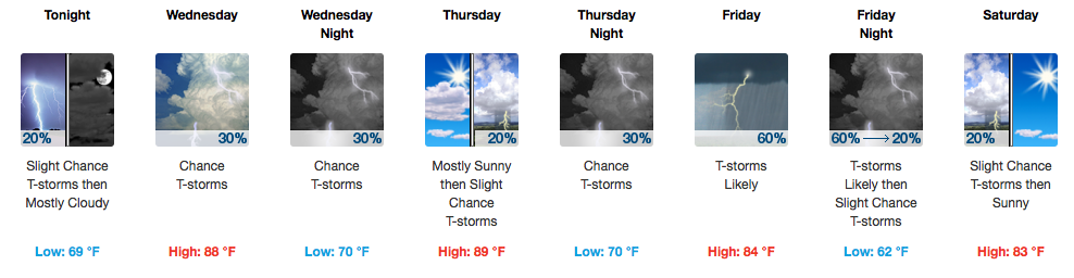
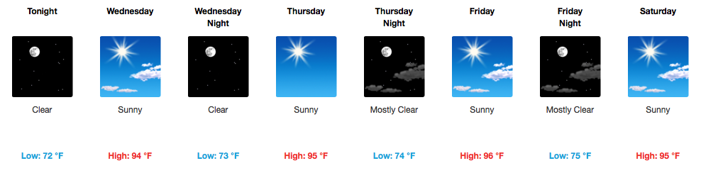
A slight chance of a storm exists today from Davidson/Williamson Counties westward. There’s just enough moisture, apparent on this morning’s upper-air observations, to squeeze out a storm or two. Not everyone gets so lucky, but some burnt area lawns could definitely use it. read more

The Great Outdoors Have Great Weather In Store

On A Roll — Great Weather Through Tuesday

GFS says, and we agree, no rain until (maybe) Wednesday.

GFS Loop through Tuesday

Expect temps to climb slowly into the 90s by Tuesday. Humidity will also return at that time.

Wednesday’s System Hangs Around For Awhile

Rain chances ramp up during the mid-afternoon on Wednesday and continue through at least Friday. read more

Hot and Stormy 48 Hours, Followed By a Very Pleasant Weekend

HOT and Muggy Today, Storms Also On the Way

There’s probably one word that would describe “outside”, today: unpleasant. Afternoon temperatures, even with some intermittent cloud cover, are expected to reach into the middle 90s here in Davidson/Williamson Counties. read more

Storms Possible Most of the Week, Next Weekend Looks Great!

Off/On Rain Chances This Week – Storms Likely Thursday-Friday

More afternoon “popcorn” storms are possible on Tuesday as the very weak cold front sitting to our north today sags southward. Severe weather is not expected.

Temperatures each day through Friday, thanks to abundant sunshine, should reach the lower 90s, too. read more

Hot Temps Holding On, Rain Chances Slowly Going Up

Heat Advisory Extended Through Sunday

At 10:00AM, the Airport is already at 89ºF. We are reaching for 98ºF once again this afternoon.

Our eyes will be on radar today as a few isolated showers may develop. These are expected mainly south and east of Davidson/Williamson Counties, but we can’t rule out a pop-up rainer here completely. Once the sun sets, these will quickly dissipate. read more

Living Inside a Toaster Oven (Heat Advisory In Effect)

Heat Advisories Here, Extreme Heat Everywhere

The country’s mid-section is painted colorfully today — you can thank the NWS and extreme heat for that.

Let’s zoom in a bit closer for the scoop on our heat advisory:

read more

HOT and Dry, Relief In the Form of Rain By the Weekend

Tracking the Heat

[av_textblock av_uid=’av-nstd3s’]
[cjtoolbox name=’Treg DONT DELETE’]
[/av_textblock]


Everybody, Do the “Heat Wave!” (Through Sunday)

If it is going to be consistently hot and dry, might as well try to make the best out of it. NWS Nashville put it very plainly this morning, “…most locations will have no rain this week under blazing sunshine. read more

Rain Over, Drier Sunday, HOT This Week

Flash Flood Watch Cancelled

Our Flash Flood Watch was originally set to expire at 7 PM. After lunch, the rain moved out, and the Watch was cancelled. We may see a few very light showers tonight as the cold front comes through, but that should not discourage your outdoor plans. read more

Scattered Storms Friday, Some Strong

Storms Likely On Friday, Some Strong

SPC Day 2 Convective Outlook

Widespread showers and storms are expected to develop late morning and into the afternoon once again tomorrow as a frontal boundary approaches from the north. A few of these storms could produce gusty winds so we will be keeping a close eye on anything that quickly sprouts up. read more

HOT is the Recurring Story, Rain Slowly Returns Wed.-Sat.

Toasty Tuesday, No Rain Yet

It’s definitely an A/C, waterpark, turn on the sprinkler kind of day. We’re already starting out a degree shy of 70ºF at the airport this morning. Temperatures this afternoon will soar well into the low-mid 90s — the official high for today is 94ºF, but I would not be surprised at all to see us reach 95ºF. read more