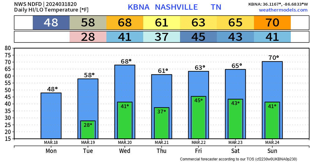
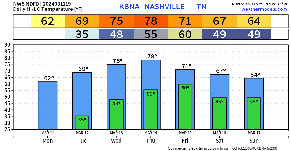
Approaching storm line healthy. Producing frequent lightning. Even rotating at mid levels. Expect here heavy rain, lightning, gusty winds, maybe small hail 5-6 PM, give or take an hour or so.

Brace yourself for a drastic temp change. 60°s this afternoon. 30°s before midnight with subfreezing wind chills lasting until late Sunday AM. read more

Rain (Maybe a Storm) Moving In, Maybe Changing To Snow, Little to No Impacts Expected.

Nice day so far, but unfortunately change is coming.

HRRR model (above) shows:

  • rain, maybe a few thunderstorms between 4 and 8pm
  • no severe weather expected
  • we may brefiely change over to sleet and snow around 9 or 10pm
  • little to no impacts are expected, bridges, overpasses and elevated surface may be a little slick Saturday AM

Saturday will be dry, but cold.

High temperatures Saturday are expected to only reach the upper 30s. Wind chills may not make it above the freezing mark tomorrow. read more

New HRRR model run, Friday timing. Estimates only. May change:

  • Rain arriving bt 4 PM – 7 PM
  • Rain to Sleet to Snow bt 9 PM – Midnight

Most snow to melt on impact. Little to no accumulation.

Bridges, Overpasses, and Areas at Higher Elevation may be slick late Friday night thru Sat AM. Expecting below freezing temps late Friday night until about 9 AM Sat. Bridges and overpasses are the exception because they cool down way faster than earth. read more