
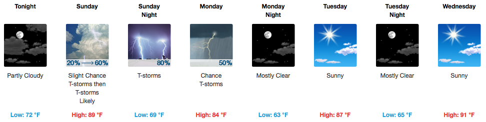
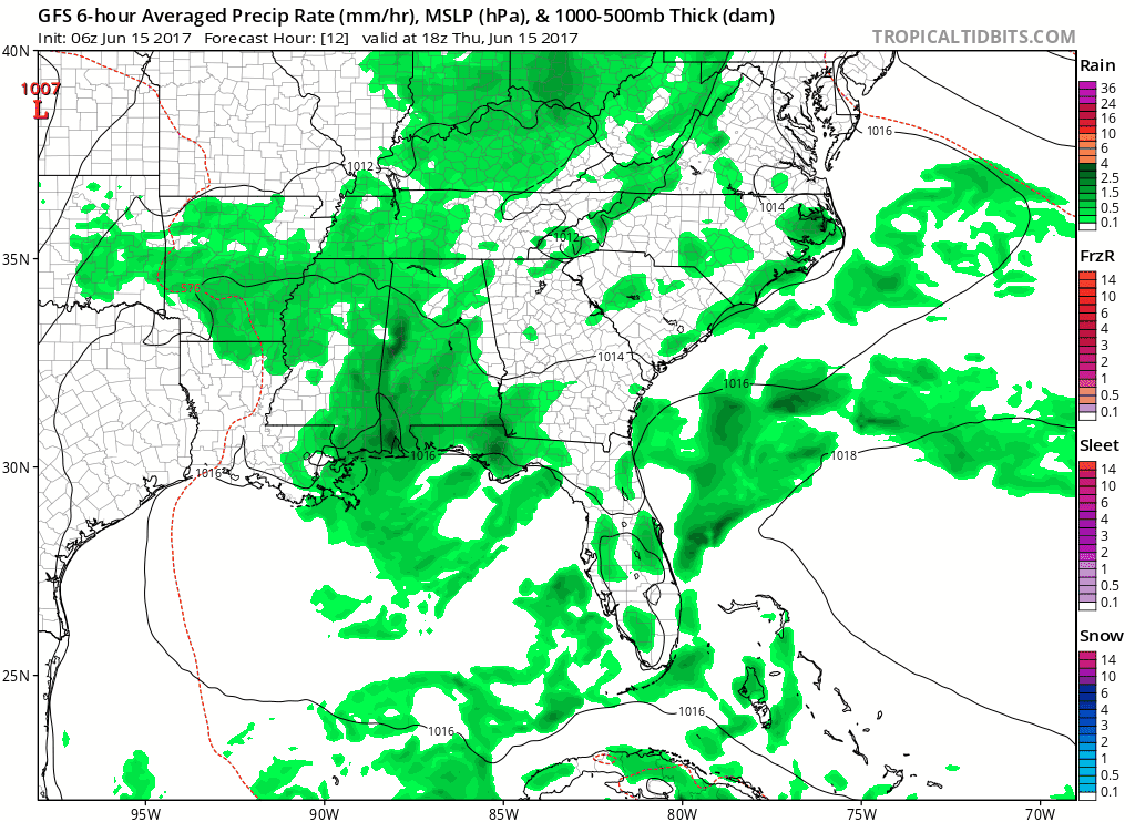
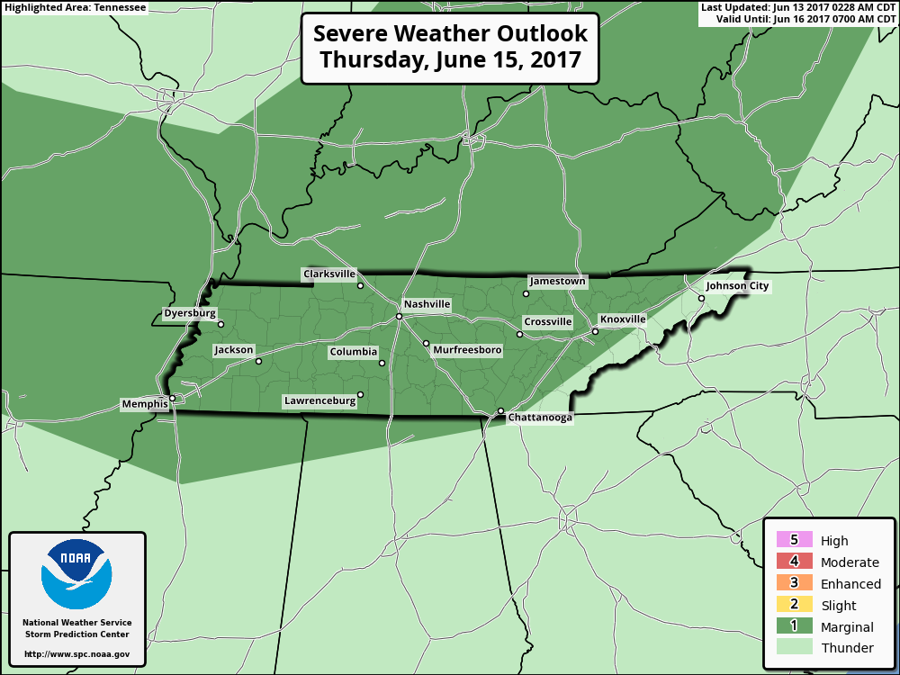
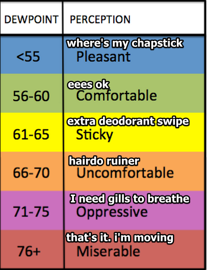
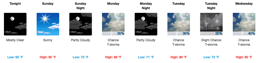
Tomorrow’s Storms – Severe Weather Possible for Father’s Day
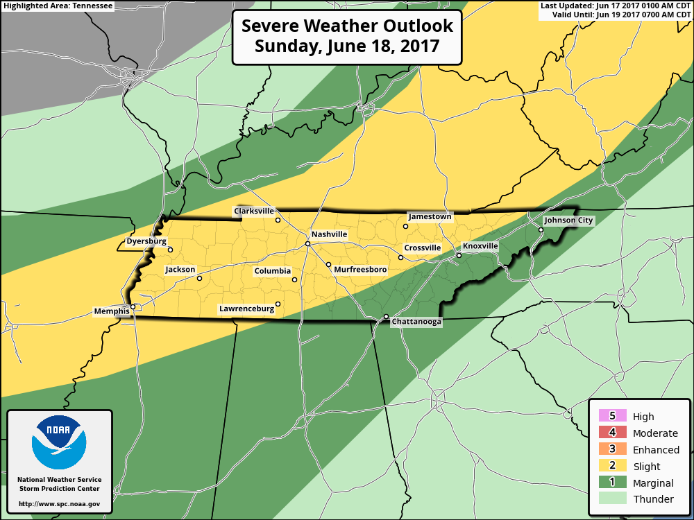
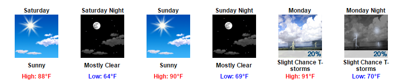
The Storm Prediction Center gives all of us a “2 out of 5”, or Slight Risk, for severe weather on Sunday.
What: Showers and storms, some strong/severe. Main concerns are damaging winds, but hail and an isolated tornado cannot be ruled out.


You must be logged in to post a comment.