
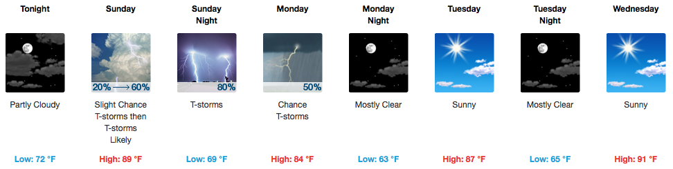
Tomorrow’s Storms – Severe Weather Possible for Father’s Day
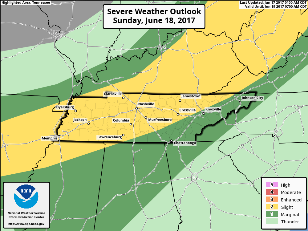
The Storm Prediction Center gives all of us a “2 out of 5”, or Slight Risk, for severe weather on Sunday.
What: Showers and storms, some strong/severe. Main concerns are damaging winds, but hail and an isolated tornado cannot be ruled out.
When: 3-6PM arrival time. This can and will probably shift around a little bit, but the GFS and NAM are in decent enough agreement with storm development to our northwest, moving through here mid-late afternoon.
Compared to our storms earlier this week, the atmosphere will be a bit more primed for severe storms tomorrow. So, if you have outdoor plans in Sunday afternoon, it would likely be wise to have a backup “indoors” plan for when the rain approaches.
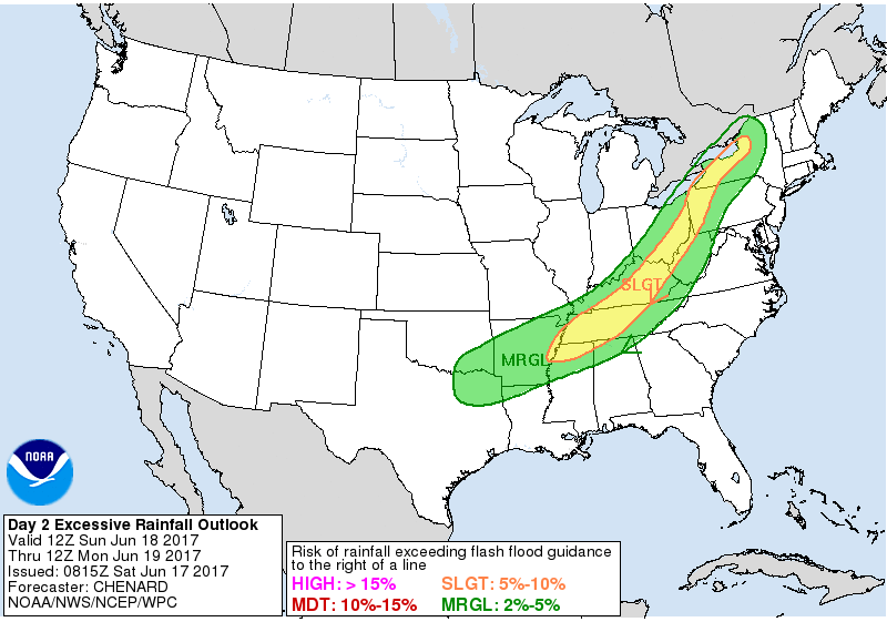
Based on the latest forecasts, the Weather Prediction Center has also placed middle Tennessee under a “Slight Risk” for excessive rainfall potential. This means that there is a 5-10% chance that with some heavier thunderstorms tomorrow afternoon, a few areas of flash flooding are possible.
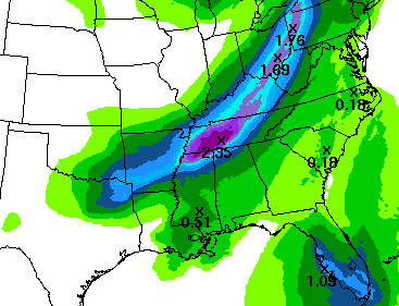
This idea of excessive rainfall runs in line with their rainfall forecast, which predicts ~ 2″ of total precipitation tomorrow for our area.
Bottom line: Check back here and to @NashSevereWx on Twitter for updates today and tomorrow on the impending storms and heavy rain.
Drying Out, Becoming a Bit “Cooler”
Monday, rain is expected to move out during the morning hours. A chance for showers/storm continues into the early afternoon, but a cold front will be moving through. Once that clears Davidson and Williamson Counties, we’ll be done with any rain. Afternoon temps are expected to be in the mid 80s.
Tuesday and Wednesday, we’ll begin to warm back up with highs in the upper 80s to near 90ºF.
Rain chances will return by the end of the week and weekend as instability increases.
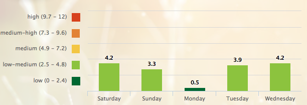
5-Day Pollen.com Forecast

Categories: Forecast Blogs (Legacy)
You must be logged in to post a comment.