
It’s been a while since we’ve had rain chances so close to each other, but don’t get your hopes up, this next chance doesn’t look to be much.
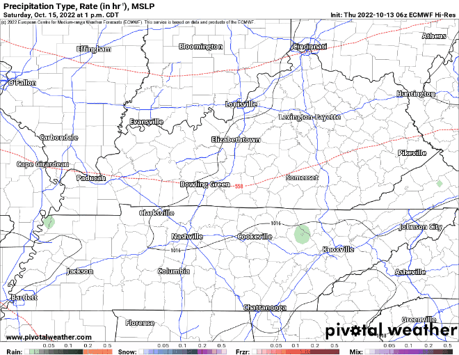
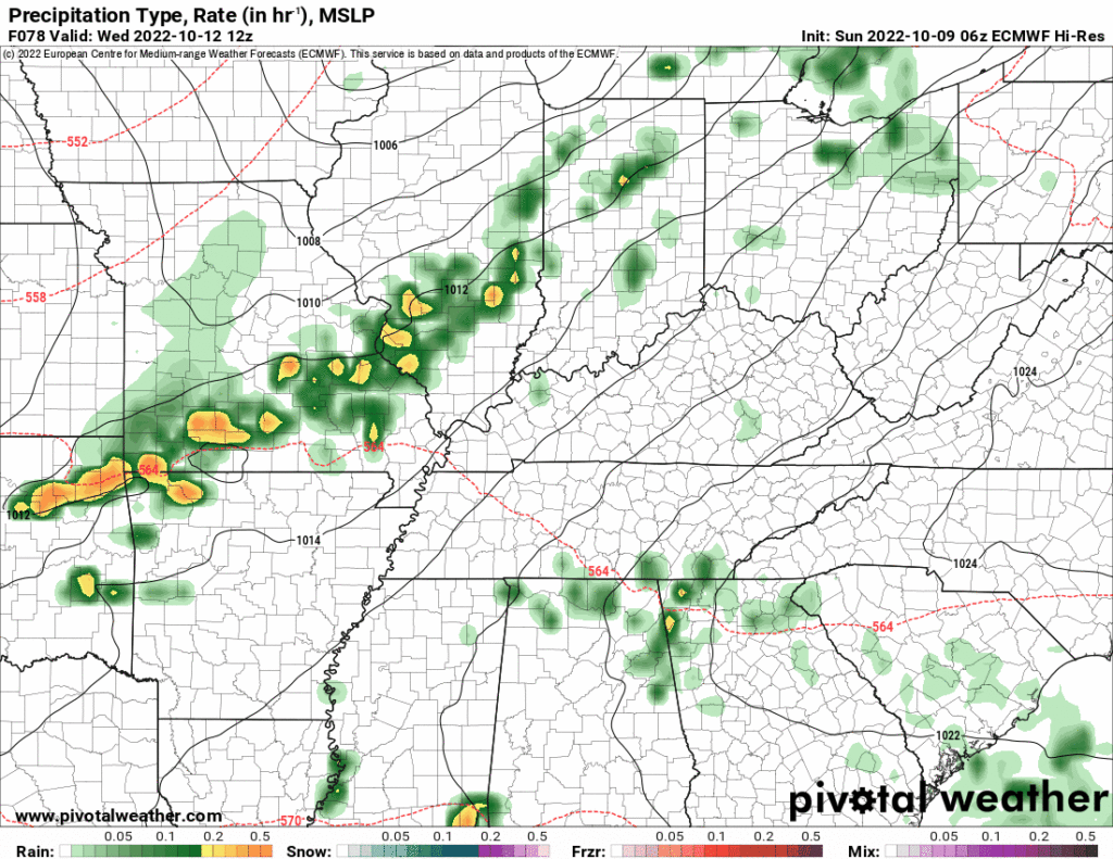
🌧️The Euro model above shows rain chances Saturday thru Sunday.

It’s been a while since we’ve had rain chances so close to each other, but don’t get your hopes up, this next chance doesn’t look to be much.
🌧️The Euro model above shows rain chances Saturday thru Sunday.
Some light showers this morning – no worries with these.
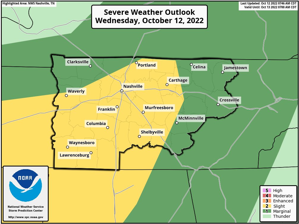
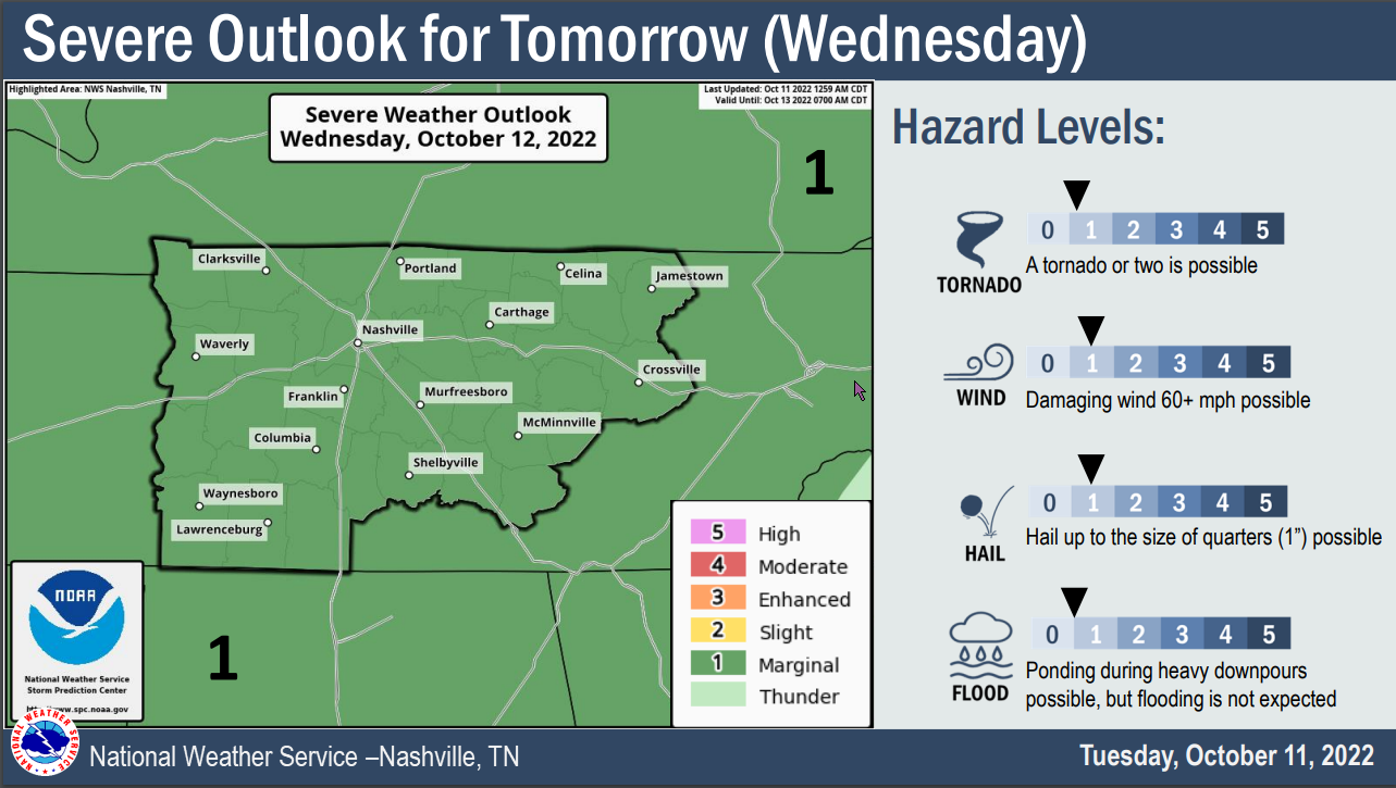
🕜 General ETA for main line of storms is 4-7 PM –> HRRR model thinks 5-6 PM (This could very easily change, stay connected!)
🕜 NAM3k model thinks storms in front of the line arrive 6-7 PM, while the main line gets here around 10-11 PM. (Majority of models lean toward the HRRR solution, ETA of 4-7PM is more likely, but it is unwise to discount any model).
⚠️Updated from earlier today.
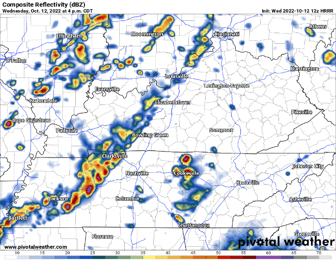
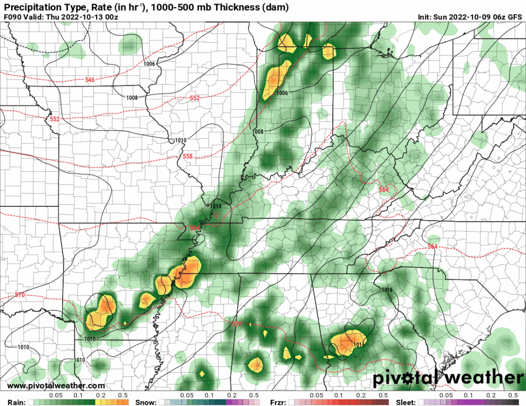
This morning we thought the storms would come in around 9 PM to 10 PM Wednesday night. Now we think that’s earlier.
⌚ HRRR model ETA is now 5 PM to 6 PM. Timing may change so stay informed.

I’ve forgotten what it looks like, but it may* rain from above on Wednesday. Yes, maybe, not for sure.
Two models show two different solutions. Sus.
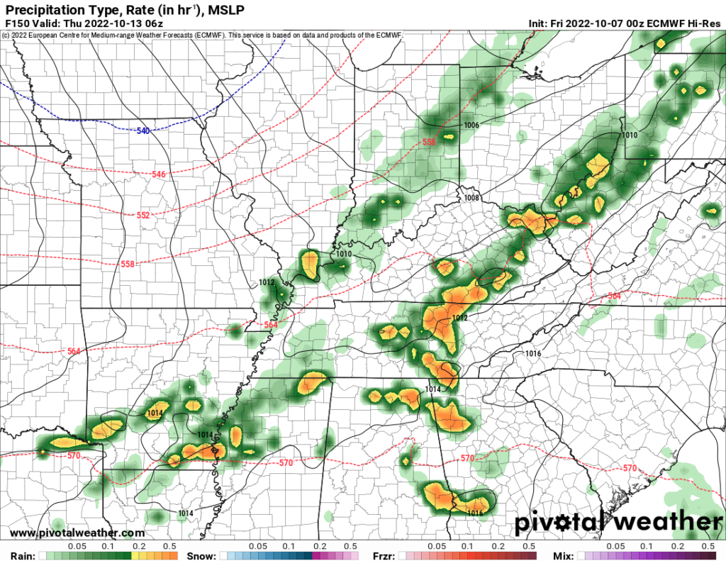
The EURO (below) shows very little, if any. Maybe just enough to get the ground a lil’ wet.
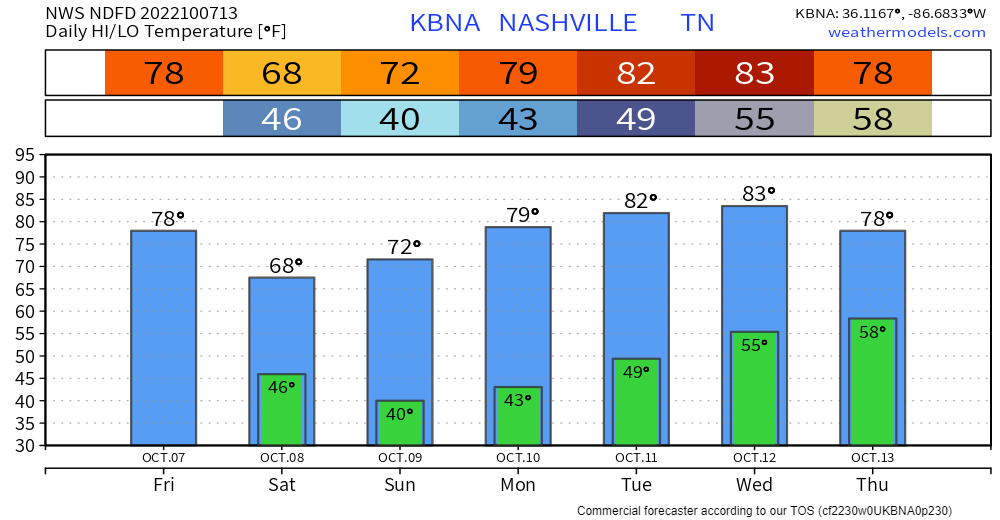
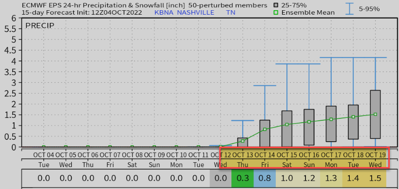
What’ll be a 31 day streak without 0.02″+ of rain might end Thursday morning.
🗣️ Wait, what was that about “might“?
🗣️ Which one is right?

National Blend of Models thinks rain totaling 0.4″, so I guess go for that? I’m not betting on anything. We need the higher res models to get into range Tuesday to get a grip.
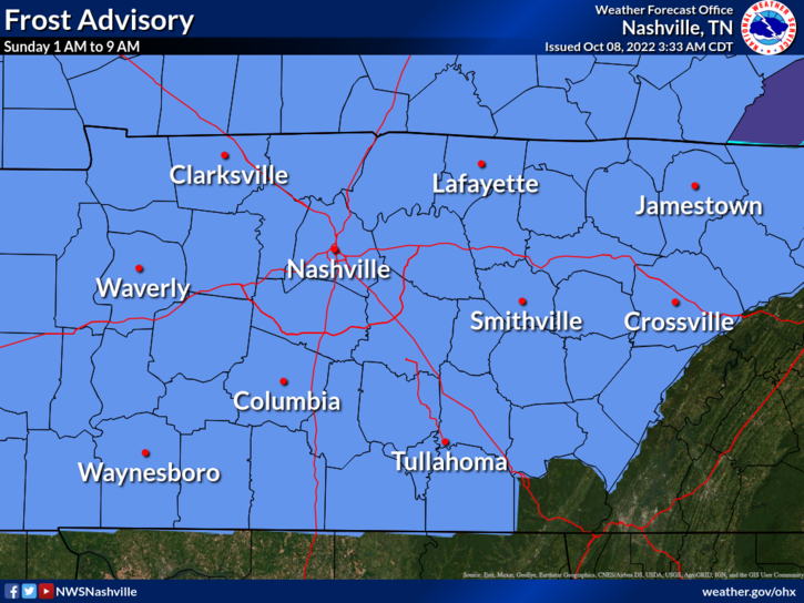
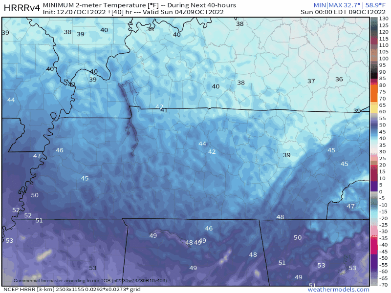
Frost Advisory tonight.
Cover or shelter beloved frost sensitive plants.
Rain increasingly likely late Wednesday into Thursday.
🤞🏽 Thunderstorms – probably not severe – may accompany this rain. This’ll be a “high shear, low instability” event common here in the fall.

Dry cold front arrives today.
Gradual warmup next week 📈.
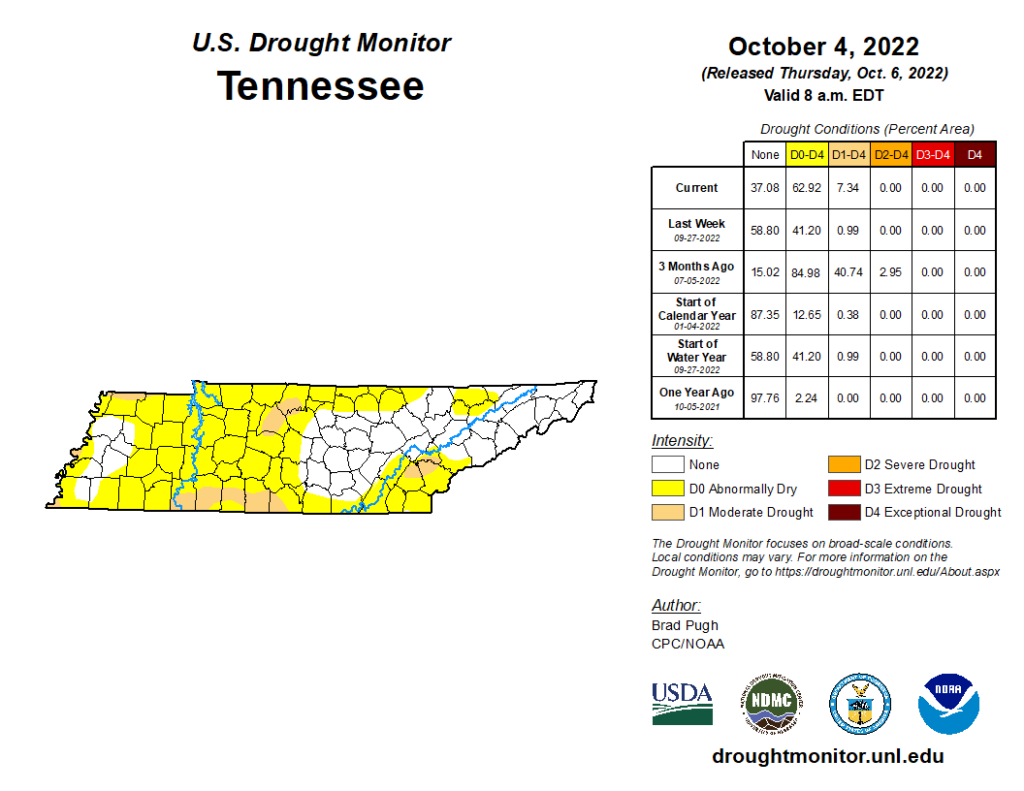
Drought continues ⌛
Quick References:
Weather changes constantly.
Follow @NashSevereWx on Twitter for any changes to this forecast.
Live coverage during tornado and severe thunderstorm warnings.
We are all “abnormally dry.”

You know how it happened:
Not even a chance of rain until maybe late Wednesday, Oct. 12. Low confidence in that.
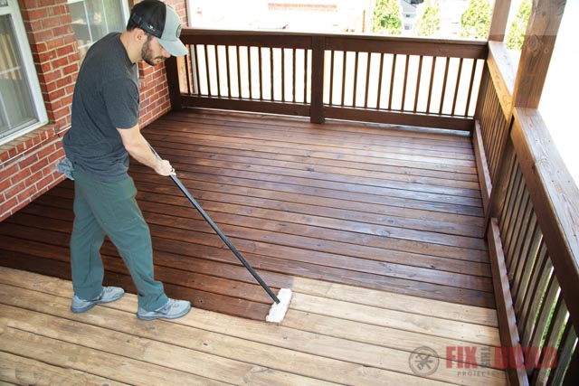
It’s a great time to seal your driveway or stain your deck.

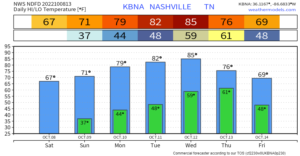
No rain until maybe the Thursday the 13th:
Many of us will dip into the upper 30°s around sunrise weekend.
Alert tweeter Justin side-eyed Tuesday’s crap app forecast: 38° in the morning to 97° in the afternoon, guh.
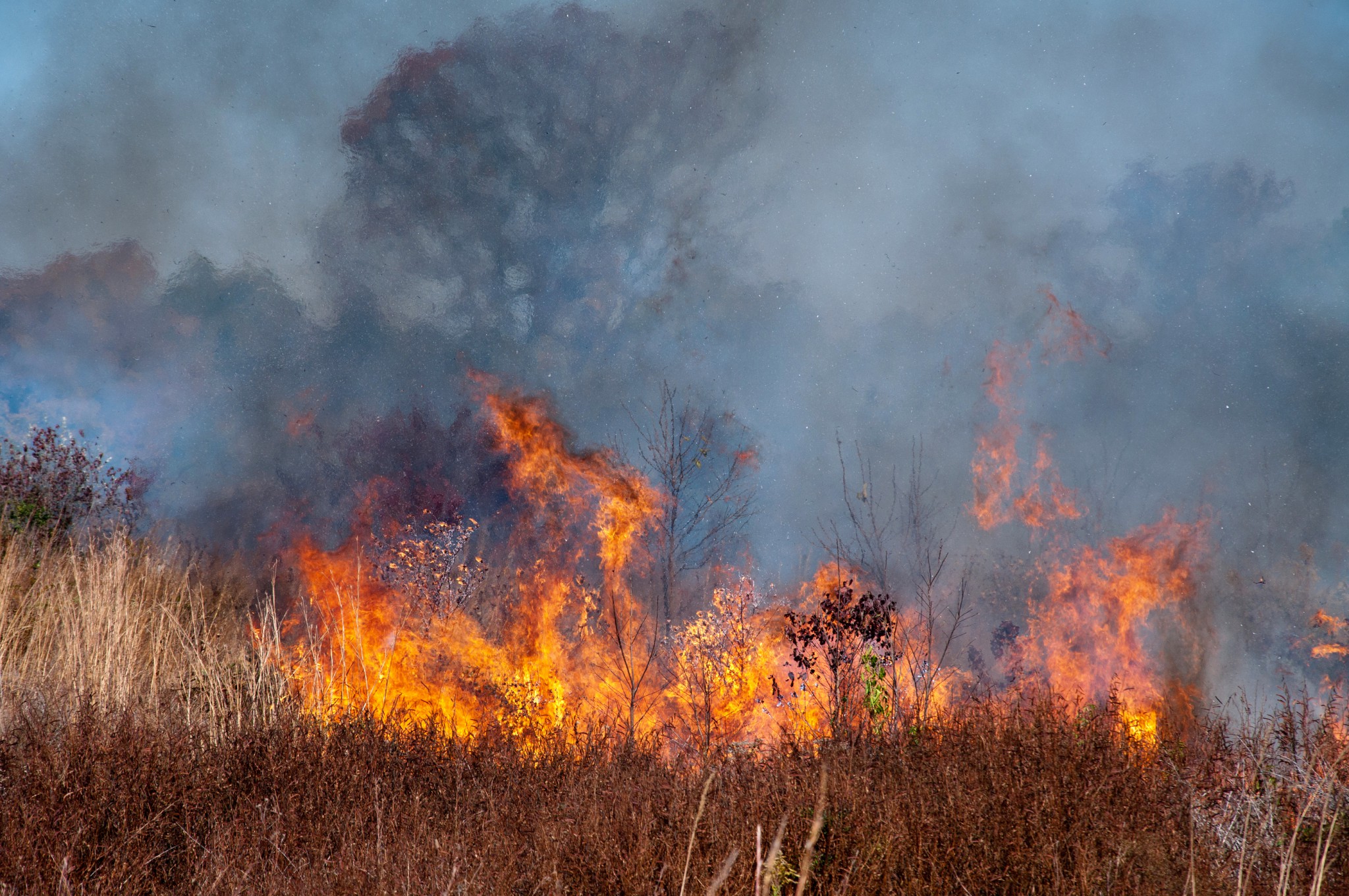
… no significant rain has fallen in Middle Tennessee since September 11 and our area has become quite dry – so elevated fire danger is expected during the afternoon hours with a risk for brush fires.
You must be logged in to post a comment.