
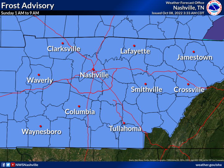
Frost Advisory tonight.
Cover or shelter beloved frost sensitive plants.
- Advisory is technically for overnight, 1 AM to 9 AM. Coldest temps will last for a few hours around sunrise.
- We do not think it’ll freeze but it’ll be close.
- Models came in about three degrees colder overnight. BNA’s low went from 40° to 37°.
- Your backyard is usually colder than BNA during fall and winter mornings.
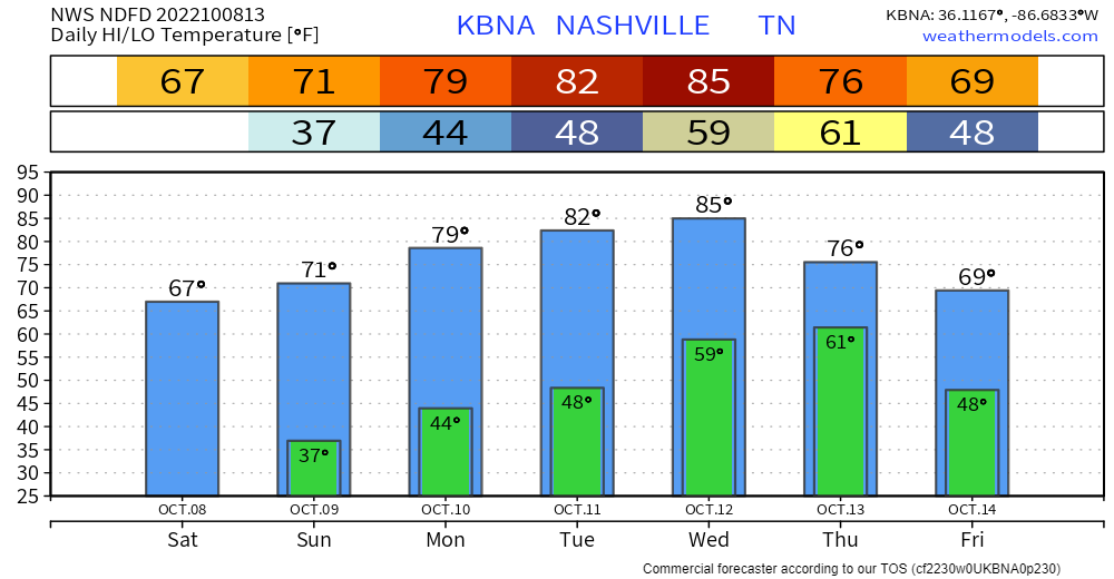
Rain increasingly likely late Wednesday into Thursday.
- GFS, Euro, and National Blend of Models show 0.6″ to 1.2″ rain total.
- Most of this should fall Thursday.
🤞🏽 Thunderstorms – probably not severe – may accompany this rain. This’ll be a “high shear, low instability” event common here in the fall.
This one’ll probably do what these usually do: we get rain and leaves off the trees, nothing more.
💁🏽♂️ Only when we get a surge in instability will it cause severe straight line wind and tornado potential.
- It’s a potent system in the broad sensed. When a negatively tilted trough pushes a sharp cold front across dewpoints in Middle Tennessee running in the low to mid 60°s, that’s usually bad times.
- Models think we’ll have plenty of wind shear, which is a key severe storm ingredient.
- But! Models also think instability – another essential bad storm ingredient – will be insufficient for severe weather.
- It’s too soon to rule anything in or out. SPC and NWS-Nashville just don’t see enough bad stuff in the models to start raising concerns in the form of outlooks or discussion. If/When they do, we’ll let you know.
- Anxiety level right now: I’m more worried about the Titans tbh, but ask me again after Sunday.
Quick References:
Weather changes constantly.
Follow @NashSevereWx on Twitter for any changes to this forecast.
Live coverage during tornado and severe thunderstorm warnings.

Look good.
Support the mission.

We are 100% community supported. No ads. No subscription fees. Keep it free for everyone.


Categories: Forecast Blogs (Legacy)
You must be logged in to post a comment.