
What’ll be a 31 day streak without 0.02″+ of rain might end Thursday morning.
🗣️ Wait, what was that about “might“?
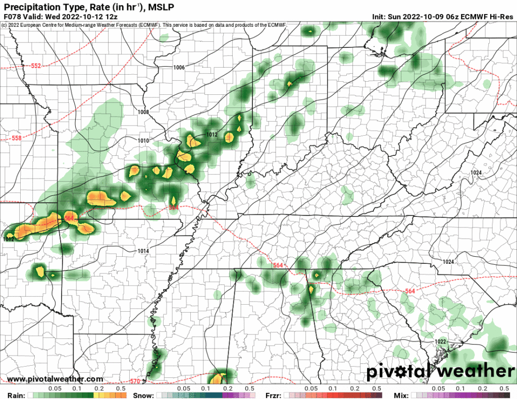
- It’s still a bit sus. Rain misses us in the last two Euro model runs, it goes east. (Makes sense, the good “moisture return” is east).
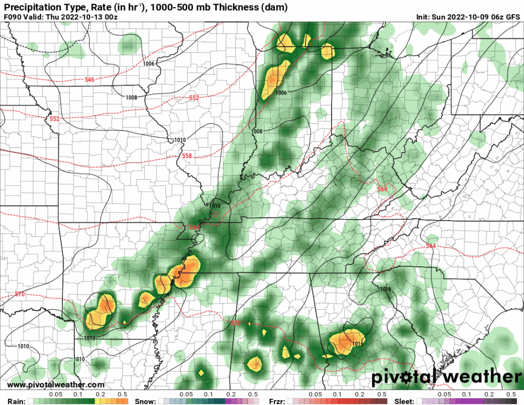
- GFS disagrees, delivers streak-breaking rain 👇🏽
🗣️ Which one is right?

National Blend of Models thinks rain totaling 0.4″, so I guess go for that? I’m not betting on anything. We need the higher res models to get into range Tuesday to get a grip.
💨🍃 If the rain line arrives, expect strong straight line winds. Leaves off the trees, inflatables blown, maybe a few strong or borderline straight line wind bursts. Tornadoes and hail not expected because of insufficient instability. More on this thru the week.
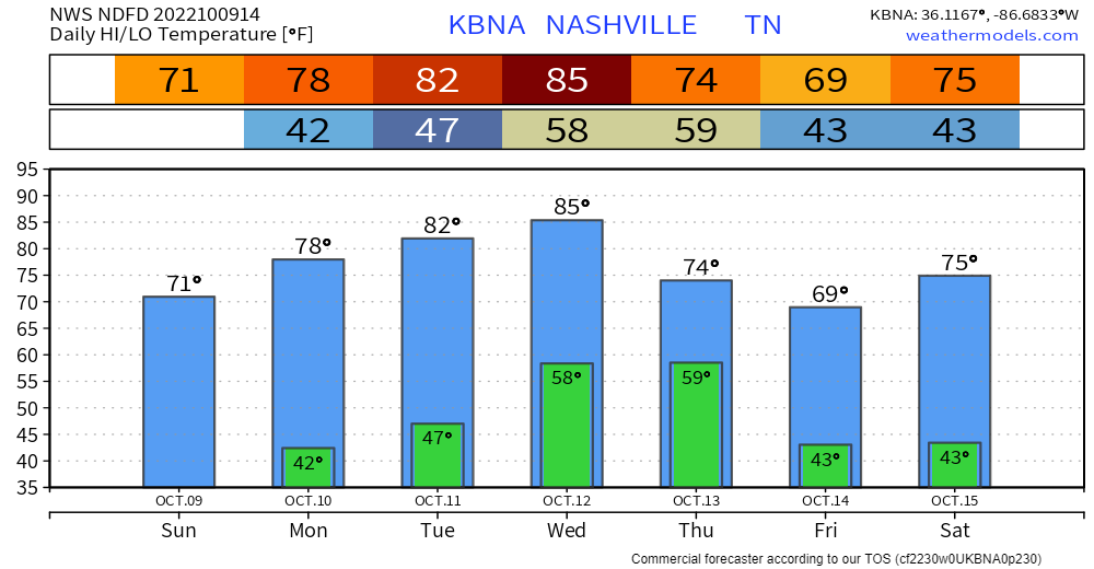
Temp Trivia: 85° Weds is three degrees off the all time October 12 high of 88° set in 1969.
Quick References:
Weather changes constantly.
Follow @NashSevereWx on Twitter for any changes to this forecast.
Live coverage during tornado and severe thunderstorm warnings.

Look good.
Support the mission.

We are 100% community supported. No ads. No subscription fees. Keep it free for everyone.


Categories: Forecast Blogs (Legacy)
You must be logged in to post a comment.