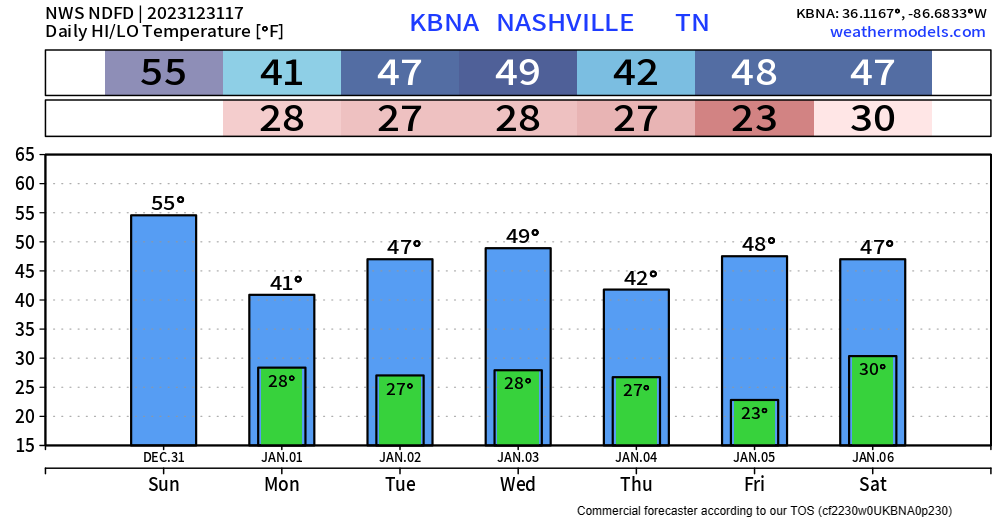
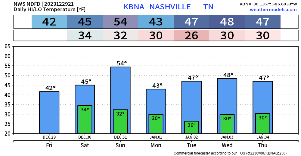
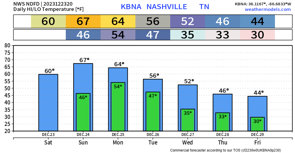
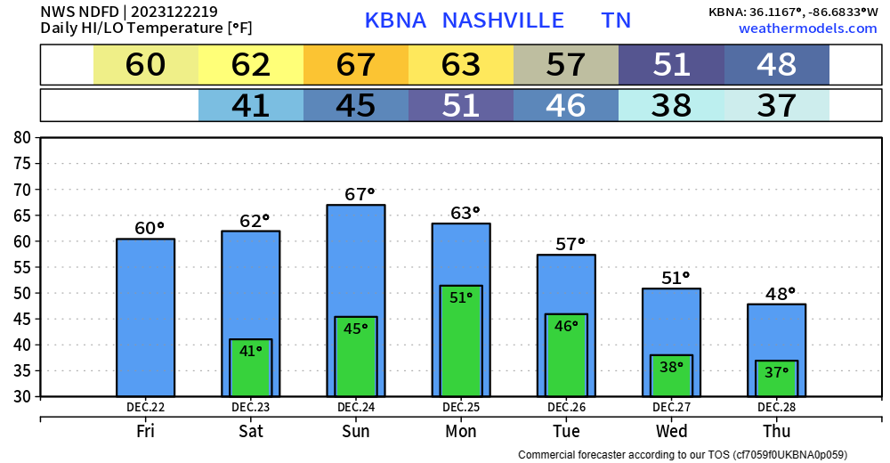
The last day of 2023 will quite nice, with high temperatures in the mid 50s.
This handy dandy graphic from NWS Nashville shows the expected temperatures and wind chills tonight. If going out, make sure to bundle up.

The last day of 2023 will quite nice, with high temperatures in the mid 50s.
This handy dandy graphic from NWS Nashville shows the expected temperatures and wind chills tonight. If going out, make sure to bundle up.
Fairly tame upcoming forecast for us.
Temperatures will be fairly seasonal. High temps for NYE will be in the low to mid 50s.
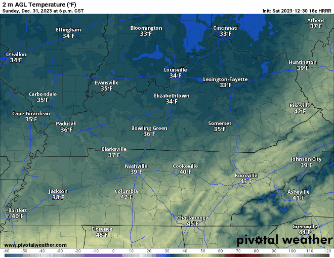
For the brave souls going downtown, you’ll want to prepare for temperatures to quickly drop after sunset. Mid 30s expected as the calendar changes to 1/1/24. It’ll be dry.
As of 4pm, surface temperatures throughout our two counties are ranging from 37-40°, which is the reason the precip moving thru will mostly be light rain, although temperatures way up are very cold which could call for some flurries mixing in.
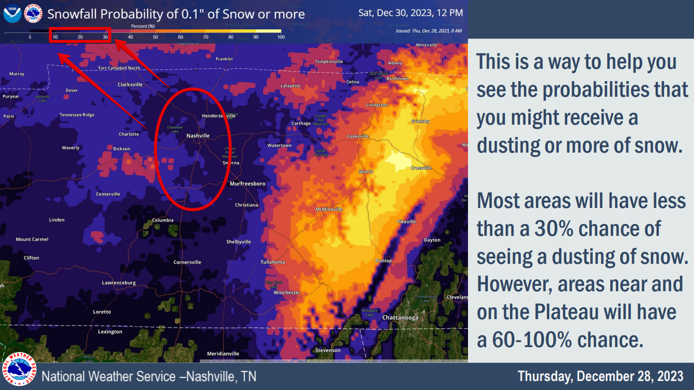

This graph from NWS Nashville shows only a 10 – 30% chance of us seeing 0.1″ +, or more commonly known as a dusting.
The odds are not in our favor.
New model data keeps coming in, and it shows bad news for those who had their fingers crossed for accumulating snow.
The snow target time is Friday morning.
The below NWS Nashville graf has good information for Middle Tennessee:
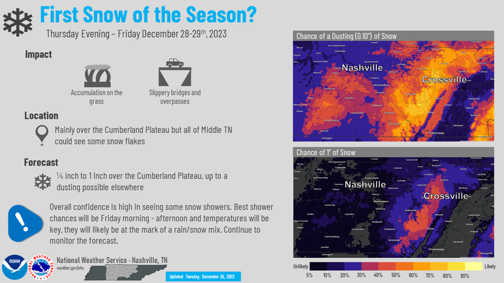
Takeaways for us in Davidson and Williamson Counties:

We’ll be dry until Wednesday evening, when some showers (just rain) move in, shown below by the HRRR model.
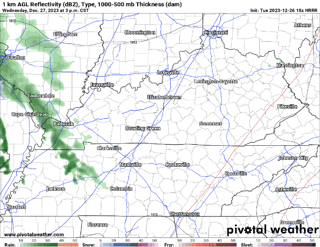
This will just be some light rain. If you look closely, you can see the swirl near the bootheel of MO and southern Illinois, that low pressure system will be the culprit for our snow chances.
Morning rain will end during lunch. A few hit/miss showers may drive by your place this afternoon, otherwise cloudy with a few breaks of sunshine for some. HRRR model through 7 PM today below:
Colder air later this week, wind chills near freezing Weds morning with colder mornings after that.

Gorgeous weather for Christmas Eve, temperatures have crept up into the mid to upper 60s.
Clouds will increase as we go throughout the day, hinting at the incoming rain.

Not only will rain pick up overnight, but so will the wind.

Because it’s been raining, Margo.
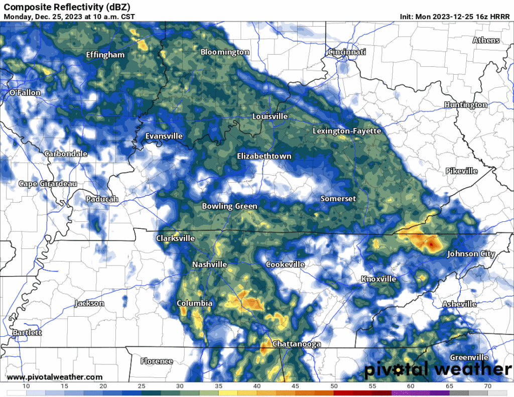
On/off rain has been moving thru throughout the day, and chances will continue thru this evening. You can check the radar anytime here: Radar – Nashville Severe Weather
A year ago today, I wrote the blog about temperatures expected to get around 0°, wind chills -20° to -30°, with a Winter Storm Warning along with it. NWS Nashville put together a page about this event, you can click here if you’d like to read.
You must be logged in to post a comment.