

Gorgeous weather for Christmas Eve, temperatures have crept up into the mid to upper 60s.
Clouds will increase as we go throughout the day, hinting at the incoming rain.

Rough Ride For Rudolph
Not only will rain pick up overnight, but so will the wind.
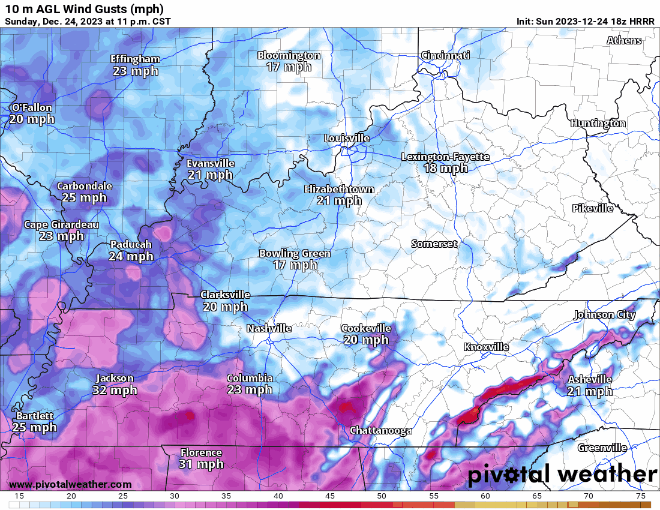
Winds will pick up after midnight and stick around thru around noon Monday. Not sure we get the 40-45 mph gusts, but gusts up to 30 – 35 mph are possible. Santa may encounter some turbulence. Securing X-mas decorations, outdoor furniture won’t be a bad idea.
Along with the wind picking up around midnight, rain will accompany it.
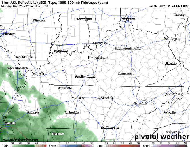
The HRRR (above) shows a steady rain, heavy at times, sticking around thru noon, becoming scattered thru the end of the day. Rainfall totals expected to be around 0.75″ – 1″.
Tuesday looks dry, along with the majority of the day Wednesday, until some more moisture creeps back in.
Details are still hazy, but occasional showers are possible Wednesday PM thru Thursday. Too far out to try to give any specific timing deets. Your crapapp may show a snowflake towards the end of the week, although air aloft may support frozen precipitation, temperatures at the surface will be above freezing. More details on this as we get closer.
Quick References:
Weather changes constantly.
Follow @NashSevereWx on Twitter for any changes to this forecast.
Live coverage during tornado and severe thunderstorm warnings:

Look good.
Support the mission.

We are 100% community supported. No ads. No subscription fees. Keep it free for everyone.


Categories: Forecast Blogs (Legacy)
You must be logged in to post a comment.