
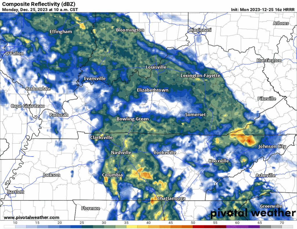
Morning rain will end during lunch. A few hit/miss showers may drive by your place this afternoon, otherwise cloudy with a few breaks of sunshine for some. HRRR model through 7 PM today below:
Colder air later this week, wind chills near freezing Weds morning with colder mornings after that.
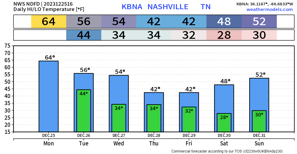
Next rain event is questionable. Most models think the most likely time is Thursday night. No one is sure about that. Looks right now like a light, cold rain with wintry precip missing us to the north and east.
Another rain event is modeled for New Year’s Day. Best data right now thinks it’s a cold rain without wintry precip. Model data 1 week away is unreliable making it too soon to discuss wintry precip beyond what we’ve already said about it.
Thanks to all you doctors, nurses, police, firefolks, meteorologists and other Essential People working today. You are the real ones.
Quick References:
Weather changes constantly.
Follow @NashSevereWx on Twitter for any changes to this forecast.
Live coverage during tornado and severe thunderstorm warnings:

Look good.
Support the mission.

We are 100% community supported. No ads. No subscription fees. Keep it free for everyone.


Categories: Forecast Blogs (Legacy)
You must be logged in to post a comment.