
- WINDY. A storm line will arrive Wednesday night, but before that, south winds will howl 20-30 MPH and could gust over 40 MPH. Then when the storm line comes through those winds may briefly intensify and blow from the west/southwest so maybe yeah, tie down your things unless you want them in your neighbor’s yard.
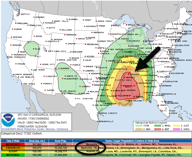
- RANT ABOUT /OH NOES IT’S GONNA BE A THREE OUT OF FIVE/. You may have seen/heard breathless exclamations “it’s a THREE out of FIVE” threat based on the below SPC map. It is factually true on the SPC scale this is a 3 of 5 but that is like saying “the Titans are playing an NFL team tomorrow” and getting scared for no good reason — the Titans could be playing any NFL team. For example, Jacksonville (they suck, why worry because /checks notes/ they’re the Jaguars). Or, the Bengals (ruh roh, they are now featuring a competent offensive line and they franchise tagged their interception-making safety). Or, the Colts (whose QB carousel landed on 37 year old Matt Ryan so if the Titans were ever down 28-3 are we worried yet). The point is “three out of five” is like saying “an NFL team is coming to Nissan,” you don’t know whether to be concerned until you hear/read more about the opponent. (Note I considered using a Broadway play analogy but I am uncultured and would have made a mistake ranking the plays, although for sure The Scarlet Pimpernel would have been bottom).

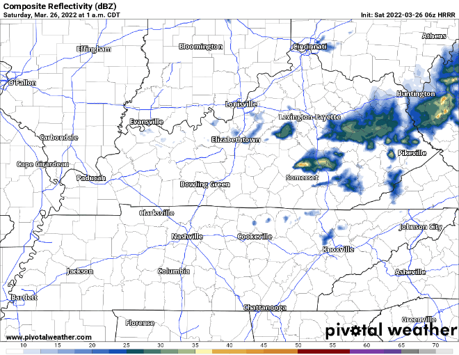
3. TIMING. A squall line is going to come speeding through here probably early evening Wednesday night. “7-8 PM” is NWS-Nashville’s thought which seems about right to me (HRRR model agrees, below) tho that ETA could wiggle earlier or later than that, so look for an update (changes?) tonight and tomorrow.


You must be logged in to post a comment.