

Lotta rain coming in. Some thunderstorms. Severe risk is low, but not zero.
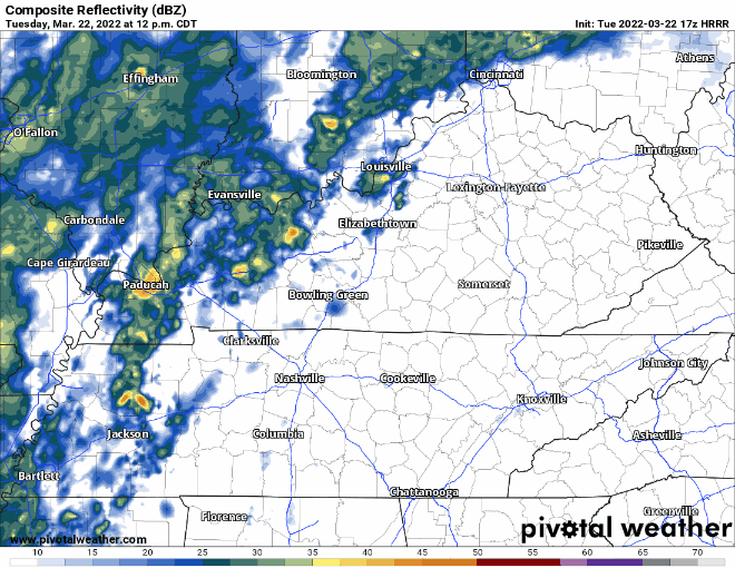
HRRR model below shows showers and storms coming in this evening. Main line is over our area around 9:00 pm. Stay weather aware this afternoon through evening time. These showers and storms should be out of the area by early Wednesday morning with lingering sprinkles up until 12pm Wednesday. HRRR through 6:00 am tomorrow:
Threats
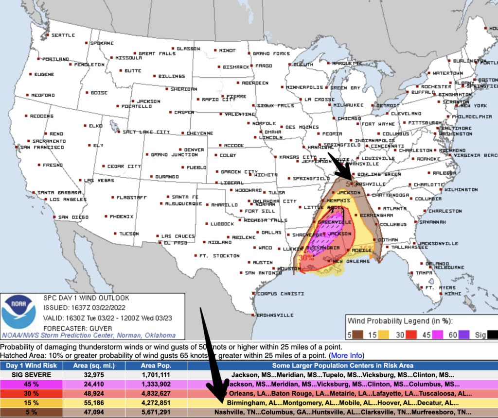
Main concerns with this system are damaging winds and possible localized flooding. SPC has included us in a 5% chance of seeing damaging straight line winds within 25 miles of us. This is the only SPC outlook we’re included in. We’ll let you know if that changes, but CAPE (available energy) is awfully low this far north. So, we don’t expect storms to have much to work with.
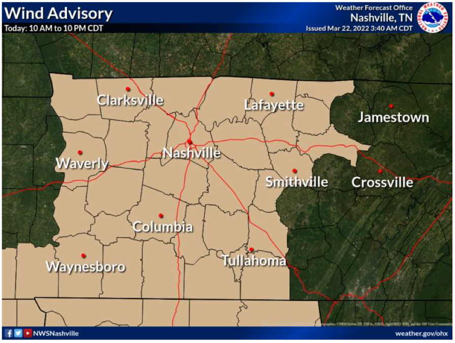
Our area is in a wind advisory until tomorrow night at 10pm due to south winds from 15 to 25 mph with gusts up to 40 mph. This may cause a tree or two to fall.
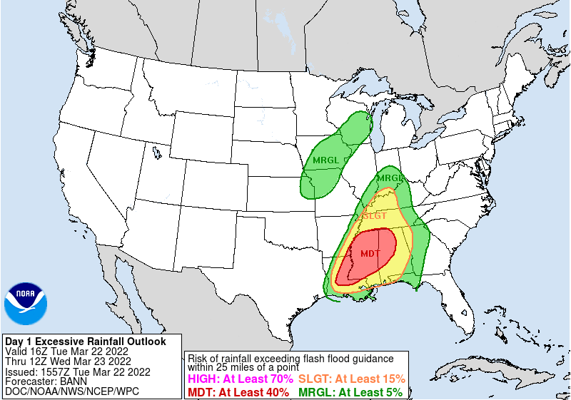
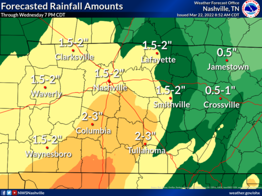
From this system our counties could see 1.5-3″ possible. Our area is in a 15% risk for flash flooding within 25 miles from any point within our counties. Usual low spots and urban areas watch out for localized flooding with these amounts. Remember: turn around don’t drown.
Stay up to date as these storms come into our area on our twitter.
Quick References:
Weather changes constantly.
Follow @NashSevereWx on Twitter for any changes to this forecast.
Live coverage during tornado and severe thunderstorm warnings:
Look good.
Support the mission.
We are 100% community supported. No ads. No subscription fees. Keep it free for everyone.
Categories: Forecast Blogs (Legacy)
You must be logged in to post a comment.