

Another beautiful spring day today. Low 70s and sunshine. Clouds increase throughout today ahead of the system that is affecting us tomorrow.
Low pressure sweeps across the southeast tomorrow. Severe weather is not a concern for our area, that concern stays south of us (the legitimate severe thunderstorm and tornado concern will sweep from TX tonight to LA overnight into MS to AL Tuesday). For us nonsevere thunder, downpours, and gusty winds < 30 mph will be what we get.
Our rain gets here sometime late Tuesday afternoon and continues into the evening. ETA remains around rush hour Tuesday afternoon (5-6 PM per current HRRR model). It’ll rain all night Tuesday and pretty hard. Outdoor sportsball does not look good Tuesday night. Some showers linger after midnight but the bulk will be well on its way out of here by the time you wake up Wednesday morning.
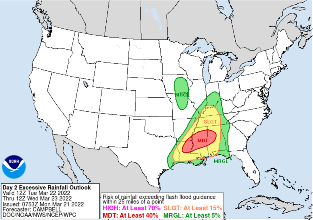
This is a low probability localized flooding event for Tuesday night. Our area has a low probability for excessive rainfall: 15% within 25 miles of you.
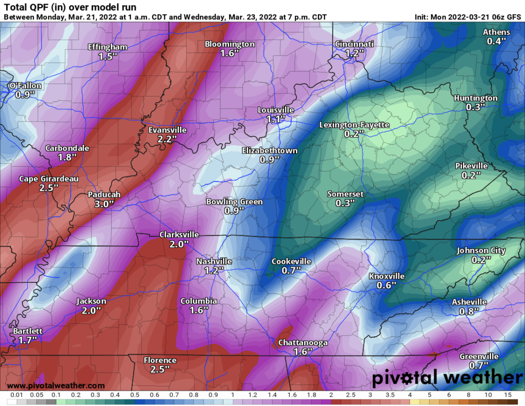
The flooding concern is not for everyone. Most of us will get 1″+, maybe up to 2″. Below is the GFS model estimate.
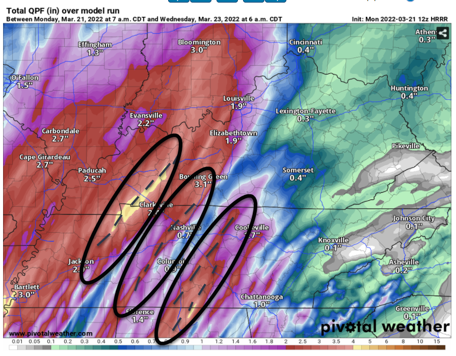
The concern is where the heaviest downpours will “train” through. Exactly where is impossible to determine but we see the threat in the models. The 12z HRRR model (below) shows training streaks of 3″+ through Middle TN. If one sets up over an area that feeds a local, small creek or stream near you that’s flood prone, watch out. HRRR has none of those streaks in either of our counties, but it’s got them east and west of us, and the model is rarely that accurate for location/placement of training rainfall. So, it will be watched closely.
After lingering showers and cold front pass Wednesday, we are a little cooler for the rest of the week. Highs dance around the 60 degree mark till Sunday with mornings in the upper 30s to low 40s. Rest of the week looks pretty quiet which is great news for late March. We’re nearing peak severe season.
Quick References:
Weather changes constantly.
Follow @NashSevereWx on Twitter for any changes to this forecast.
Live coverage during tornado and severe thunderstorm warnings:
Look good.
Support the mission.
We are 100% community supported. No ads. No subscription fees. Keep it free for everyone.
Categories: Forecast Blogs (Legacy)
You must be logged in to post a comment.