You’re here to read about Tuesday so let’s speed through the weekend. (All quotes from NWS-Nashville).
BNA reported 36° after lunch. We won’t get much/any warmer today.
Back below freezing tonight and overnight with wind chills in the 20°s.

You’re here to read about Tuesday so let’s speed through the weekend. (All quotes from NWS-Nashville).
BNA reported 36° after lunch. We won’t get much/any warmer today.
Back below freezing tonight and overnight with wind chills in the 20°s.
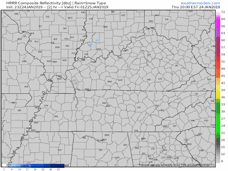
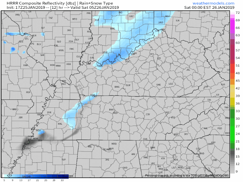
At 6PM we’re sitting at 38° and looking dry. Clouds cleared out early but they’ll soon return as a cold front approaches. There was mention of very light snow flurries earlier, but now models don’t seem to be picking them up. We might be lacking the moisture needed to get snowflakes to form.

No snow tonight.
The precip moved east, faster than all models thought.
Foiled again by cold air chasing the precip.
At 7:25 PM, BNA reported 43°. At 8:05 PM, it’s 39°. And falling.
Rainwater continues running off the roads. Runoff means less water to freeze.
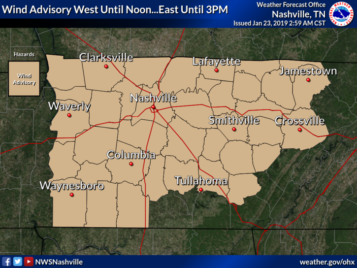
TIMING: Until 3 PM CST today
WINDS: Breezy south winds 20 to 25 mph with gusts around 40 mph.
IMPACTS: Gusty winds can cause tree and branch damage. Loose outdoor objects may be blown around. High profile vehicles, especially those traveling on east-west roadways, may experience travel difficulties.

Clouds are arriving. Rain is coming Wednesday, and it may turn to snow Wednesday night.
Alert! Editor’s Rant. This isn’t about you most of you. Warning: what you’re about to skip over read is indulgent and arguably therapeutic (for me). If you came here for No Rants, Just Weather, I respect that, skip the blue words.

Today things will be warming up and quite mild overnight tonight. Breezy, but really pleasant for mid January, or early November for that matter. Rain will begin late Tuesday night as a precursor to a change coming through the day Wednesday.
26° is our pre-dawn low Tuesday morning.
A Wind Advisory is effective beginning noon Tuesday through 9 AM Wednesday.
Strong south winds, 15-25 MPH, gusting around 40 MPH, may topple lightweight elderly and tip mostly empty garbage cans.
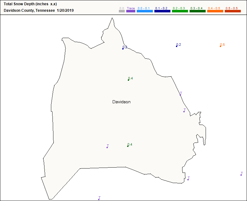
Winds dried wet roads last night. Throughout last night’s dusting, winds blew between 13-17 MPH, gusts 25 to 35 MPH.
Some Middle Tennesseans saw snow. Clarksville’s emergency manager reported 1.2″. Sumner County CoCoRahs observer near Portland logged 1.0″. Same for Greenbrier in Robertson County.
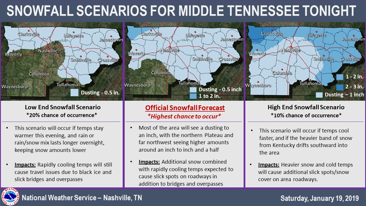
Here’s the low end / high end snowfall probability on either side of NWS-Nashville’s snowfall forecast:
Meanwhile, wind speeds pick up significantly. Sustained winds of 12 mph in the afternoon will quickly jump close to 21 mph after 8 PM – gusting upwards of 35 mph at times in the night.
(Editor’s comments in blue).
Get out and enjoy today. If you need to do anything outside, or put gas in your car, that kind of stuff, do it today or, if you love risk and adventure, Saturday afternoon.
You must be logged in to post a comment.