Category: Forecast Blogs (Legacy)

Heat and Sunshine Currently Here to Stay; Drop in Dewpoints Friday; Update on the Drought Monitor

Copy and Paste Forecast? Pretty Much.

It’s still kinda humid and dry, though we will have a slight drop in high temps.

These above-average high temperatures keep pushing us closer to breaking a record:

“Still looks to reach the 90s for much of the area, with Nashville now at the #2 most 90 degree days ever in a year and inching ever closer to the all time record set in 1954.” @NWS-Nashville read more

Hot Today, Lower Dewpoints Tomorrow and Friday; No Rain in Sight

Wednesday? Nothing new. The Heat continues.

Hot, unfortunately. The heat continues into the middle of the month.

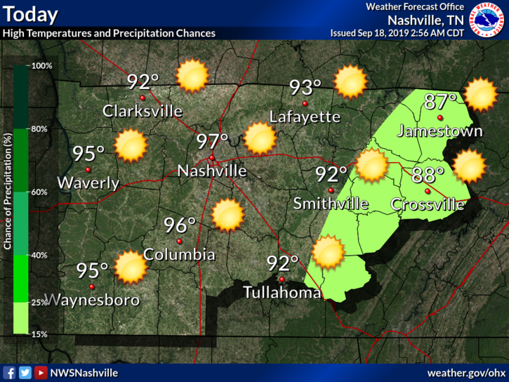
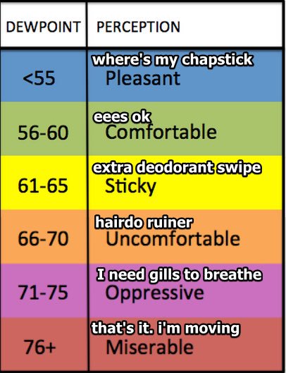
High today expected to be in the upper 90°s. Dewpoints in the mid 60°s. Bleh.

Any relief coming?

NWS-Nashville:

Surface observations this morning show it`s (surprise) another warm and humid one with current readings in the 60s and 70s. Some patchy fog is noted mainly over eastern counties, and cannot rule out a few dense spots. Otherwise, another unusually hot mid September day is on tap, although at least highs look to be a degree or two below yesterday`s levels. Models continue to show a surge of slightly cooler and significantly drier air coming down the east side of the Appalachians then spreading westward into our area later today.

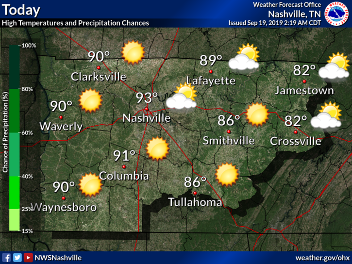
Just barely. We might be dealing with some dry heat instead of our typical muggy heat. Let’s check the dewpoints on the models! read more

Hot Today and Tomorrow; Beginning Thursday — Slight/Meaningless Relief in Temps with a Humidity Drop-Off

Would you be surprised if I told you we had another day of oppressive heat?

High temperatures Tuesday (today) will reach 97°, but we could see a heat index up to 101°.

Dewpoint temps? Mid-60s. Not bad, but not great.

Due to a weak frontal boundary that came through yesterday evening, a few could see a shower or two, but that’s super unlikely. read more