
Beautiful Wednesday Ahead
Warmer temps + sunny skies + a nice breeze = a beautiful day!
We saw some patchy fog this morning, especially around bodies of water. With temperatures warming up through the morning hours, it has since dissipated.

Warmer temps + sunny skies + a nice breeze = a beautiful day!
We saw some patchy fog this morning, especially around bodies of water. With temperatures warming up through the morning hours, it has since dissipated.

To be social is to be forgiving.
Robert Frost
The cold front that moved through yesterday left us with a beautiful fall day.
Tonight will be cool with a low of 46°.
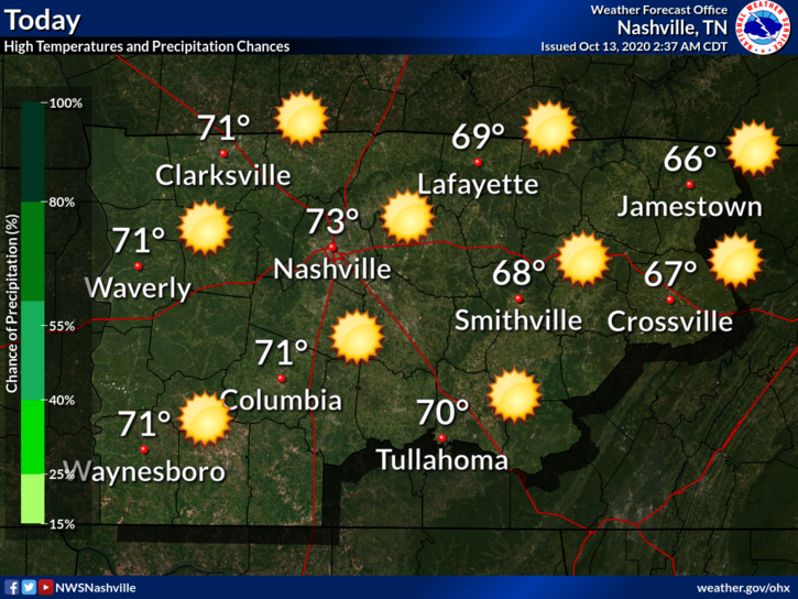
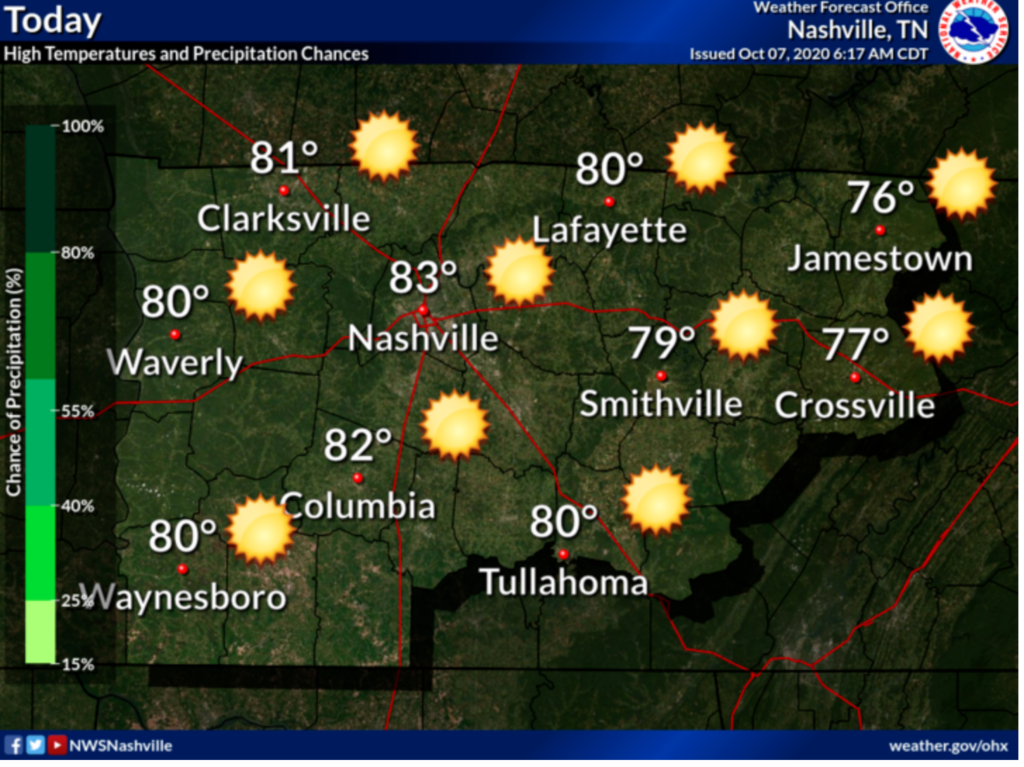
Similar story Wednesday albeit a bit warmer. Maybe touching 80° by the afternoon.
Cold front ETA Thursday night. Some light rain is possible with this passage.
The remnants of Hurricane Delta have moved along and are now out of the picture.
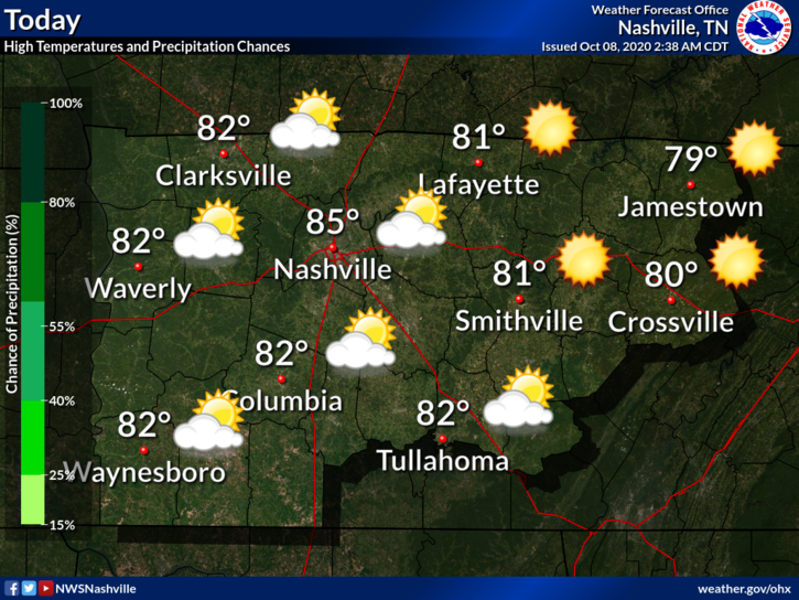
Although, we are still experiencing overcast skies today that could possibly bring us showers this afternoon with a high of 81.
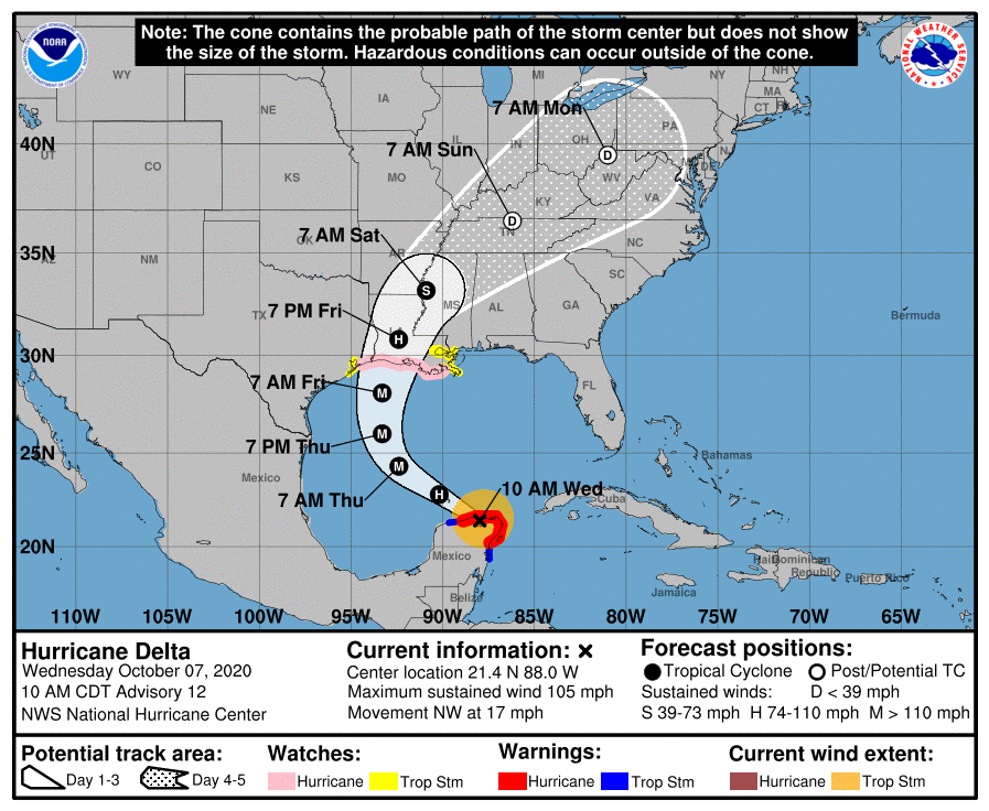
Delta is now a post-tropical cyclone. Its center is located to our southwest this morning.
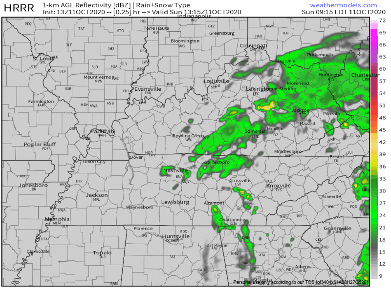
Delta’s remnants produced light showers this morning. According to the HRRR model, they should clear the area around noon.
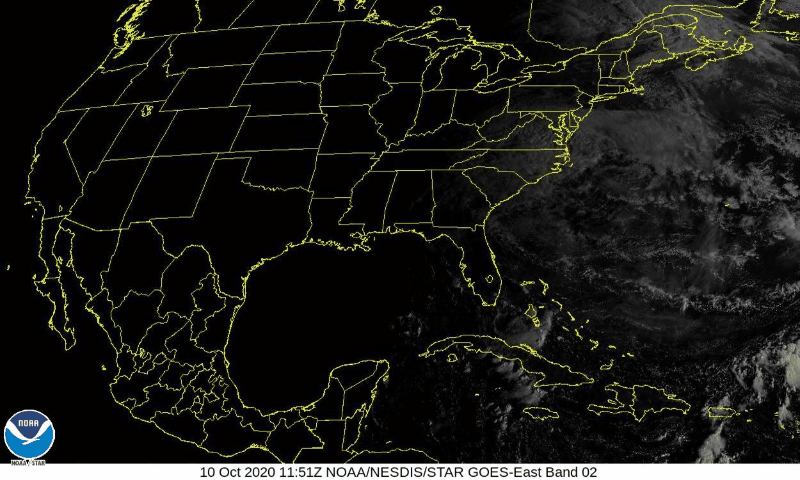
Delta made landfall last night as a Cat 2. It hit the Louisiana coast, and has since traveled towards the northeast, weakening into a depression.
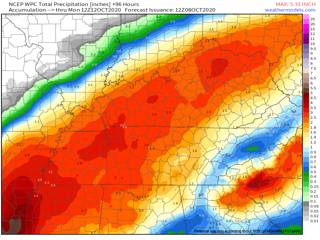
Rain. Lots and lots of rain.

Many of us have already seen some of that rain this morning. Below is the radar loop for 11am.
Category 3 Hurricane Delta still churning in the Gulf of Mexico this morning as its arrival time to make landfall awaits tonight.
A build-up of cloud cover over the Middle Tennessee area into the afternoon is due to the very outer bands of Delta as it approaches the Louisiana coastline.
Few passing clouds today. No worries. High 85.
Hurricane Delta is expected to make landfall on the Louisiana Coast Friday Evening. It will impact the same areas, now covered in blue tarps, because of Hurricane Laura.
Nothing to talk about today or Thursday. Mid 80°s and sunshiny.
Hurricane Delta is expected to make landfall on the Louisiana coast Friday night.

It will weaken and move inland and head our way this weekend.

The beautiful weather persists for a few more days! An upper ridge is building along the Gulf Coast ahead of Hurricane Delta which will cause our temperatures to continue to warm. High temperatures should top off in the upper 70’s today.
Cold front passage yesterday afternoon allowed our temperatures to cool, leaving us with a pretty chilly morning in the 40s.
We’ll warm into the upper 60s by this afternoon with a lot of sunshine and some pretty dry air.
You must be logged in to post a comment.